| Well Information Table |
|---|
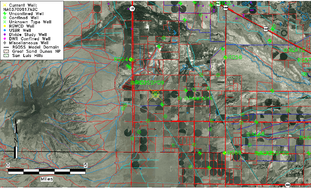
| Common Well ID | NA03700817ABC |
| USGS Well ID | 372700106072501 |
| USGS Station Name | NA03700817ABC |
| USGS Site Type | Well |
| USGS Site Use Information | Withdrawal of Water |
| USGS Groundwater Use Information | Irrigation |
| Data Source(s) | USGS |
| Location Data |
|---|
| TRS | NA03700817ABC |
| USGS TRS 1 | NA03700817ABC |
| USGS TRS | SWNWNES017T0037NR0008EN |
| Longitude/Latitude (NAD83) | -106.12094480 , 37.45547660 |
| Longitude/Latitude Data Source | GWSI decimal LAT/LONG field |
| USGS Longitude/Latitude (NAD83) | -106.120944800 , 37.455476600 |
| Easting, Northing RGDSS-NAD83 (US ft) | 70325.36 , 167616.45 |
| USGS Topography | Valley flat |
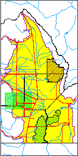
| USGS County | Rio Grande County |
| Elevation and Depth Data |
|---|
| Ground Elevation (ft NAVD88) | 7653.34 |
| Elevation Data Source | USGS GWSI database |
| USGS Ground Elevation (ft NGVD29) | 7649.00 |
| 1/3-Arc Second NED Ground Elevation (ft NAVD88) | 7654.71 |
| 1-Arc Second NED Ground Elevation (ft NAVD88) | 7654.51 |
| SRTM Ground Elevation (ft NAVD88) | 7657.95 |
| Total Depth (ft) | 125.00 |
| USGS Well Depth (ft) | 125.00 |
| Model Layer | 2 |
| Model Layer Source | Well Depth |
| Depth of Bottom of Layer 1 | 34 |
| Depth of Bottom of Layer 2 | 136 |
| Depth of Bottom of Layer 3 | 485 |
| Depth of Bottom of Layer 4 | 1734 |
| Additional Well Information | Geohydrology, Construction |
| Aquifer Information |
|---|
| Aquifer Type | Confined |
| Aquifer Type Source | TD Elevation/Model Layer |
| USGS Primary Aquifer | Cenozoic Erathem |
| USGS Aquifer Type | Confined Single Aquifer |
| USGS Hydrologic Unit | Alamosa-Trinchera |
| USGS Data Available | Water-level (GW.LEV) |
| Water-level Database Information |
|---|
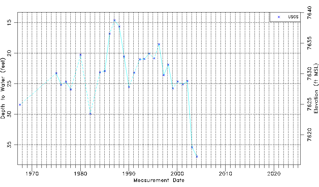
| Water-level Count | 28 |
| Water-level Date Range | 07/12/1967 thru 01/29/2004 |
| Monitored within the last 18 months | No, most recently on 01/29/2004 |
| Depth-to-Water Range (ft) | 14.60 to 36.93 |
| Water Table Elevation Range (ft NAVD88) | 7616.41 to 7638.74 |
| Water-Level-Source:Number-of-Measurements | USGS:28 |