| Well Information Table |
|---|
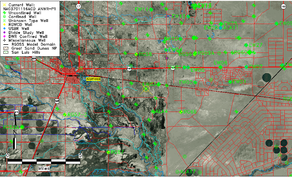
| Common Well ID | NA03701116ACD ANWR-P1 |
| USGS Well ID | 372713105462401 |
| USGS Station Name | NA03701116ACD ANWR-P1 |
| USGS Construction Date | 02/21/1994 |
| USGS Site Type | Well |
| USGS Site Use Information | Observation |
| USGS Groundwater Use Information | Unused |
| Data Source(s) | USGS |
| Location Data |
|---|
| TRS | NA03701116ACD ANWR-P1 |
| USGS TRS 1 | NA03701116ACD ANWR-P1 |
| USGS TRS | SESWNES16 T37N R11E N |
| Longitude/Latitude (NAD83) | -105.77335260 , 37.45361690 |
| Longitude/Latitude Data Source | GWSI decimal LAT/LONG field |
| USGS Longitude/Latitude (NAD83) | -105.773352600 , 37.453616900 |
| Easting, Northing RGDSS-NAD83 (US ft) | 171192.11 , 166643.81 |
| USGS Topography | Alluvial or Marine Terrace |
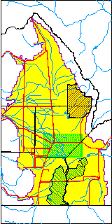
| USGS County | Alamosa County |
| USGS Map Name | ALAMOSA EAST |
| USGS Map Scale | 24000 |
| Elevation and Depth Data |
|---|
| Ground Elevation (ft NAVD88) | 7529.13 |
| Elevation Data Source | USGS GWSI database |
| USGS Ground Elevation (ft NGVD29) | 7525.15 |
| 1/3-Arc Second NED Ground Elevation (ft NAVD88) | 7527.16 |
| 1-Arc Second NED Ground Elevation (ft NAVD88) | 7526.69 |
| SRTM Ground Elevation (ft NAVD88) | 7513.13 |
| Total Depth (ft) | 16.00 |
| USGS Hole Depth (ft) | 16.00 |
| USGS Well Depth (ft) | 16.00 |
| Model Layer | 1 |
| Model Layer Source | Well Depth |
| Depth of Bottom of Layer 1 | 59 |
| Depth of Bottom of Layer 2 | 184 |
| Depth of Bottom of Layer 3 | 664 |
| Depth of Bottom of Layer 4 | 2386 |
| Additional Well Information | Geohydrology, Construction |
| Aquifer Information |
|---|
| Aquifer Type | Unconfined |
| Aquifer Type Source | TD Elevation/Model Layer |
| USGS Primary Aquifer | Cenozoic Erathem |
| USGS Aquifer Type | Unconfined Single Aquifer |
| USGS Hydrologic Unit | Alamosa-Trinchera |
| USGS Data Available | Water-level (GW.LEV) |
| Water-level Database Information |
|---|
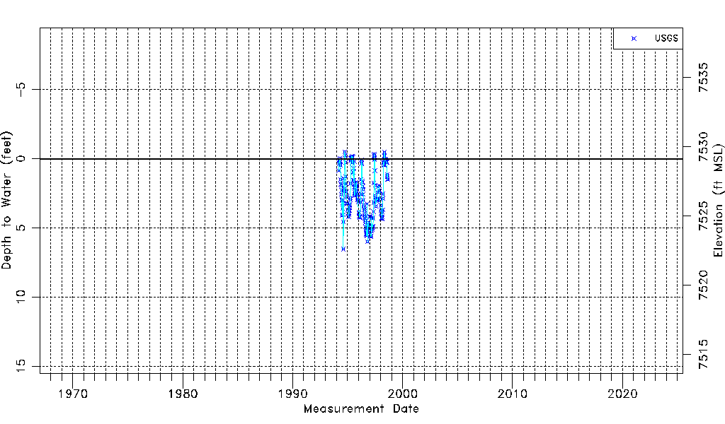
| Water-level Count | 199 |
| Water-level Date Range | 03/15/1994 thru 08/27/1998 |
| Monitored within the last 18 months | No, most recently on 08/27/1998 |
| Depth-to-Water Range (ft) | -0.50 to 6.53 |
| Water Table Elevation Range (ft NAVD88) | 7522.60 to 7529.63 |
| Water-Level-Source:Number-of-Measurements | USGS:199 |