| Well Information Table |
|---|
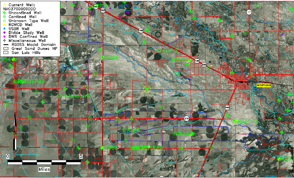
| Common Well ID | NA03700909DDD |
| USGS Well ID | 372715105590901 |
| USGS Station Name | NA03700909DDD |
| USGS Construction Date | 01/01/1966 |
| USGS Site Type | Well |
| USGS Site Use Information | Observation |
| USGS Groundwater Use Information | Unused |
| Data Source(s) | USGS |
| Location Data |
|---|
| TRS | NA03700909DDD |
| USGS TRS 1 | NA03700909DDD |
| USGS TRS | SESESES009T0037NR0009EN |
| Longitude/Latitude (NAD83) | -105.98410757 , 37.45903474 |
| Longitude/Latitude Data Source | Davis Engineering Survey |
| USGS Longitude/Latitude (NAD83) | -105.484067300 , 37.459090670 |
| Easting, Northing RGDSS-NAD83 (US ft) | 110038.98 , 168750.83 |
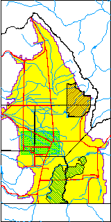
| USGS County | Alamosa County |
| USGS Map Name | ALAMOSA WEST |
| USGS Map Scale | 24000 |
| Elevation and Depth Data |
|---|
| Ground Elevation (ft NAVD88) | 7574.80 |
| Elevation Data Source | Davis Engineering Survey |
| USGS Ground Elevation (ft NGVD29) | 7572.00 |
| 1/3-Arc Second NED Ground Elevation (ft NAVD88) | 7573.73 |
| 1-Arc Second NED Ground Elevation (ft NAVD88) | 7573.70 |
| SRTM Ground Elevation (ft NAVD88) | 7579.77 |
| Total Depth (ft) | 24.00 |
| USGS Well Depth (ft) | 24.00 |
| Model Layer | 1 |
| Model Layer Source | Well Depth |
| Depth of Bottom of Layer 1 | 37 |
| Depth of Bottom of Layer 2 | 274 |
| Depth of Bottom of Layer 3 | 676 |
| Depth of Bottom of Layer 4 | 2238 |
| Additional Well Information | Geohydrology, Construction |
| Aquifer Information |
|---|
| Aquifer Type | Unconfined |
| Aquifer Type Source | TD Elevation/Model Layer |
| USGS Primary Aquifer | Cenozoic Erathem |
| USGS Aquifer Type | Unconfined Single Aquifer |
| USGS Hydrologic Unit | Alamosa-Trinchera |
| USGS Data Available | Water-level (GW.LEV) |
| Water-level Database Information |
|---|
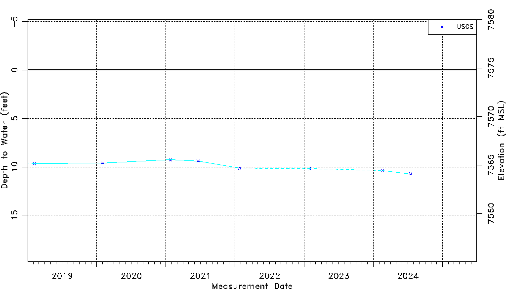
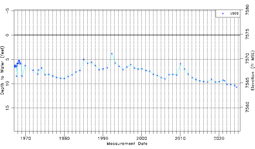
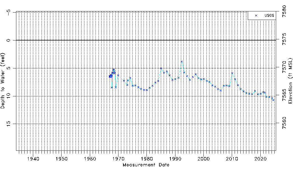
| Water-level Count | 81 |
| Water-level Date Range | 12/05/1966 thru 07/16/2024 |
| Monitored within the last 18 months | No, most recently on 07/16/2024 |
| Depth-to-Water Range (ft) | 3.83 to 10.72 |
| Water Table Elevation Range (ft NAVD88) | 7564.08 to 7570.97 |
| Water-Level-Source:Number-of-Measurements | USGS:81 |