| Well Information Table |
|---|
| Common Well ID | NA03701115BAD-ANWR-P10 |
| USGS Well ID | 372727105452701 |
| USGS Station Name | NA03701115BAD-ANWR-P10 |
| USGS Construction Date | 02/25/1994 |
| USGS Site Type | Well |
| USGS Site Use Information | Observation |
| USGS Groundwater Use Information | Unused |
| Data Source(s) | USGS |
| Location Data |
|---|
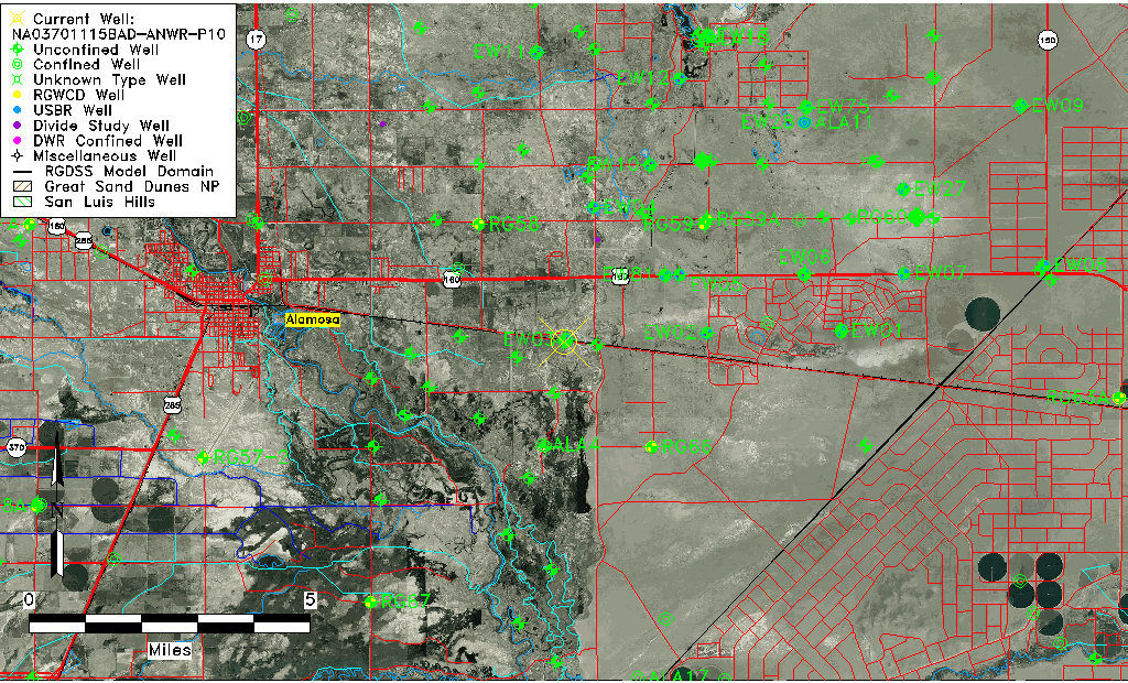
| TRS | NA03701115BAD-ANWR-P10 |
| USGS TRS 1 | NA03701115BAD-ANWR-P10 |
| USGS TRS | SWNENWS15 T37N R11E N |
| Longitude/Latitude (NAD83) | -105.75807440 , 37.45750580 |
| Longitude/Latitude Data Source | GWSI decimal LAT/LONG field |
| USGS Longitude/Latitude (NAD83) | -105.758074400 , 37.457505800 |
| Easting, Northing RGDSS-NAD83 (US ft) | 175626.98 , 168054.92 |
| USGS Topography | Alluvial or Marine Terrace |
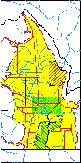
| USGS County | Alamosa County |
| USGS Map Name | ALAMOSA EAST |
| USGS Map Scale | 24000 |
| Elevation and Depth Data |
|---|
| Ground Elevation (ft NAVD88) | 7527.56 |
| Elevation Data Source | USGS GWSI database |
| USGS Ground Elevation (ft NGVD29) | 7523.56 |
| 1/3-Arc Second NED Ground Elevation (ft NAVD88) | 7527.43 |
| 1-Arc Second NED Ground Elevation (ft NAVD88) | 7524.69 |
| SRTM Ground Elevation (ft NAVD88) | 7526.25 |
| Total Depth (ft) | 19.50 |
| USGS Hole Depth (ft) | 19.50 |
| USGS Well Depth (ft) | 19.50 |
| Model Layer | 1 |
| Model Layer Source | Well Depth |
| Depth of Bottom of Layer 1 | 62 |
| Depth of Bottom of Layer 2 | 171 |
| Depth of Bottom of Layer 3 | 664 |
| Depth of Bottom of Layer 4 | 2398 |
| Additional Well Information | Geohydrology, Construction |
| Aquifer Information |
|---|
| Aquifer Type | Unconfined |
| Aquifer Type Source | TD Elevation/Model Layer |
| USGS Primary Aquifer | Cenozoic Erathem |
| USGS Aquifer Type | Unconfined Single Aquifer |
| USGS Hydrologic Unit | Alamosa-Trinchera |
| USGS Data Available | Water-level (GW.LEV) |
| Water-level Database Information |
|---|
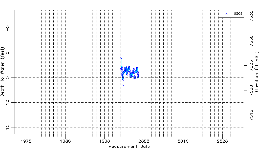
| Water-level Count | 202 |
| Water-level Date Range | 03/15/1994 thru 08/27/1998 |
| Monitored within the last 18 months | No, most recently on 08/27/1998 |
| Depth-to-Water Range (ft) | 1.09 to 6.56 |
| Water Table Elevation Range (ft NAVD88) | 7521.00 to 7526.47 |
| Water-Level-Source:Number-of-Measurements | USGS:202 |