| Well Information Table |
|---|
| Common Well ID | NA03701105DCB |
| USGS Well ID | 372835105473001 |
| USGS Station Name | NA03701105DCB |
| USGS Construction Date | 01/01/1955 |
| USGS Site Type | Well |
| USGS Site Use Information | Withdrawal of Water |
| USGS Groundwater Use Information | Irrigation |
| Data Source(s) | USGS |
| Location Data |
|---|
| TRS | NA03701105DCB |
| USGS TRS 1 | NA03701105DCB |
| USGS TRS | NWSWSES005T0037NR0011EN |
| Longitude/Latitude (NAD83) | -105.79224200 , 37.47639400 |
| Longitude/Latitude Data Source | GWSI decimal LAT/LONG field |
| USGS Longitude/Latitude (NAD83) | -105.792242000 , 37.476394000 |
| Easting, Northing RGDSS-NAD83 (US ft) | 165721.29 , 174941.27 |
| USGS Topography | Valley flat |
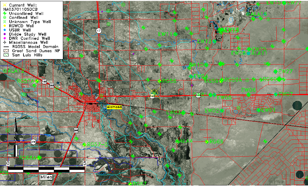
| USGS County | Alamosa County |
| Elevation and Depth Data |
|---|
| Ground Elevation (ft NAVD88) | 7531.88 |
| Elevation Data Source | USGS GWSI database |
| USGS Ground Elevation (ft NGVD29) | 7528.00 |
| 1/3-Arc Second NED Ground Elevation (ft NAVD88) | 7532.60 |
| 1-Arc Second NED Ground Elevation (ft NAVD88) | 7531.30 |
| SRTM Ground Elevation (ft NAVD88) | 7529.53 |
| Total Depth (ft) | 850.00 |
| USGS Well Depth (ft) | 850.00 |
| Model Layer | 4 |
| Model Layer Source | Well Depth |
| Depth of Bottom of Layer 1 | 60 |
| Depth of Bottom of Layer 2 | 244 |
| Depth of Bottom of Layer 3 | 712 |
| Depth of Bottom of Layer 4 | 2516 |
| Additional Well Information | Geohydrology, Construction |
| Aquifer Information |
|---|
| Aquifer Type | Confined |
| Aquifer Type Source | TD Elevation/Model Layer |
| USGS Primary Aquifer | Cenozoic Erathem |
| USGS Hydrologic Unit | Alamosa-Trinchera |
| USGS Data Available | Water-level (GW.LEV) |
| Water-level Database Information |
|---|
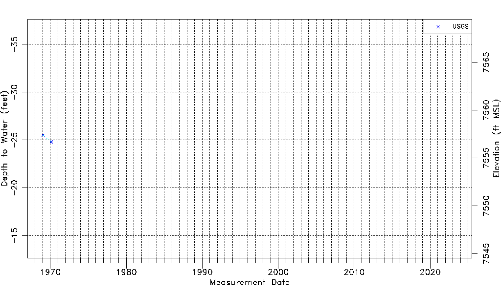
| Water-level Count | 2 |
| Water-level Date Range | 01/20/1969 thru 02/19/1970 |
| Monitored within the last 18 months | No, most recently on 02/19/1970 |
| Depth-to-Water Range (ft) | -25.50 to -24.80 |
| Water Table Elevation Range (ft NAVD88) | 7556.68 to 7557.38 |
| Water-Level-Source:Number-of-Measurements | USGS:2 |