| Well Information Table |
|---|
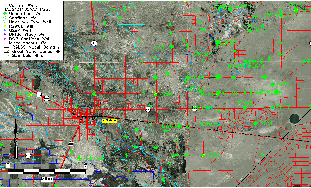
| Common Well ID | NA03701105AAA RG58 |
| RGWCD Well ID | RG58 |
| USGS Well ID | 372918105471101 |
| USGS Station Name | NA03701105AAA RG58 |
| USGS Construction Date | 01/25/1974 |
| USGS Site Type | Well |
| USGS Site Use Information | Unused |
| USGS Groundwater Use Information | Unused |
| Data Source(s) | USGS, RGWCD |
| Location Data |
|---|
| TRS | NA03701105AAA RG58 |
| RGWCD TRS | NA03701105AAA |
| USGS TRS 1 | NA03701105AAA RG58 |
| USGS TRS | NENENES005T0037NR0011EN |
| Longitude/Latitude (NAD83) | -105.78561667 , 37.48773611 |
| Longitude/Latitude Data Source | RGWCD/Davis Engineering |
| RGWCD Longitude/Latitude (NAD83) | -105:47:08.22 , 37:29:15.85 |
| USGS Longitude/Latitude (NAD83) | -105.786964000 , 37.488338190 |
| Easting, Northing RGDSS-NAD83 (US ft) | 167648.36 , 179067.43 |
| USGS Topography | Valley flat |
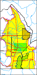
| USGS County | Alamosa County |
| USGS Map Name | ALAMOSA EAST |
| USGS Map Scale | 24000 |
| Elevation and Depth Data |
|---|
| Ground Elevation (ft NAVD88) | 7528.90 |
| Elevation Data Source | RGWCD well database |
| RGWCD Measuring Point Elevation (ft NAVD88) | 7529.700 |
| RGWCD Well Riser Height (ft) | 0.800 |
| RGWCD Ground Surface (ft NAVD88) | 7528.90 |
| USGS Ground Elevation (ft NGVD29) | 7526.00 |
| 1/3-Arc Second NED Ground Elevation (ft NAVD88) | 7531.44 |
| 1-Arc Second NED Ground Elevation (ft NAVD88) | 7529.60 |
| SRTM Ground Elevation (ft NAVD88) | 7529.64 |
| Total Depth (ft) | 26.00 |
| USGS Hole Depth (ft) | 26.00 |
| USGS Well Depth (ft) | 26.00 |
| Model Layer | 1 |
| Model Layer Source | RGWCD |
| Depth of Bottom of Layer 1 | 60 |
| Depth of Bottom of Layer 2 | 293 |
| Depth of Bottom of Layer 3 | 767 |
| Depth of Bottom of Layer 4 | 2684 |
| Additional Well Information | Production, Geohydrology, Construction, Aquifer |
| Aquifer Information |
|---|
| Aquifer Type | Unconfined |
| Aquifer Type Source | RGWCD_AQ |
| USGS Primary Aquifer | Quaternary System |
| USGS Hydrologic Unit | Alamosa-Trinchera |
| USGS Data Available | Water-level (GW.LEV) |
| Water-level Database Information |
|---|
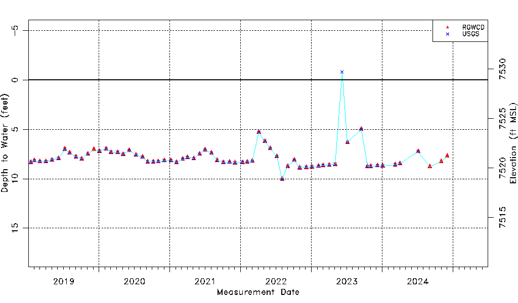
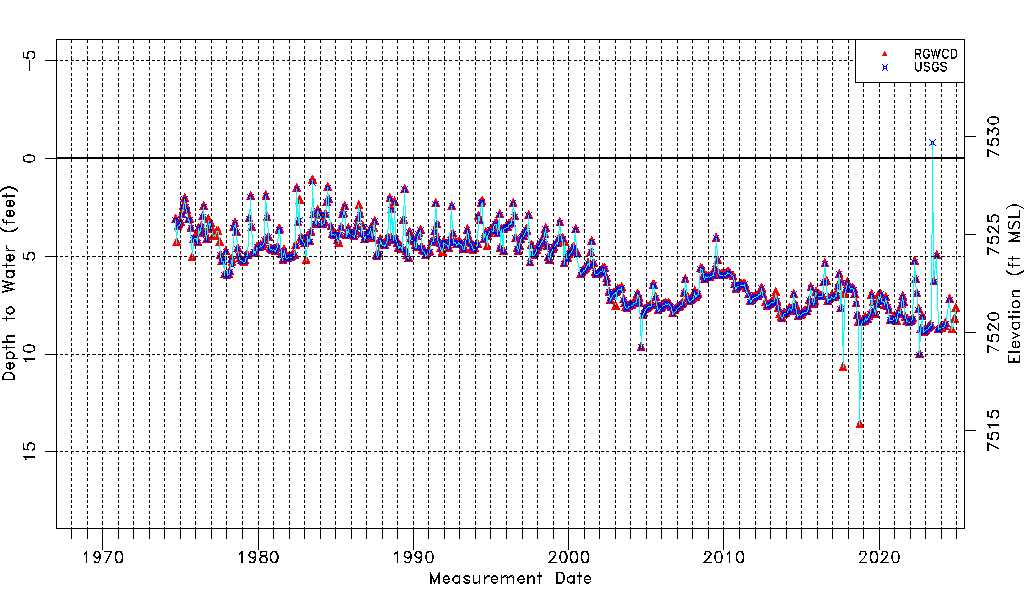
| Water-level Count | 625 |
| Water-level Date Range | 09/05/1974 thru 12/02/2024 |
| Monitored within the last 18 months | Yes, most recently on 12/02/2024 |
| Depth-to-Water Range (ft) | -0.80 to 13.61 |
| Water Table Elevation Range (ft NAVD88) | 7515.29 to 7529.70 |
| Water-Level-Source:Number-of-Measurements | RGWCD:612 USGS:553 |