| Well Information Table |
|---|
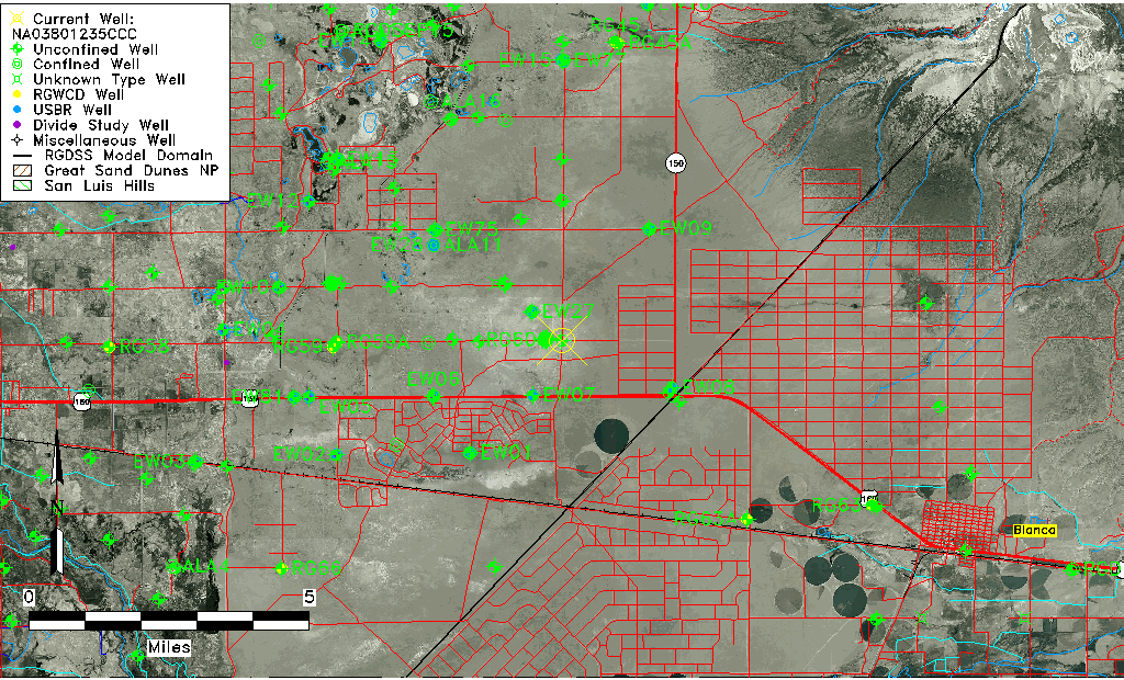
| Common Well ID | NA03801235CCC |
| USGS Well ID | 372922105381701 |
| USGS Station Name | NA03801235CCC |
| USGS Site Type | Well |
| USGS Site Use Information | Observation |
| USGS Groundwater Use Information | Unused |
| Data Source(s) | USGS |
| Location Data |
|---|
| TRS | NA03801235CCC |
| USGS TRS 1 | NA03801235CCC |
| USGS TRS | SWSWSWS035T0038NR0012EN |
| Longitude/Latitude (NAD83) | -105.63862680 , 37.48945010 |
| Longitude/Latitude Data Source | GWSI decimal LAT/LONG field |
| USGS Longitude/Latitude (NAD83) | -105.638626800 , 37.489450100 |
| Easting, Northing RGDSS-NAD83 (US ft) | 210283.25 , 179672.47 |
| USGS Topography | Alluvial or Marine Terrace |
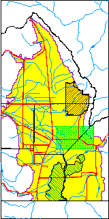
| USGS County | Alamosa County |
| USGS Map Name | BALDY |
| USGS Map Scale | 24000 |
| Elevation and Depth Data |
|---|
| Ground Elevation (ft NAVD88) | 7606.19 |
| Elevation Data Source | USGS GWSI database |
| USGS Ground Elevation (ft NGVD29) | 7602.00 |
| 1/3-Arc Second NED Ground Elevation (ft NAVD88) | 7608.20 |
| 1-Arc Second NED Ground Elevation (ft NAVD88) | 7607.91 |
| SRTM Ground Elevation (ft NAVD88) | 7604.99 |
| Total Depth (ft) | 27.00 |
| USGS Hole Depth (ft) | 27.00 |
| USGS Well Depth (ft) | 27.00 |
| Model Layer | 1 |
| Model Layer Source | Well Depth |
| Depth of Bottom of Layer 1 | 122 |
| Depth of Bottom of Layer 2 | 262 |
| Depth of Bottom of Layer 3 | 634 |
| Depth of Bottom of Layer 4 | 1777 |
| Additional Well Information | Geohydrology, Aquifer |
| Aquifer Information |
|---|
| Aquifer Type | Unconfined |
| Aquifer Type Source | TD Elevation/Model Layer |
| USGS Primary Aquifer | Quaternary System |
| USGS Hydrologic Unit | San Luis |
| USGS Data Available | Water-level (GW.LEV) |
| Water-level Database Information |
|---|
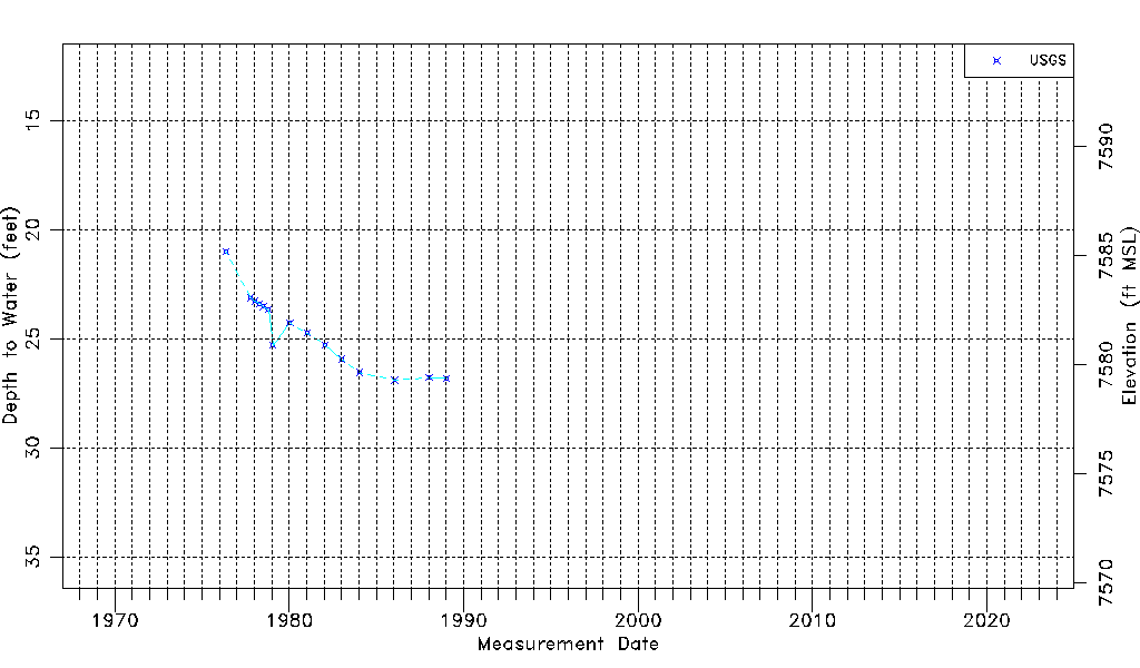
| Water-level Count | 15 |
| Water-level Date Range | 05/12/1976 thru 01/09/1989 |
| Monitored within the last 18 months | No, most recently on 01/09/1989 |
| Depth-to-Water Range (ft) | 21.00 to 26.90 |
| Water Table Elevation Range (ft NAVD88) | 7579.29 to 7585.19 |
| Water-Level-Source:Number-of-Measurements | USGS:15 |