| Well Information Table |
|---|
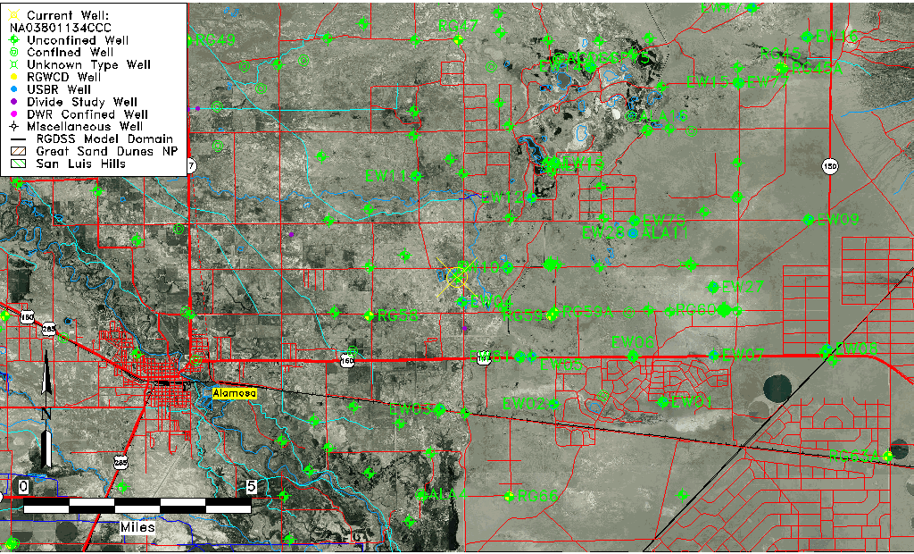
| Common Well ID | NA03801134CCC |
| USGS Well ID | 373000105450001 |
| USGS Station Name | NA03801134CCC |
| USGS Construction Date | 01/01/1946 |
| USGS Site Type | Well |
| USGS Site Use Information | Observation |
| USGS Groundwater Use Information | Unused |
| Data Source(s) | USGS |
| Location Data |
|---|
| TRS | NA03801134CCC |
| USGS TRS 1 | NA03801134CCC |
| USGS TRS | SWSWSWS034T0038NR0011EN |
| Longitude/Latitude (NAD83) | -105.75057440 , 37.50000480 |
| Longitude/Latitude Data Source | GWSI decimal LAT/LONG field |
| USGS Longitude/Latitude (NAD83) | -105.750574400 , 37.500004800 |
| Easting, Northing RGDSS-NAD83 (US ft) | 177816.41 , 183522.74 |
| USGS Topography | Flat Surface |
| USGS County | Alamosa County |
| Elevation and Depth Data |
|---|
| Ground Elevation (ft NAVD88) | 7529.96 |
| Elevation Data Source | USGS GWSI database |
| USGS Ground Elevation (ft NGVD29) | 7526.00 |
| 1/3-Arc Second NED Ground Elevation (ft NAVD88) | 7524.93 |
| 1-Arc Second NED Ground Elevation (ft NAVD88) | 7525.98 |
| SRTM Ground Elevation (ft NAVD88) | 7519.46 |
| Total Depth (ft) | 34.00 |
| USGS Well Depth (ft) | 34.00 |
| Model Layer | 1 |
| Model Layer Source | Well Depth |
| Depth of Bottom of Layer 1 | 69 |
| Depth of Bottom of Layer 2 | 323 |
| Depth of Bottom of Layer 3 | 791 |
| Depth of Bottom of Layer 4 | 2665 |
| Additional Well Information | Geohydrology, Construction |
| Aquifer Information |
|---|
| Aquifer Type | Unconfined |
| Aquifer Type Source | TD Elevation/Model Layer |
| USGS Primary Aquifer | Cenozoic Erathem |
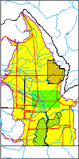
| USGS Hydrologic Unit | San Luis |
| USGS Data Available | Water-level (GW.LEV) |
| Water-level Database Information |
|---|
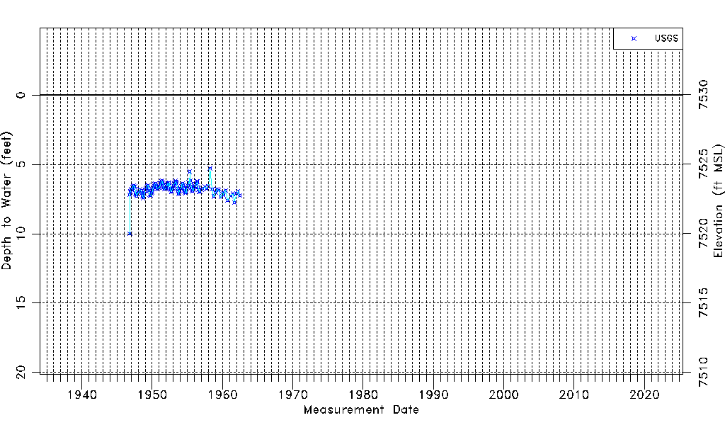
| Water-level Count | 143 |
| Water-level Date Range | 10/14/1946 thru 06/27/1962 |
| Monitored within the last 18 months | No, most recently on 06/27/1962 |
| Depth-to-Water Range (ft) | 5.27 to 10.00 |
| Water Table Elevation Range (ft NAVD88) | 7519.96 to 7524.69 |
| Water-Level-Source:Number-of-Measurements | USGS:143 |