| Well Information Table |
|---|
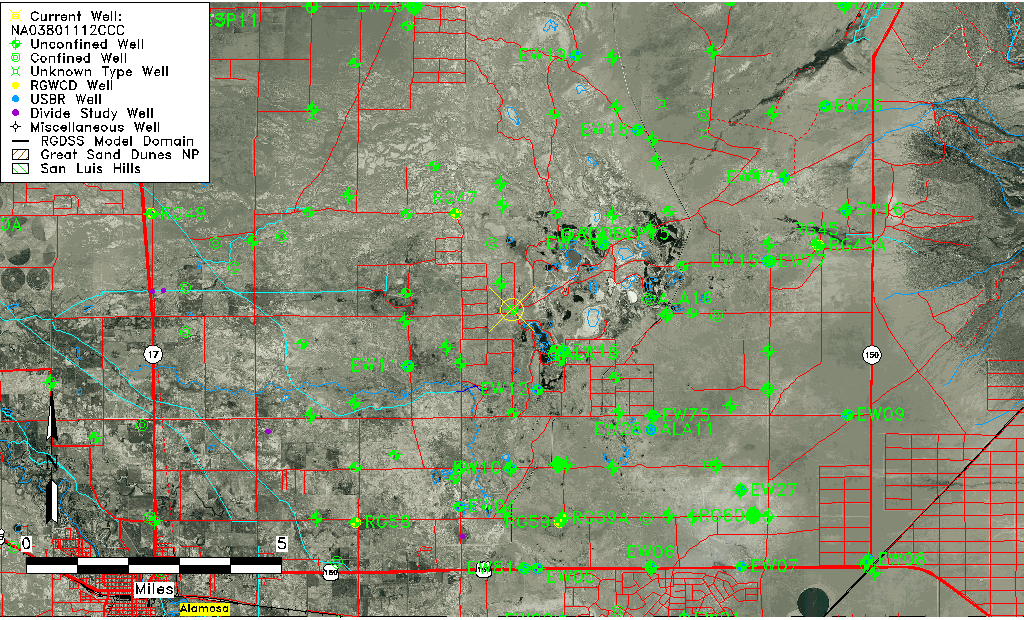
| Common Well ID | NA03801112CCC |
| USGS Well ID | 373215105440001 |
| USGS Station Name | NA03801112CCC |
| USGS Construction Date | 01/01/1967 |
| USGS Site Type | Well |
| USGS Site Use Information | Observation |
| USGS Groundwater Use Information | Unused |
| Data Source(s) | USGS |
| Location Data |
|---|
| TRS | NA03801112CCC |
| USGS TRS 1 | NA03801112CCC |
| USGS TRS | SWSWSWS012T0038NR0011EN |
| Longitude/Latitude (NAD83) | -105.72987930 , 37.54814280 |
| Longitude/Latitude Data Source | GWSI decimal LAT/LONG field |
| USGS Longitude/Latitude (NAD83) | -105.729879300 , 37.548142800 |
| Easting, Northing RGDSS-NAD83 (US ft) | 183829.33 , 201040.72 |
| USGS Topography | Valley flat |
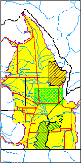
| USGS County | Alamosa County |
| USGS Map Name | DRY LAKES |
| USGS Map Scale | 24000 |
| Elevation and Depth Data |
|---|
| Ground Elevation (ft NAVD88) | 7525.02 |
| Elevation Data Source | USGS GWSI database |
| USGS Ground Elevation (ft NGVD29) | 7521.00 |
| 1/3-Arc Second NED Ground Elevation (ft NAVD88) | 7524.55 |
| 1-Arc Second NED Ground Elevation (ft NAVD88) | 7525.59 |
| SRTM Ground Elevation (ft NAVD88) | 7527.48 |
| Total Depth (ft) | 22.00 |
| USGS Well Depth (ft) | 22.00 |
| Model Layer | 1 |
| Model Layer Source | Well Depth |
| Depth of Bottom of Layer 1 | 28 |
| Depth of Bottom of Layer 2 | 322 |
| Depth of Bottom of Layer 3 | 881 |
| Depth of Bottom of Layer 4 | 2684 |
| Additional Well Information | Geohydrology, Construction |
| Aquifer Information |
|---|
| Aquifer Type | Unconfined |
| Aquifer Type Source | TD Elevation/Model Layer |
| USGS Primary Aquifer | Cenozoic Erathem |
| USGS Aquifer Type | Unconfined Single Aquifer |
| USGS Hydrologic Unit | San Luis |
| USGS Data Available | Water-level (GW.LEV) |
| Water-level Database Information |
|---|
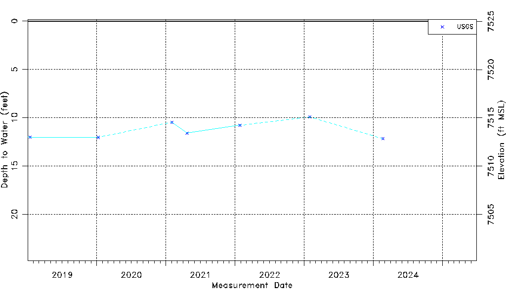
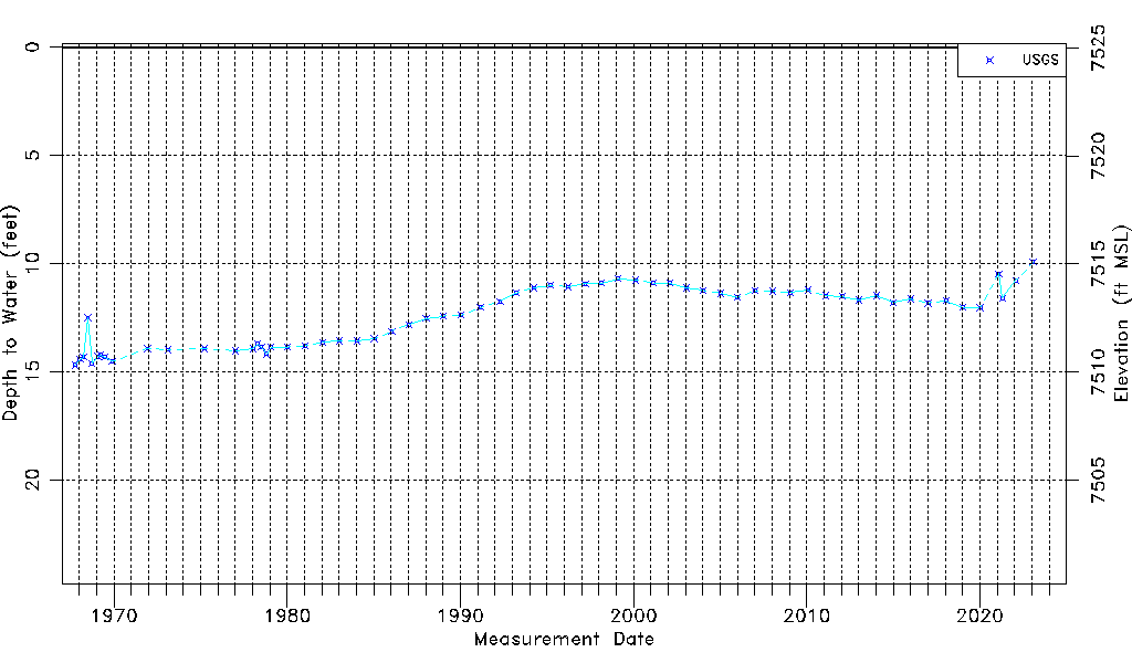
| Water-level Count | 64 |
| Water-level Date Range | 10/04/1967 thru 02/21/2024 |
| Monitored within the last 18 months | No, most recently on 02/21/2024 |
| Depth-to-Water Range (ft) | 9.93 to 14.69 |
| Water Table Elevation Range (ft NAVD88) | 7510.33 to 7515.09 |
| Water-Level-Source:Number-of-Measurements | USGS:64 |