| Well Information Table |
|---|
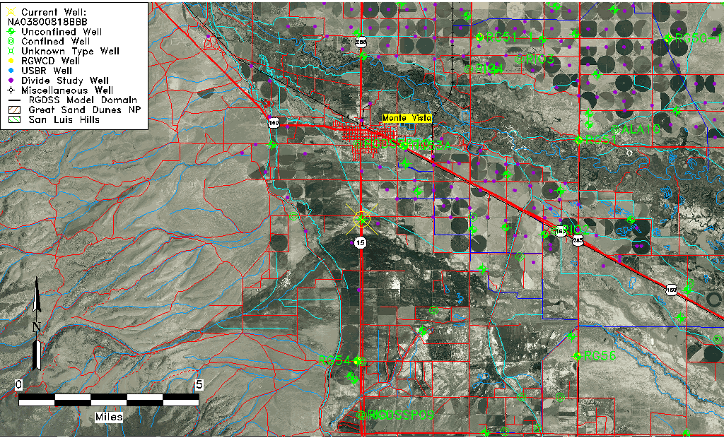
| Common Well ID | NA03800818BBB |
| USGS Well ID | 373224106085101 |
| USGS Station Name | NA03800818BBB |
| USGS Construction Date | 01/01/1967 |
| USGS Site Type | Well |
| USGS Site Use Information | Observation |
| USGS Groundwater Use Information | Unused |
| Data Source(s) | USGS |
| Location Data |
|---|
| TRS | NA03800818BBB |
| USGS TRS 1 | NA03800818BBB |
| USGS TRS | NWNWNWS018T0038NR0008EN |
| Longitude/Latitude (NAD83) | -106.14808440 , 37.54472554 |
| Longitude/Latitude Data Source | GWSI decimal LAT/LONG field |
| USGS Longitude/Latitude (NAD83) | -106.148084400 , 37.544725540 |
| Easting, Northing RGDSS-NAD83 (US ft) | 62614.46 , 200144.12 |
| USGS Topography | Valley flat |
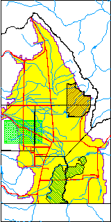
| USGS County | Rio Grande County |
| USGS Map Name | MONTE VISTA |
| USGS Map Scale | 24000 |
| Elevation and Depth Data |
|---|
| Ground Elevation (ft NAVD88) | 7663.40 |
| Elevation Data Source | USGS GWSI database |
| USGS Ground Elevation (ft NGVD29) | 7659.00 |
| 1/3-Arc Second NED Ground Elevation (ft NAVD88) | 7657.31 |
| 1-Arc Second NED Ground Elevation (ft NAVD88) | 7657.37 |
| SRTM Ground Elevation (ft NAVD88) | 7663.98 |
| Total Depth (ft) | 18.00 |
| USGS Well Depth (ft) | 18.00 |
| Model Layer | 1 |
| Model Layer Source | Well Depth |
| Depth of Bottom of Layer 1 | 67 |
| Depth of Bottom of Layer 2 | 185 |
| Depth of Bottom of Layer 3 | 463 |
| Depth of Bottom of Layer 4 | 1419 |
| Additional Well Information | Geohydrology, Construction |
| Aquifer Information |
|---|
| Aquifer Type | Unconfined |
| Aquifer Type Source | TD Elevation/Model Layer |
| USGS Primary Aquifer | Cenozoic Erathem |
| USGS Hydrologic Unit | Alamosa-Trinchera |
| USGS Data Available | Water-level (GW.LEV) |
| Water-level Database Information |
|---|
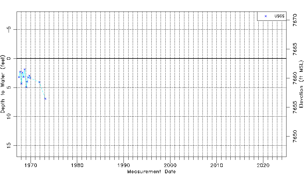
| Water-level Count | 13 |
| Water-level Date Range | 07/03/1967 thru 02/23/1973 |
| Monitored within the last 18 months | No, most recently on 02/23/1973 |
| Depth-to-Water Range (ft) | 1.89 to 6.95 |
| Water Table Elevation Range (ft NAVD88) | 7656.45 to 7661.51 |
| Water-Level-Source:Number-of-Measurements | USGS:13 |