| Well Information Table |
|---|
| Common Well ID | NA03800812ACA |
| USGS Well ID | 373323106025001 |
| USGS Station Name | NA03800812ACA |
| USGS Construction Date | 08/09/1993 |
| USGS Site Type | Well |
| USGS Site Use Information | Observation |
| USGS Groundwater Use Information | Unused |
| Data Source(s) | USGS |
| Location Data |
|---|
| TRS | NA03800812ACA |
| USGS TRS 1 | NA03800812ACA |
| USGS TRS | NESWNES 12T 38NR 8E |
| Longitude/Latitude (NAD83) | -106.04810830 , 37.55658056 |
| Longitude/Latitude Data Source | GWSI decimal LAT/LONG field |
| USGS Longitude/Latitude (NAD83) | -106.048108300 , 37.556580560 |
| Easting, Northing RGDSS-NAD83 (US ft) | 91609.98 , 204327.55 |
| USGS Topography | Valley flat |
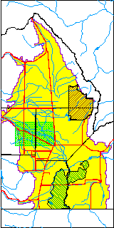
| USGS County | Rio Grande County |
| USGS Map Name | HOMELAKE |
| USGS Map Scale | 2400 |
| Elevation and Depth Data |
|---|
| Ground Elevation (ft NAVD88) | 7615.00 |
| Elevation Data Source | USGS GWSI database |
| USGS Ground Elevation (ft NAVD88) | 7615.00 |
| 1/3-Arc Second NED Ground Elevation (ft NAVD88) | 7613.20 |
| 1-Arc Second NED Ground Elevation (ft NAVD88) | 7613.02 |
| SRTM Ground Elevation (ft NAVD88) | 7618.54 |
| Total Depth (ft) | 19.85 |
| USGS Hole Depth (ft) | 20.00 |
| USGS Well Depth (ft) | 19.85 |
| Model Layer | 1 |
| Model Layer Source | Well Depth |
| Depth of Bottom of Layer 1 | 51 |
| Depth of Bottom of Layer 2 | 182 |
| Depth of Bottom of Layer 3 | 666 |
| Depth of Bottom of Layer 4 | 2219 |
| Additional Well Information | Logs, Geohydrology, Construction, Aquifer |
| Aquifer Information |
|---|
| Aquifer Type | Unconfined |
| Aquifer Type Source | TD Elevation/Model Layer |
| USGS Primary Aquifer | 112ALMS |
| USGS Aquifer Type | Unconfined Single Aquifer |
| USGS Hydrologic Unit | Alamosa-Trinchera |
| USGS Data Available | Water-level (GW.LEV) |
| Water-level Database Information |
|---|
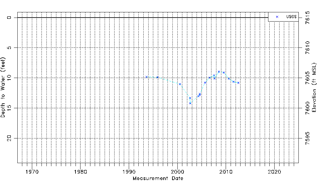
| Water-level Count | 17 |
| Water-level Date Range | 08/26/1993 thru 07/25/2012 |
| Monitored within the last 18 months | No, most recently on 07/25/2012 |
| Depth-to-Water Range (ft) | 8.96 to 14.20 |
| Water Table Elevation Range (ft NAVD88) | 7600.80 to 7606.04 |
| Water-Level-Source:Number-of-Measurements | USGS:17 |