| Well Information Table |
|---|
| Common Well ID | NA03801104AAA |
| USGS Well ID | 373355105461201 |
| USGS Station Name | NA03801104AAA |
| USGS Site Type | Well |
| USGS Site Use Information | Observation |
| USGS Groundwater Use Information | Unused |
| Data Source(s) | USGS |
| Location Data |
|---|
| TRS | NA03801104AAA |
| USGS TRS 1 | NA03801104AAA |
| USGS TRS | NENENES004T0038NR0011EN |
| Longitude/Latitude (NAD83) | -105.76729680 , 37.57528097 |
| Longitude/Latitude Data Source | GWSI decimal LAT/LONG field |
| USGS Longitude/Latitude (NAD83) | -105.767296800 , 37.575280970 |
| Easting, Northing RGDSS-NAD83 (US ft) | 172995.20 , 210928.36 |
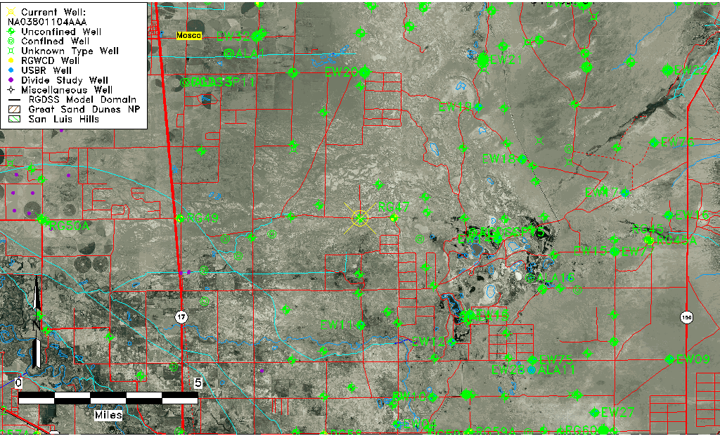
| USGS County | Alamosa County |
| Elevation and Depth Data |
|---|
| Ground Elevation (ft NAVD88) | 7526.93 |
| Elevation Data Source | USGS GWSI database |
| USGS Ground Elevation (ft NGVD29) | 7523.00 |
| 1/3-Arc Second NED Ground Elevation (ft NAVD88) | 7529.26 |
| 1-Arc Second NED Ground Elevation (ft NAVD88) | 7528.16 |
| SRTM Ground Elevation (ft NAVD88) | 7530.44 |
| Total Depth (ft) | 15.00 |
| USGS Well Depth (ft) | 15.00 |
| Model Layer | 1 |
| Model Layer Source | Well Depth |
| Depth of Bottom of Layer 1 | 41 |
| Depth of Bottom of Layer 2 | 498 |
| Depth of Bottom of Layer 3 | 967 |
| Depth of Bottom of Layer 4 | 2730 |
| Additional Well Information | Geohydrology, Construction |
| Aquifer Information |
|---|
| Aquifer Type | Unconfined |
| Aquifer Type Source | TD Elevation/Model Layer |
| USGS Primary Aquifer | Cenozoic Erathem |
| USGS Aquifer Type | Unconfined Single Aquifer |
| USGS Hydrologic Unit | San Luis |
| USGS Data Available | Water-level (GW.LEV) |
| Water-level Database Information |
|---|
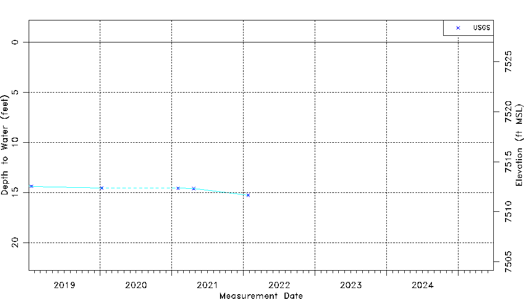
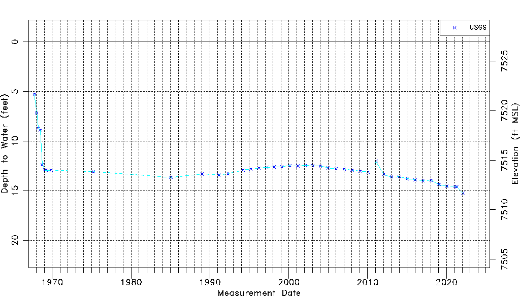
| Water-level Count | 44 |
| Water-level Date Range | 10/04/1967 thru 01/25/2022 |
| Monitored within the last 18 months | No, most recently on 01/25/2022 |
| Depth-to-Water Range (ft) | 5.29 to 15.27 |
| Water Table Elevation Range (ft NAVD88) | 7511.66 to 7521.64 |
| Water-Level-Source:Number-of-Measurements | USGS:44 |