| Well Information Table |
|---|
| Common Well ID | NA03901034DDD RG49 |
| RGWCD Well ID | RG49 |
| USGS Well ID | 373433105513201 |
| USGS Station Name | NA03901034DDD RG49 |
| USGS Construction Date | 01/22/1974 |
| USGS Site Type | Well |
| USGS Site Use Information | Observation |
| USGS Groundwater Use Information | Unused |
| Data Source(s) | USGS, RGWCD, Divide Study |
| Location Data |
|---|
| TRS | NA03901034DDD RG49 |
| RGWCD TRS | NA03901034DDD |
| USGS TRS 1 | NA03901034DDD RG49 |
| USGS TRS | SESESES034T0039NR0010EN |
| Longitude/Latitude (NAD83) | -105.85856447 , 37.57517150 |
| Longitude/Latitude Data Source | Divide Study |
| RGWCD Longitude/Latitude (NAD83) | -105:51:30.83 , 37:34:30.62 |
| USGS Longitude/Latitude (NAD83) | -105.859465600 , 37.575836090 |
| Easting, Northing RGDSS-NAD83 (US ft) | 146553.07 , 210928.98 |
| USGS Topography | Valley flat |
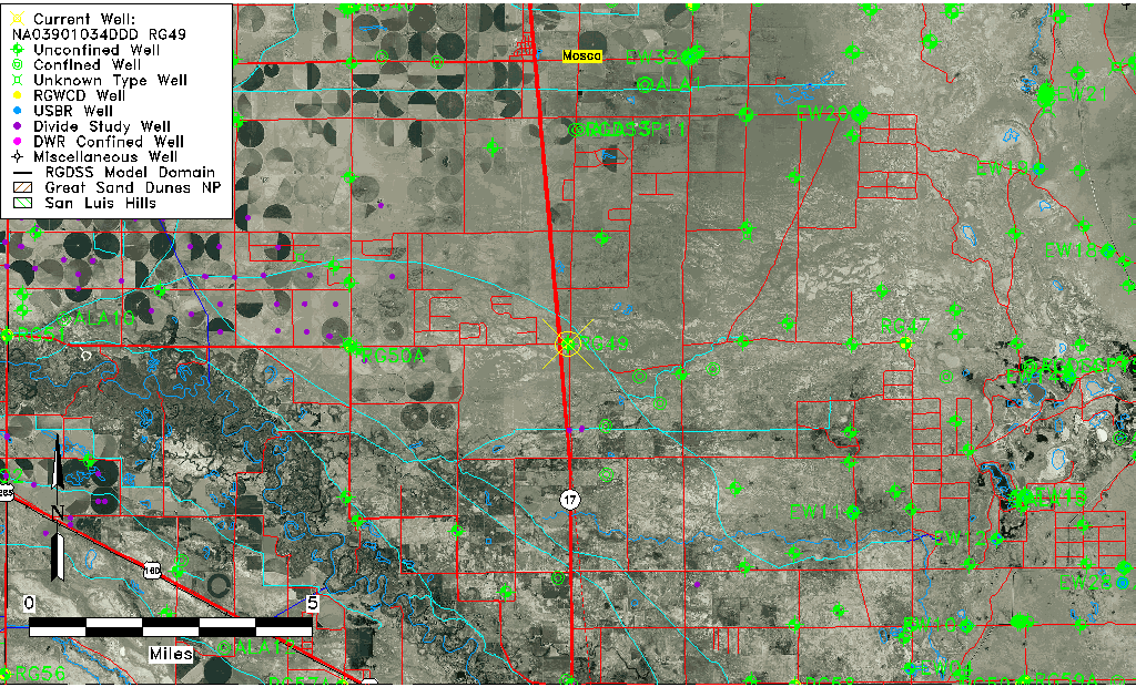
| USGS County | Alamosa County |
| USGS Map Name | HOOPER S.E. |
| USGS Map Scale | 24000 |
| Elevation and Depth Data |
|---|
| Ground Elevation (ft NAVD88) | 7549.15 |
| Elevation Data Source | Divide study surveying by Davis Engineering |
| RGWCD Measuring Point Elevation (ft NAVD88) | 7549.800 |
| RGWCD Well Riser Height (ft) | 1.100 |
| RGWCD Ground Surface (ft NAVD88) | 7548.70 |
| USGS Ground Elevation (ft NGVD29) | 7547.00 |
| 1/3-Arc Second NED Ground Elevation (ft NAVD88) | 7551.95 |
| 1-Arc Second NED Ground Elevation (ft NAVD88) | 7549.47 |
| SRTM Ground Elevation (ft NAVD88) | 7555.07 |
| Total Depth (ft) | 30.00 |
| USGS Hole Depth (ft) | 30.00 |
| USGS Well Depth (ft) | 30.00 |
| Model Layer | 1 |
| Model Layer Source | RGWCD |
| Depth of Bottom of Layer 1 | 62 |
| Depth of Bottom of Layer 2 | 456 |
| Depth of Bottom of Layer 3 | 982 |
| Depth of Bottom of Layer 4 | 2350 |
| Additional Well Information | Production, Geohydrology, Construction, Aquifer |
| Aquifer Information |
|---|
| Aquifer Type | Unconfined |
| Aquifer Type Source | RGWCD_AQ |
| USGS Primary Aquifer | Quaternary System |
| USGS Hydrologic Unit | San Luis |
| USGS Data Available | Water-level (GW.LEV) |
| Water-level Database Information |
|---|
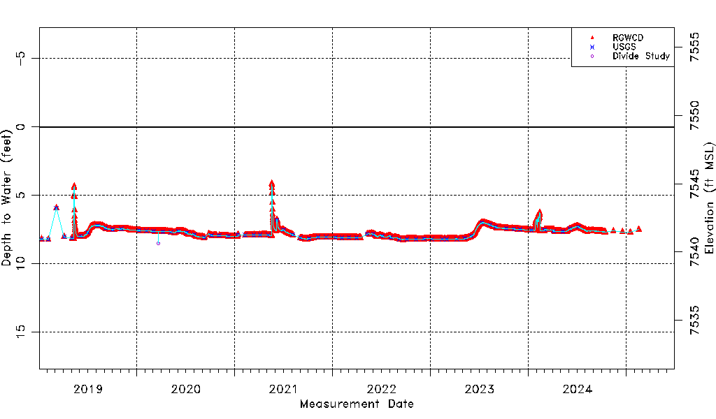
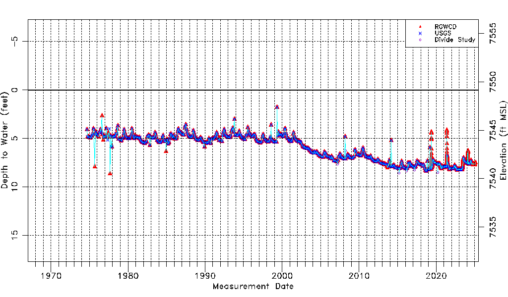
| Water-level Count | 4425 |
| Water-level Date Range | 09/05/1974 thru 06/09/2026 |
| Monitored within the last 18 months | Yes, most recently on 06/09/2026 |
| Depth-to-Water Range (ft) | 1.78 to 8.63 |
| Water Table Elevation Range (ft NAVD88) | 7540.52 to 7547.37 |
| Water-Level-Source:Number-of-Measurements | RGWCD:4395 USGS:581 Divide Study:7 |