| Well Information Table |
|---|
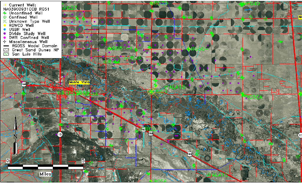
| Common Well ID | NA03900931CCB RG51 |
| RGWCD Well ID | RG51 |
| USGS Well ID | 373438106022101 |
| USGS Station Name | NA03900931CCB RG51 |
| USGS Construction Date | 02/26/1974 |
| USGS Site Type | Well |
| USGS Site Use Information | Unused |
| USGS Groundwater Use Information | Unused |
| Data Source(s) | USGS, RGWCD, Divide Study |
| Location Data |
|---|
| TRS | NA03900931CCB RG51 |
| RGWCD TRS | NA03900931CCB |
| USGS TRS 1 | NA03900931CCB RG51 |
| USGS TRS | NWSWSWS009T0039NR9 N |
| Longitude/Latitude (NAD83) | -106.03893327 , 37.57691786 |
| Longitude/Latitude Data Source | Divide Study |
| RGWCD Longitude/Latitude (NAD83) | -106:02:20.16 , 37:34:36.90 |
| USGS Longitude/Latitude (NAD83) | -106.039747800 , 37.577224500 |
| Easting, Northing RGDSS-NAD83 (US ft) | 94298.05 , 211720.22 |
| USGS Topography | Valley flat |
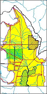
| USGS County | Alamosa County |
| USGS Map Name | HOMELAKE |
| USGS Map Scale | 24000 |
| Elevation and Depth Data |
|---|
| Ground Elevation (ft NAVD88) | 7604.08 |
| Elevation Data Source | Divide study surveying by Davis Engineering |
| RGWCD Measuring Point Elevation (ft NAVD88) | 7606.300 |
| RGWCD Well Riser Height (ft) | 4.000 |
| RGWCD Ground Surface (ft NAVD88) | 7602.30 |
| USGS Ground Elevation (ft NGVD29) | 7596.00 |
| 1/3-Arc Second NED Ground Elevation (ft NAVD88) | 7603.75 |
| 1-Arc Second NED Ground Elevation (ft NAVD88) | 7603.10 |
| SRTM Ground Elevation (ft NAVD88) | 7608.43 |
| Total Depth (ft) | 27.00 |
| USGS Well Depth (ft) | 27.00 |
| Model Layer | 1 |
| Model Layer Source | RGWCD |
| Depth of Bottom of Layer 1 | 61 |
| Depth of Bottom of Layer 2 | 191 |
| Depth of Bottom of Layer 3 | 649 |
| Depth of Bottom of Layer 4 | 2154 |
| Additional Well Information | Production, Logs, Geohydrology, Construction |
| Aquifer Information |
|---|
| Aquifer Type | Unconfined |
| Aquifer Type Source | RGWCD_AQ |
| USGS Primary Aquifer | Tertiary System |
| USGS Hydrologic Unit | Alamosa-Trinchera |
| USGS Data Available | Water-level (GW.LEV) |
| Water-level Database Information |
|---|
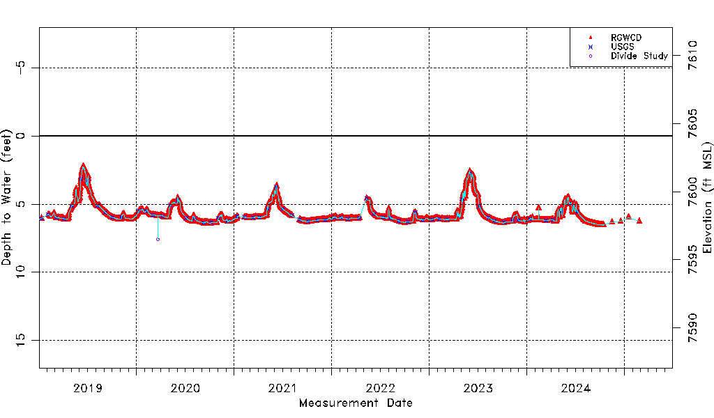
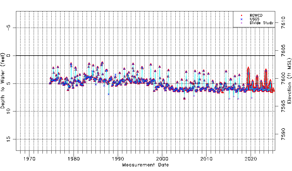
| Water-level Count | 4602 |
| Water-level Date Range | 09/05/1974 thru 07/15/2026 |
| Monitored within the last 18 months | Yes, most recently on 07/15/2026 |
| Depth-to-Water Range (ft) | 1.30 to 7.75 |
| Water Table Elevation Range (ft NAVD88) | 7596.33 to 7602.78 |
| Water-Level-Source:Number-of-Measurements | RGWCD:4578 USGS:586 Divide Study:7 |