| Well Information Table |
|---|
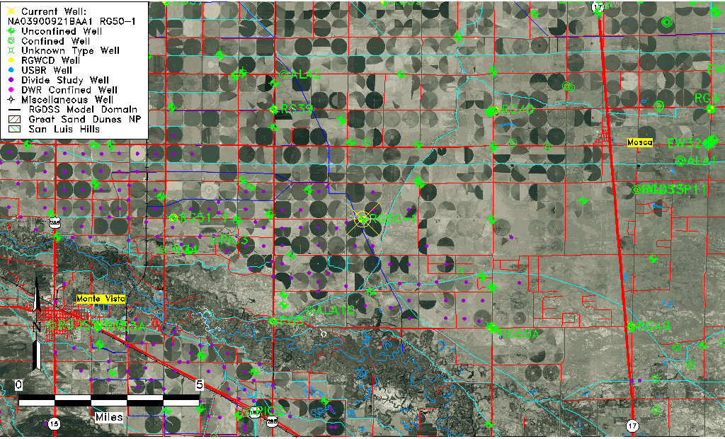
| Common Well ID | NA03900921BAA1 RG50-1 |
| RGWCD Well ID | RG50-1 |
| USGS Well ID | 373704105593401 |
| USGS Station Name | NA03900921BAA1 RG50-1 |
| USGS Construction Date | 03/04/1980 |
| USGS Site Type | Well |
| USGS Site Use Information | Observation |
| USGS Groundwater Use Information | Unused |
| Data Source(s) | USGS, RGWCD, Divide Study |
| Location Data |
|---|
| TRS | NA03900921BAA1 RG50-1 |
| RGWCD TRS | NA03900921BAA1 |
| USGS TRS 1 | NA03900921BAA1 RG50-1 |
| USGS TRS | NENENWS021T0039NR0009EN |
| Longitude/Latitude (NAD83) | -105.99401876 , 37.61788688 |
| Longitude/Latitude Data Source | Divide Study |
| RGWCD Longitude/Latitude (NAD83) | -105:59:38.46 , 37:37:04.40 |
| USGS Longitude/Latitude (NAD83) | -105.993357400 , 37.617779290 |
| Easting, Northing RGDSS-NAD83 (US ft) | 107362.43 , 226585.76 |
| USGS Topography | Valley flat |
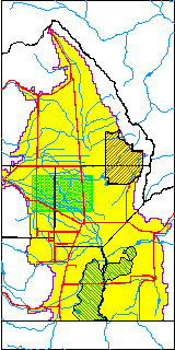
| USGS County | Alamosa County |
| USGS Map Name | MT PLEASANT |
| USGS Map Scale | 24000 |
| Elevation and Depth Data |
|---|
| Ground Elevation (ft NAVD88) | 7594.98 |
| Elevation Data Source | Divide study surveying by Davis Engineering |
| RGWCD Measuring Point Elevation (ft NAVD88) | 7596.800 |
| RGWCD Well Riser Height (ft) | 2.000 |
| RGWCD Ground Surface (ft NAVD88) | 7594.80 |
| USGS Ground Elevation (ft NGVD29) | 7590.00 |
| 1/3-Arc Second NED Ground Elevation (ft NAVD88) | 7593.23 |
| 1-Arc Second NED Ground Elevation (ft NAVD88) | 7593.25 |
| SRTM Ground Elevation (ft NAVD88) | 7604.99 |
| Total Depth (ft) | 32.50 |
| USGS Hole Depth (ft) | 33.60 |
| USGS Well Depth (ft) | 32.50 |
| Model Layer | 1 |
| Model Layer Source | RGWCD |
| Depth of Bottom of Layer 1 | 85 |
| Depth of Bottom of Layer 2 | 233 |
| Depth of Bottom of Layer 3 | 734 |
| Depth of Bottom of Layer 4 | 1979 |
| Additional Well Information | Production, Logs, Geohydrology, Construction |
| Aquifer Information |
|---|
| Aquifer Type | Unconfined |
| Aquifer Type Source | RGWCD_AQ |
| USGS Hydrologic Unit | San Luis |
| USGS Data Available | Water-level (GW.LEV) |
| Water-level Database Information |
|---|
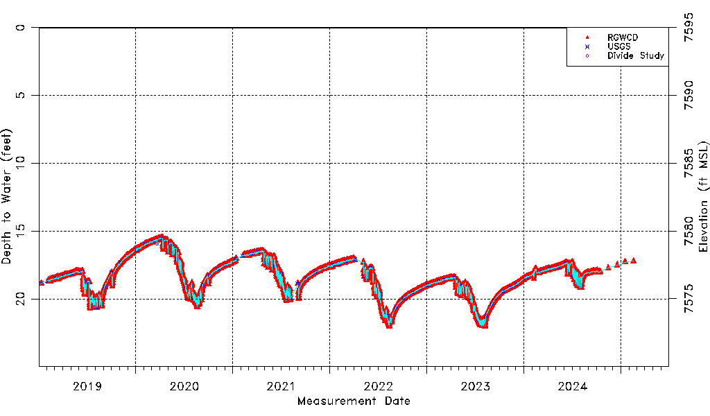
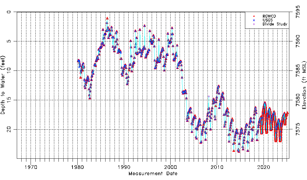
| Water-level Count | 4541 |
| Water-level Date Range | 03/06/1980 thru 07/15/2026 |
| Monitored within the last 18 months | Yes, most recently on 07/15/2026 |
| Depth-to-Water Range (ft) | 1.13 to 23.79 |
| Water Table Elevation Range (ft NAVD88) | 7571.19 to 7593.85 |
| Water-Level-Source:Number-of-Measurements | RGWCD:4515 USGS:509 Divide Study:7 |