| Well Information Table |
|---|
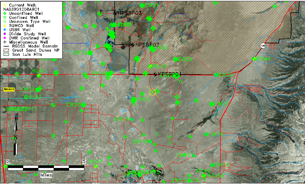
| Common Well ID | NA03901208ABC1 |
| USGS Well ID | 373847105405401 |
| GSDNP Well Name | 373847105405401 |
| USGS Station Name | NA03901208ABC1 |
| USGS Site Type | Well |
| USGS Site Use Information | Withdrawal of Water |
| USGS Groundwater Use Information | Stock |
| Data Source(s) | USGS |
| Location Data |
|---|
| TRS | NA03901208ABC1 |
| USGS TRS 1 | NA03901208ABC1 |
| USGS TRS | SWNWNES08 T039N R012E N |
| Longitude/Latitude (NAD83) | -105.68223890 , 37.64639108 |
| Longitude/Latitude Data Source | GWSI decimal LAT/LONG field |
| USGS Longitude/Latitude (NAD83) | -105.682238900 , 37.646391080 |
| Easting, Northing RGDSS-NAD83 (US ft) | 197641.61 , 236798.39 |
| USGS Topography | Alluvial or Marine Terrace |
| USGS County | Alamosa County |
| USGS Map Name | MEDANO RANCH |
| USGS Map Scale | 24000 |
| Elevation and Depth Data |
|---|
| Ground Elevation (ft NAVD88) | 7542.14 |
| Elevation Data Source | USGS GWSI database |
| USGS Ground Elevation (ft NGVD29) | 7538.00 |
| 1/3-Arc Second NED Ground Elevation (ft NAVD88) | 7543.70 |
| 1-Arc Second NED Ground Elevation (ft NAVD88) | 7541.06 |
| SRTM Ground Elevation (ft NAVD88) | 7549.56 |
| Depth of Bottom of Layer 1 | 140 |
| Depth of Bottom of Layer 2 | 498 |
| Depth of Bottom of Layer 3 | 1518 |
| Depth of Bottom of Layer 4 | 3996 |
| Additional Well Information | Production, Geohydrology, Aquifer |
| Aquifer Information |
|---|
| Aquifer Type | Unknown |
| Aquifer Type Source | None |
| USGS Primary Aquifer | Quaternary System |
| USGS Hydrologic Unit | San Luis |
| USGS Data Available | Water-level (GW.LEV) |
| Water-level Database Information |
|---|
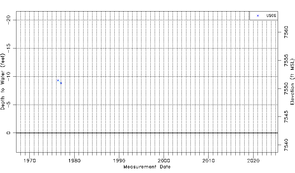
| Water-level Count | 2 |
| Water-level Date Range | 05/12/1976 thru 01/13/1977 |
| Monitored within the last 18 months | No, most recently on 01/13/1977 |
| Depth-to-Water Range (ft) | -9.30 to -8.80 |
| Water Table Elevation Range (ft NAVD88) | 7550.94 to 7551.44 |
| Water-Level-Source:Number-of-Measurements | USGS:2 |