| Well Information Table |
|---|
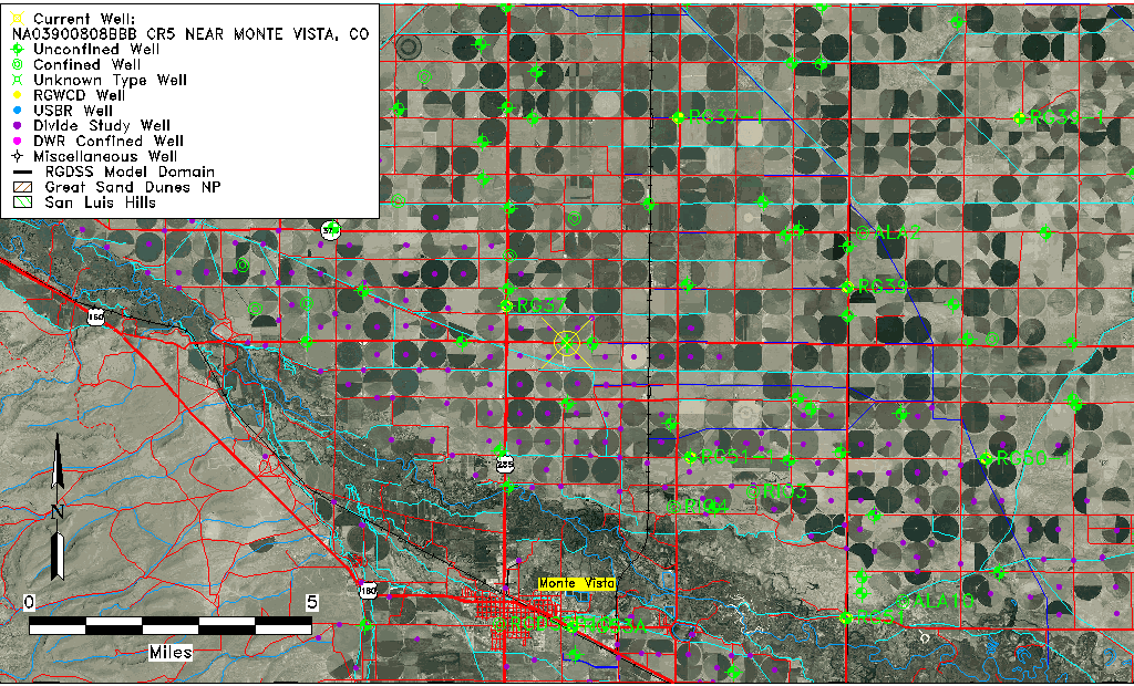
| Common Well ID | NA03900808BBB CR5 NEAR MONTE VISTA, CO |
| USGS Well ID | 373849106074301 |
| USGS Station Name | NA03900808BBB CR5 NEAR MONTE VISTA, CO |
| USGS Construction Date | 08/14/1993 |
| USGS Site Type | Well |
| USGS Site Use Information | Observation |
| USGS Groundwater Use Information | Unused |
| Data Source(s) | USGS |
| Location Data |
|---|
| TRS | NA03900808BBB CR5 NEAR MONTE VISTA, CO |
| USGS TRS 1 | NA03900808BBB CR5 NEAR MONTE VISTA, CO |
| USGS TRS | NWNWNWS 8T 39NR 8E |
| Longitude/Latitude (NAD83) | -106.12920560 , 37.64712220 |
| Longitude/Latitude Data Source | GWSI decimal LAT/LONG field |
| USGS Longitude/Latitude (NAD83) | -106.129205600 , 37.647122200 |
| Easting, Northing RGDSS-NAD83 (US ft) | 68269.28 , 237392.32 |
| USGS Topography | Valley flat |
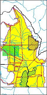
| USGS County | Rio Grande County |
| USGS Map Name | SEVENMILE PLAZA |
| USGS Map Scale | 2400 |
| Elevation and Depth Data |
|---|
| Ground Elevation (ft NAVD88) | 7670.00 |
| Elevation Data Source | USGS GWSI database |
| USGS Ground Elevation (ft NAVD88) | 7670.00 |
| 1/3-Arc Second NED Ground Elevation (ft NAVD88) | 7666.49 |
| 1-Arc Second NED Ground Elevation (ft NAVD88) | 7666.40 |
| SRTM Ground Elevation (ft NAVD88) | 7675.52 |
| Total Depth (ft) | 26.00 |
| USGS Hole Depth (ft) | 26.00 |
| USGS Well Depth (ft) | 26.00 |
| Model Layer | 1 |
| Model Layer Source | Well Depth |
| Depth of Bottom of Layer 1 | 86 |
| Depth of Bottom of Layer 2 | 261 |
| Depth of Bottom of Layer 3 | 403 |
| Depth of Bottom of Layer 4 | 2254 |
| Additional Well Information | Logs, Geohydrology, Construction, Aquifer |
| Aquifer Information |
|---|
| Aquifer Type | Unconfined |
| Aquifer Type Source | TD Elevation/Model Layer |
| USGS Primary Aquifer | 112ALMS |
| USGS Aquifer Type | Unconfined Single Aquifer |
| USGS Hydrologic Unit | San Luis |
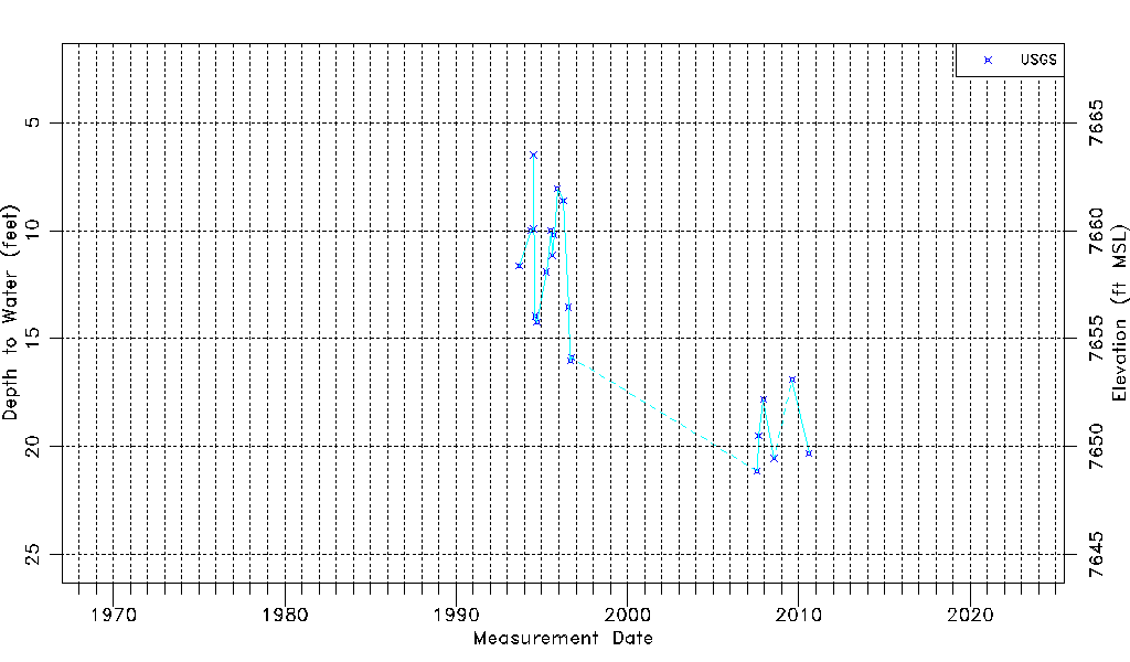
| USGS Data Available | Water-level (GW.LEV) |
| Water-level Database Information |
|---|
| Water-level Count | 21 |
| Water-level Date Range | 09/07/1993 thru 08/07/2010 |
| Monitored within the last 18 months | No, most recently on 08/07/2010 |
| Depth-to-Water Range (ft) | 6.50 to 21.13 |
| Water Table Elevation Range (ft NAVD88) | 7648.87 to 7663.50 |
| Water-Level-Source:Number-of-Measurements | USGS:21 |