| Well Information Table |
|---|
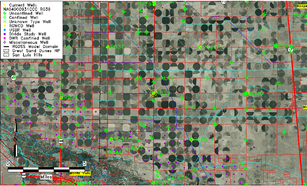
| Common Well ID | NA04000931CCC RG39 |
| RGWCD Well ID | RG39 |
| USGS Well ID | 373944106022001 |
| USGS Station Name | NA04000931CCC RG39 |
| USGS Construction Date | 03/01/1974 |
| USGS Site Type | Well |
| USGS Site Use Information | Observation |
| USGS Groundwater Use Information | Unused |
| Data Source(s) | USGS, RGWCD, Divide Study |
| Location Data |
|---|
| TRS | NA04000931CCC RG39 |
| RGWCD TRS | NA04000931CCC |
| USGS TRS 1 | NA04000931CCC RG39 |
| USGS TRS | SWSWSWS031T0040NR0009EN |
| Longitude/Latitude (NAD83) | -106.03886752 , 37.66177545 |
| Longitude/Latitude Data Source | Divide Study |
| RGWCD Longitude/Latitude (NAD83) | -106:02:19.92 , 37:39:42.40 |
| USGS Longitude/Latitude (NAD83) | -106.039469600 , 37.662223390 |
| Easting, Northing RGDSS-NAD83 (US ft) | 94439.00 , 242610.56 |
| USGS Topography | Valley flat |
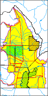
| USGS County | Alamosa County |
| USGS Map Name | CENTER SOUTH |
| USGS Map Scale | 24000 |
| Elevation and Depth Data |
|---|
| Ground Elevation (ft NAVD88) | 7618.19 |
| Elevation Data Source | Divide study surveying by Davis Engineering |
| RGWCD Measuring Point Elevation (ft NAVD88) | 7618.700 |
| RGWCD Well Riser Height (ft) | 2.000 |
| RGWCD Ground Surface (ft NAVD88) | 7616.70 |
| USGS Ground Elevation (ft NGVD29) | 7612.00 |
| 1/3-Arc Second NED Ground Elevation (ft NAVD88) | 7616.90 |
| 1-Arc Second NED Ground Elevation (ft NAVD88) | 7616.16 |
| SRTM Ground Elevation (ft NAVD88) | 7616.37 |
| Total Depth (ft) | 28.00 |
| USGS Well Depth (ft) | 28.00 |
| Model Layer | 1 |
| Model Layer Source | RGWCD |
| Depth of Bottom of Layer 1 | 100 |
| Depth of Bottom of Layer 2 | 229 |
| Depth of Bottom of Layer 3 | 696 |
| Depth of Bottom of Layer 4 | 2273 |
| Additional Well Information | Production, Logs, Geohydrology, Construction |
| Aquifer Information |
|---|
| Aquifer Type | Unconfined |
| Aquifer Type Source | RGWCD_AQ |
| USGS Primary Aquifer | Cenozoic Erathem |
| USGS Aquifer Type | Unconfined Single Aquifer |
| USGS Hydrologic Unit | San Luis |
| USGS Data Available | Water-level (GW.LEV) |
| Water-level Database Information |
|---|
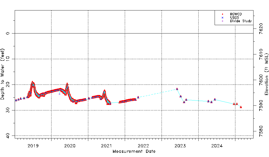
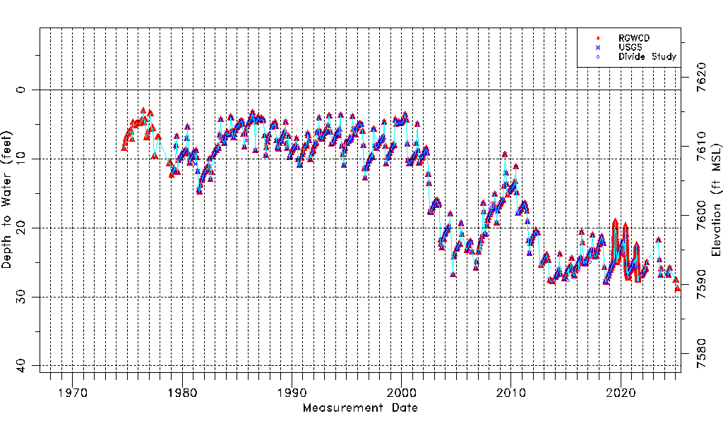
| Water-level Count | 2423 |
| Water-level Date Range | 09/10/1974 thru 06/09/2026 |
| Monitored within the last 18 months | Yes, most recently on 06/09/2026 |
| Depth-to-Water Range (ft) | 3.08 to 28.86 |
| Water Table Elevation Range (ft NAVD88) | 7589.33 to 7615.11 |
| Water-Level-Source:Number-of-Measurements | RGWCD:2396 USGS:489 Divide Study:7 |