| Well Information Table |
|---|
| Common Well ID | NA03901106BBB RG41 |
| RGWCD Well ID | RG41 |
| USGS Well ID | 373947105490701 |
| GSDNP Well Name | 373947105490701 |
| USGS Station Name | NA03901106BBB RG41 |
| USGS Construction Date | 01/10/1974 |
| USGS Site Type | Well |
| USGS Site Use Information | Observation |
| USGS Groundwater Use Information | Unused |
| Data Source(s) | USGS, RGWCD |
| Location Data |
|---|
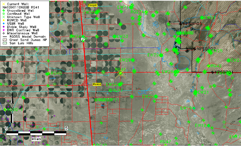
| TRS | NA03901106BBB RG41 |
| RGWCD TRS | NA03901106BBB |
| USGS TRS 1 | NA03901106BBB RG41 |
| USGS TRS | NWNWNWS06 T039N R011E N |
| Longitude/Latitude (NAD83) | -105.81863525 , 37.66237308 |
| Longitude/Latitude Data Source | RGWCD/Davis Engineering |
| RGWCD Longitude/Latitude (NAD83) | -105:49:07.0869 , 37:39:44.54309 |
| USGS Longitude/Latitude (NAD83) | -105.819186700 , 37.663056870 |
| Easting, Northing RGDSS-NAD83 (US ft) | 158172.18 , 242650.76 |
| USGS Topography | Valley flat |
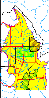
| USGS County | Alamosa County |
| USGS Map Name | HOOPER EAST |
| USGS Map Scale | 24000 |
| Elevation and Depth Data |
|---|
| Ground Elevation (ft NAVD88) | 7542.08 |
| Elevation Data Source | RGWCD well database |
| RGWCD Measuring Point Elevation (ft NAVD88) | 7544.080 |
| RGWCD Well Riser Height (ft) | 2.000 |
| RGWCD Ground Surface (ft NAVD88) | 7542.08 |
| USGS Ground Elevation (ft NGVD29) | 7540.00 |
| 1/3-Arc Second NED Ground Elevation (ft NAVD88) | 7543.85 |
| 1-Arc Second NED Ground Elevation (ft NAVD88) | 7541.66 |
| SRTM Ground Elevation (ft NAVD88) | 7557.30 |
| Total Depth (ft) | 27.00 |
| USGS Well Depth (ft) | 27.00 |
| Model Layer | 1 |
| Model Layer Source | RGWCD |
| Depth of Bottom of Layer 1 | 79 |
| Depth of Bottom of Layer 2 | 403 |
| Depth of Bottom of Layer 3 | 1249 |
| Depth of Bottom of Layer 4 | 1976 |
| Additional Well Information | Production, Geohydrology, Construction, Aquifer |
| Aquifer Information |
|---|
| Aquifer Type | Unconfined |
| Aquifer Type Source | RGWCD_AQ |
| USGS Primary Aquifer | Quaternary System |
| USGS Aquifer Type | Unconfined Multiple Aquifer |
| USGS Hydrologic Unit | San Luis |
| USGS Data Available | Water-level (GW.LEV) |
| Water-level Database Information |
|---|
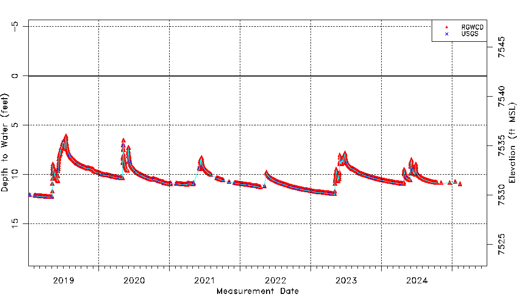
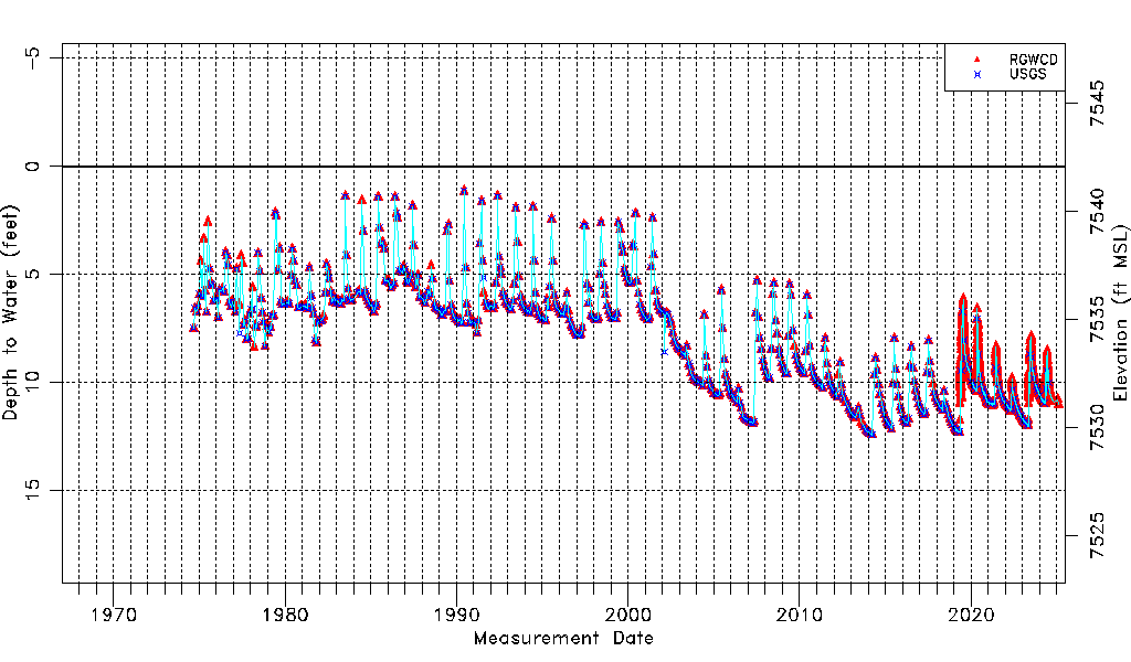
| Water-level Count | 4447 |
| Water-level Date Range | 09/05/1974 thru 06/01/2026 |
| Monitored within the last 18 months | Yes, most recently on 06/01/2026 |
| Depth-to-Water Range (ft) | 1.15 to 12.43 |
| Water Table Elevation Range (ft NAVD88) | 7529.65 to 7540.93 |
| Water-Level-Source:Number-of-Measurements | RGWCD:4431 USGS:572 |