| Well Information Table |
|---|
| Common Well ID | NA04000732CCC |
| USGS Well ID | 374000106140001 |
| USGS Station Name | NA04000732CCC |
| USGS Site Type | Well |
| USGS Site Use Information | Withdrawal of Water |
| USGS Groundwater Use Information | Irrigation |
| Data Source(s) | USGS |
| Location Data |
|---|
| TRS | NA04000732CCC |
| USGS TRS 1 | NA04000732CCC |
| USGS TRS | SWSWSWS032T0040NR0007EN |
| Longitude/Latitude (NAD83) | -106.23391980 , 37.66666937 |
| Longitude/Latitude Data Source | GWSI decimal LAT/LONG field |
| USGS Longitude/Latitude (NAD83) | -106.233919800 , 37.666669370 |
| Easting, Northing RGDSS-NAD83 (US ft) | 38001.91 , 244674.23 |
| USGS Topography | Flat Surface |
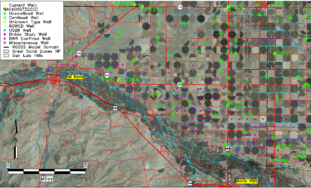
| USGS County | Rio Grande County |
| Elevation and Depth Data |
|---|
| Ground Elevation (ft NAVD88) | 7767.68 |
| Elevation Data Source | USGS GWSI database |
| USGS Ground Elevation (ft NGVD29) | 7763.00 |
| 1/3-Arc Second NED Ground Elevation (ft NAVD88) | 7759.53 |
| 1-Arc Second NED Ground Elevation (ft NAVD88) | 7759.66 |
| SRTM Ground Elevation (ft NAVD88) | 7766.14 |
| Total Depth (ft) | 71.00 |
| USGS Well Depth (ft) | 71.00 |
| Model Layer | 2 |
| Model Layer Source | Well Depth |
| Depth of Bottom of Layer 1 | 61 |
| Depth of Bottom of Layer 2 | 185 |
| Depth of Bottom of Layer 3 | 318 |
| Depth of Bottom of Layer 4 | 686 |
| Additional Well Information | Geohydrology, Construction |
| Aquifer Information |
|---|
| Aquifer Type | Confined |
| Aquifer Type Source | TD Elevation/Model Layer |
| USGS Primary Aquifer | Cenozoic Erathem |
| USGS Hydrologic Unit | San Luis |
| USGS Data Available | Water-level (GW.LEV) |
| Water-level Database Information |
|---|
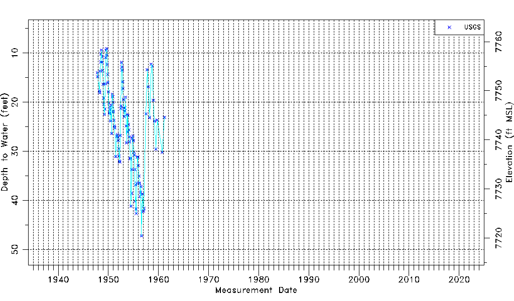
| Water-level Count | 113 |
| Water-level Date Range | 11/01/1947 thru 03/07/1961 |
| Monitored within the last 18 months | No, most recently on 03/07/1961 |
| Depth-to-Water Range (ft) | 9.13 to 47.23 |
| Water Table Elevation Range (ft NAVD88) | 7720.45 to 7758.55 |
| Water-Level-Source:Number-of-Measurements | USGS:113 |