| Well Information Table |
|---|
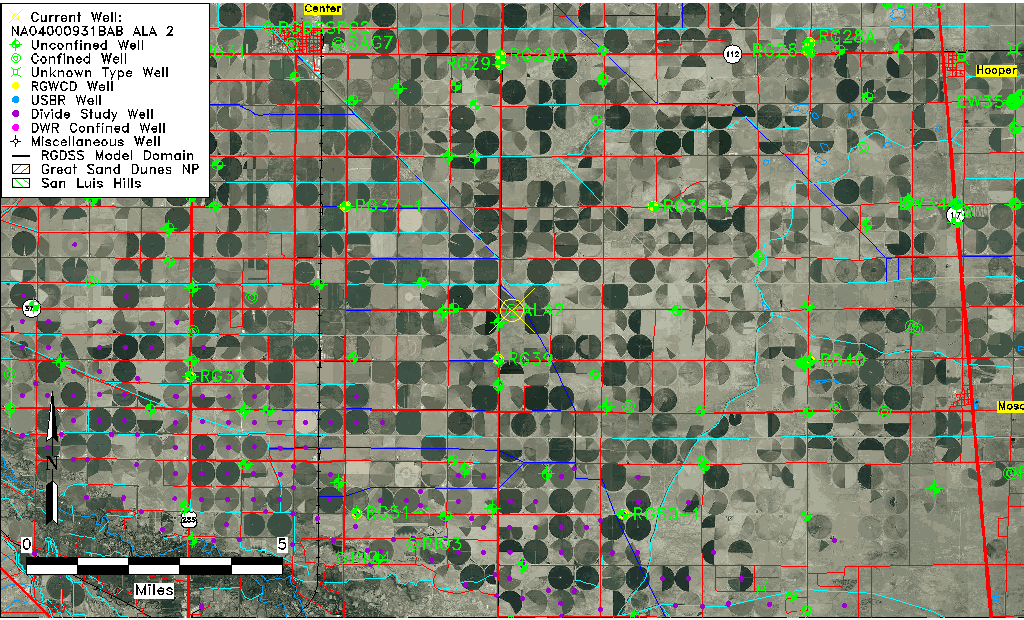
| Common Well ID | NA04000931BAB ALA 2 |
| RGWCD Confined Aquifer Well ID | ALA2 |
| USGS Well ID | 374030106020001 |
| USGS Station Name | NA04000931BAB ALA 2 |
| USGS Construction Date | 01/01/1969 |
| USGS Site Type | Well |
| USGS Site Use Information | Observation |
| USGS Groundwater Use Information | Unused |
| Data Source(s) | USGS |
| Location Data |
|---|
| TRS | NA04000931BAB ALA 2 |
| USGS TRS 1 | NA04000931BAB ALA 2 |
| USGS TRS | NWNENWS031T0040NR0009EN |
| Longitude/Latitude (NAD83) | -106.03399278 , 37.67576046 |
| Longitude/Latitude Data Source | Davis Engineering Survey |
| USGS Longitude/Latitude (NAD83) | -106.034000000 , 37.675750000 |
| Easting, Northing RGDSS-NAD83 (US ft) | 95869.61 , 247695.96 |
| USGS Topography | Valley flat |
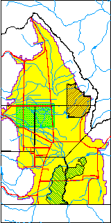
| USGS County | Alamosa County |
| Elevation and Depth Data |
|---|
| Ground Elevation (ft NAVD88) | 7614.06 |
| Elevation Data Source | Davis Engineering Survey |
| USGS Ground Elevation (ft NAVD88) | 7614.06 |
| 1/3-Arc Second NED Ground Elevation (ft NAVD88) | 7611.02 |
| 1-Arc Second NED Ground Elevation (ft NAVD88) | 7611.20 |
| SRTM Ground Elevation (ft NAVD88) | 7618.11 |
| Total Depth (ft) | 415.00 |
| USGS Well Depth (ft) | 415.00 |
| Model Layer | 3 |
| Model Layer Source | Well Depth |
| Depth of Bottom of Layer 1 | 102 |
| Depth of Bottom of Layer 2 | 220 |
| Depth of Bottom of Layer 3 | 720 |
| Depth of Bottom of Layer 4 | 2271 |
| Additional Well Information | Geohydrology, Construction |
| Aquifer Information |
|---|
| Aquifer Type | Confined |
| Aquifer Type Source | RGWCD_AQ |
| USGS Primary Aquifer | Cenozoic Erathem |
| USGS Aquifer Type | Confined Single Aquifer |
| USGS Hydrologic Unit | San Luis |
| USGS Data Available | Water-level (GW.LEV) |
| Water-level Database Information |
|---|
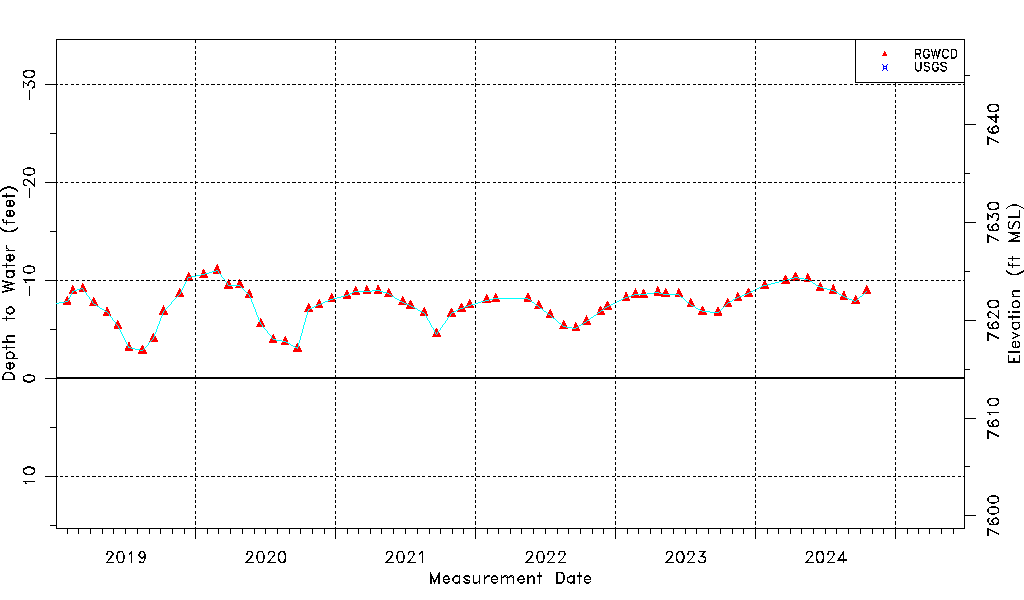
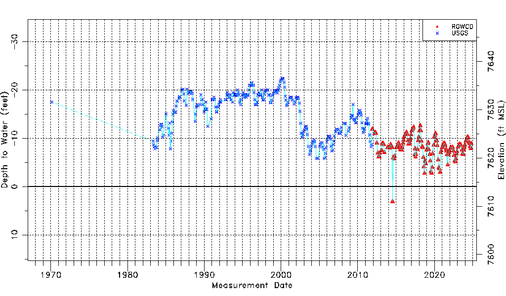
| Water-level Count | 424 |
| Water-level Date Range | 02/17/1970 thru 03/17/2026 |
| Monitored within the last 18 months | Yes, most recently on 03/17/2026 |
| Depth-to-Water Range (ft) | -22.39 to 3.07 |
| Water Table Elevation Range (ft NAVD88) | 7610.99 to 7636.45 |
| Water-Level-Source:Number-of-Measurements | RGWCD:141 USGS:283 |