| Well Information Table |
|---|
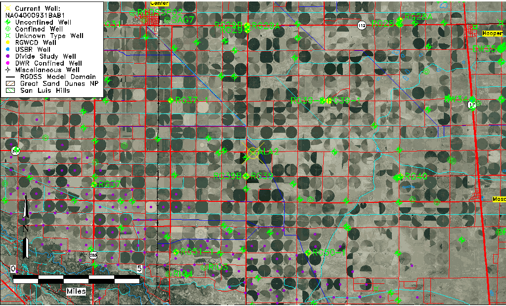
| Common Well ID | NA04000931BAB1 |
| USGS Station Name | NA04000931BAB1 |
| USGS Construction Date | 01/01/1969 |
| USGS Site Type | NNNNNYNNNNNNNNNNNNNN |
| USGS Site Use Information | Unknown |
| USGS Groundwater Use Information | Unknown |
| Data Source(s) | USGS |
| Location Data |
|---|
| TRS | NA04000931BAB1 |
| USGS TRS 1 | NA04000931BAB1 |
| USGS TRS | NWNENWS031T0040NR0009EN |
| Longitude/Latitude (NAD83) | -106.03391389 , 37.67500083 |
| Longitude/Latitude Data Source | GWSI decimal LAT/LONG field |
| USGS Longitude/Latitude (NAD83) | -106.033913889 , 37.675000833 |
| Easting, Northing RGDSS-NAD83 (US ft) | 95891.36 , 247419.35 |
| USGS Topography | Valley flat |
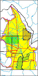
| USGS County | Alamosa County |
| Elevation and Depth Data |
|---|
| Ground Elevation (ft NAVD88) | 7614.27 |
| Elevation Data Source | USGS GWSI database |
| USGS Ground Elevation (ft NGVD29) | 7610.00 |
| 1/3-Arc Second NED Ground Elevation (ft NAVD88) | 7613.15 |
| 1-Arc Second NED Ground Elevation (ft NAVD88) | 7612.95 |
| SRTM Ground Elevation (ft NAVD88) | 7621.10 |
| Total Depth (ft) | 970.00 |
| USGS Well Depth (ft) | 970.00 |
| Model Layer | 4 |
| Model Layer Source | Well Depth |
| Depth of Bottom of Layer 1 | 102 |
| Depth of Bottom of Layer 2 | 221 |
| Depth of Bottom of Layer 3 | 719 |
| Depth of Bottom of Layer 4 | 2271 |
| Additional Well Information | Geohydrology, Construction |
| Aquifer Information |
|---|
| Aquifer Type | Confined |
| Aquifer Type Source | TD Elevation/Model Layer |
| USGS Primary Aquifer | Santa Fe Formation |
| USGS Hydrologic Unit | San Luis |
| Water-level Database Information |
|---|
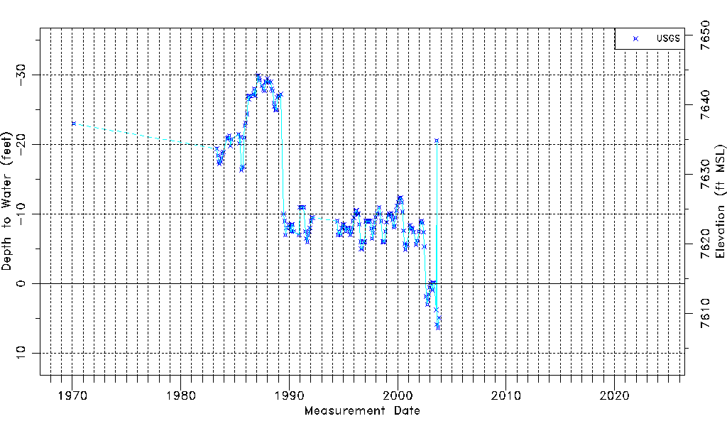
| Water-level Count | 182 |
| Water-level Date Range | 02/17/1970 thru 10/27/2003 |
| Monitored within the last 18 months | No, most recently on 10/27/2003 |
| Depth-to-Water Range (ft) | -30.00 to 6.36 |
| Water Table Elevation Range (ft NAVD88) | 7607.91 to 7644.27 |
| Water-Level-Source:Number-of-Measurements | USGS:182 |