| Well Information Table |
|---|
| Common Well ID | NA04000916DDD RG39-1 |
| RGWCD Well ID | RG39-1 |
| USGS Well ID | 374220105585801 |
| USGS Station Name | NA04000916DDD RG39-1 |
| USGS Construction Date | 02/27/1980 |
| USGS Site Type | Well |
| USGS Site Use Information | Observation |
| USGS Groundwater Use Information | Unused |
| Data Source(s) | USGS, RGWCD |
| Location Data |
|---|
| TRS | NA04000916DDD RG39-1 |
| RGWCD TRS | NA04000916DDD |
| USGS TRS 1 | NA04000916DDD RG39-1 |
| USGS TRS | SESESES016T0040NR0009EN |
| Longitude/Latitude (NAD83) | -105.98357822 , 37.70534055 |
| Longitude/Latitude Data Source | RGWCD/Davis Engineering |
| RGWCD Longitude/Latitude (NAD83) | -105:59:00.8816 , 37:42:19.22599 |
| USGS Longitude/Latitude (NAD83) | -105.983356700 , 37.705555800 |
| Easting, Northing RGDSS-NAD83 (US ft) | 110492.81 , 258410.85 |
| USGS Topography | Valley flat |
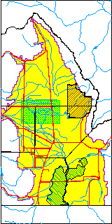
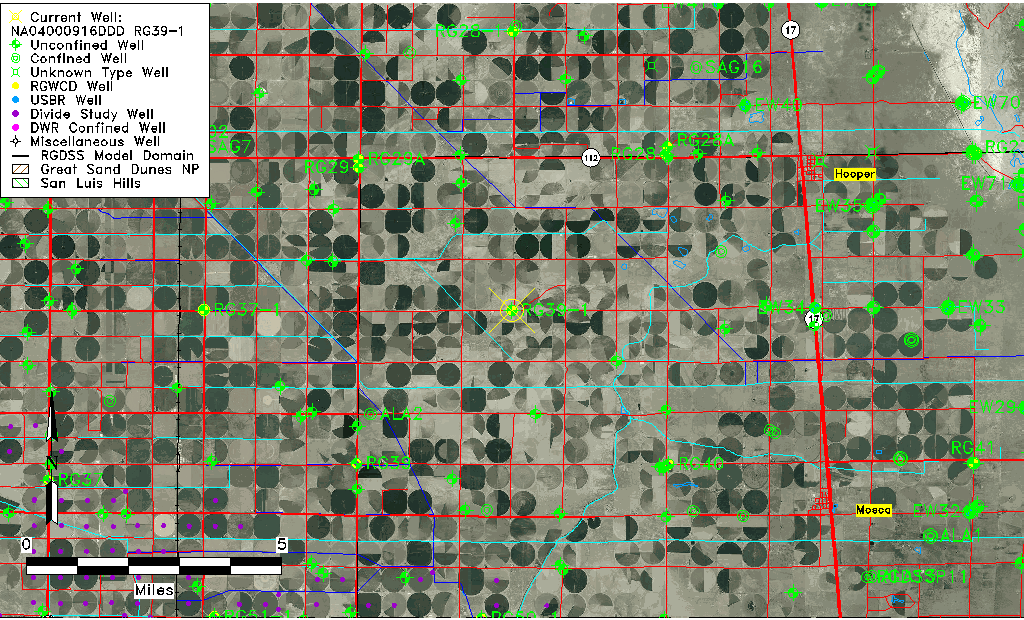
| USGS County | Alamosa County |
| USGS Map Name | HOOPER WEST |
| USGS Map Scale | 24000 |
| Elevation and Depth Data |
|---|
| Ground Elevation (ft NAVD88) | 7590.86 |
| Elevation Data Source | RGWCD well database |
| RGWCD Measuring Point Elevation (ft NAVD88) | 7592.860 |
| RGWCD Well Riser Height (ft) | 2.000 |
| RGWCD Ground Surface (ft NAVD88) | 7590.86 |
| USGS Ground Elevation (ft NGVD29) | 7585.00 |
| 1/3-Arc Second NED Ground Elevation (ft NAVD88) | 7591.04 |
| 1-Arc Second NED Ground Elevation (ft NAVD88) | 7591.04 |
| SRTM Ground Elevation (ft NAVD88) | 7602.01 |
| Total Depth (ft) | 29.20 |
| USGS Hole Depth (ft) | 34.30 |
| USGS Well Depth (ft) | 30.60 |
| Model Layer | 1 |
| Model Layer Source | RGWCD |
| Depth of Bottom of Layer 1 | 99 |
| Depth of Bottom of Layer 2 | 195 |
| Depth of Bottom of Layer 3 | 907 |
| Depth of Bottom of Layer 4 | 2357 |
| Additional Well Information | Production, Logs, Geohydrology, Construction |
| Aquifer Information |
|---|
| Aquifer Type | Unconfined |
| Aquifer Type Source | RGWCD_AQ |
| USGS Hydrologic Unit | San Luis |
| USGS Data Available | Water-level (GW.LEV) |
| Water-level Database Information |
|---|
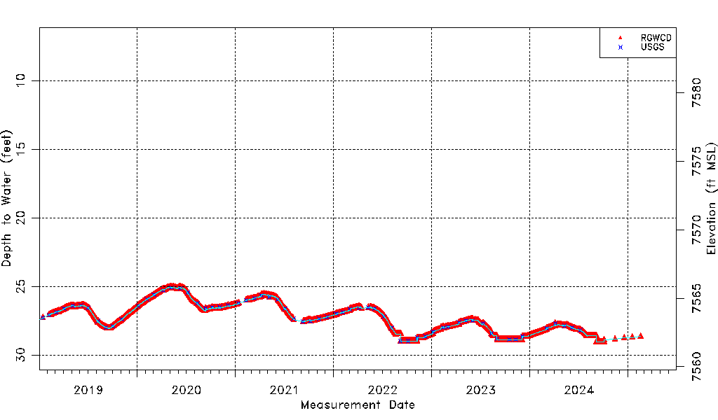
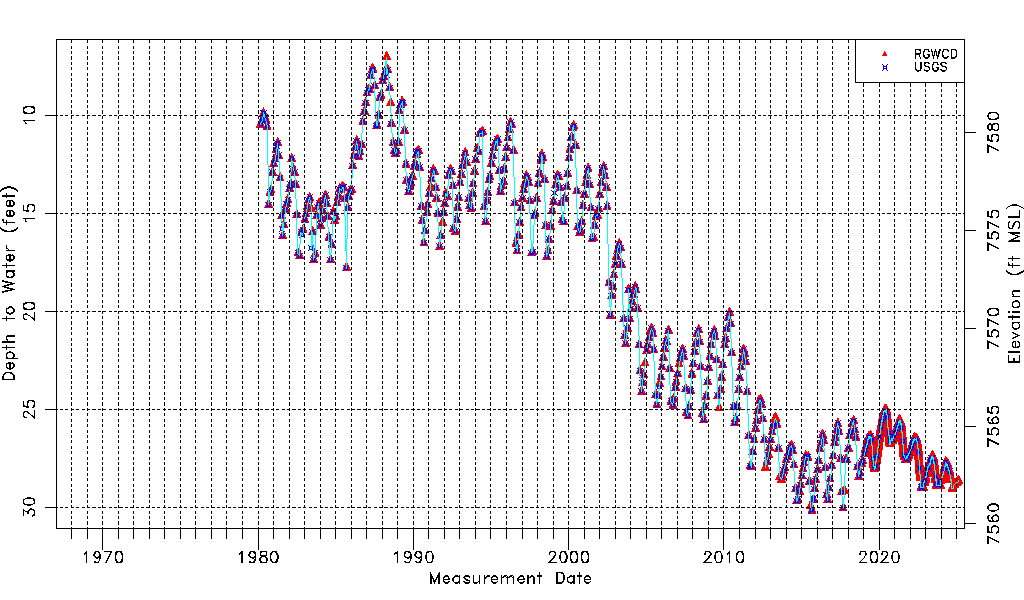
| Water-level Count | 4517 |
| Water-level Date Range | 03/06/1980 thru 06/12/2026 |
| Monitored within the last 18 months | Yes, most recently on 06/12/2026 |
| Depth-to-Water Range (ft) | 7.01 to 30.17 |
| Water Table Elevation Range (ft NAVD88) | 7560.69 to 7583.85 |
| Water-Level-Source:Number-of-Measurements | RGWCD:4489 USGS:522 |