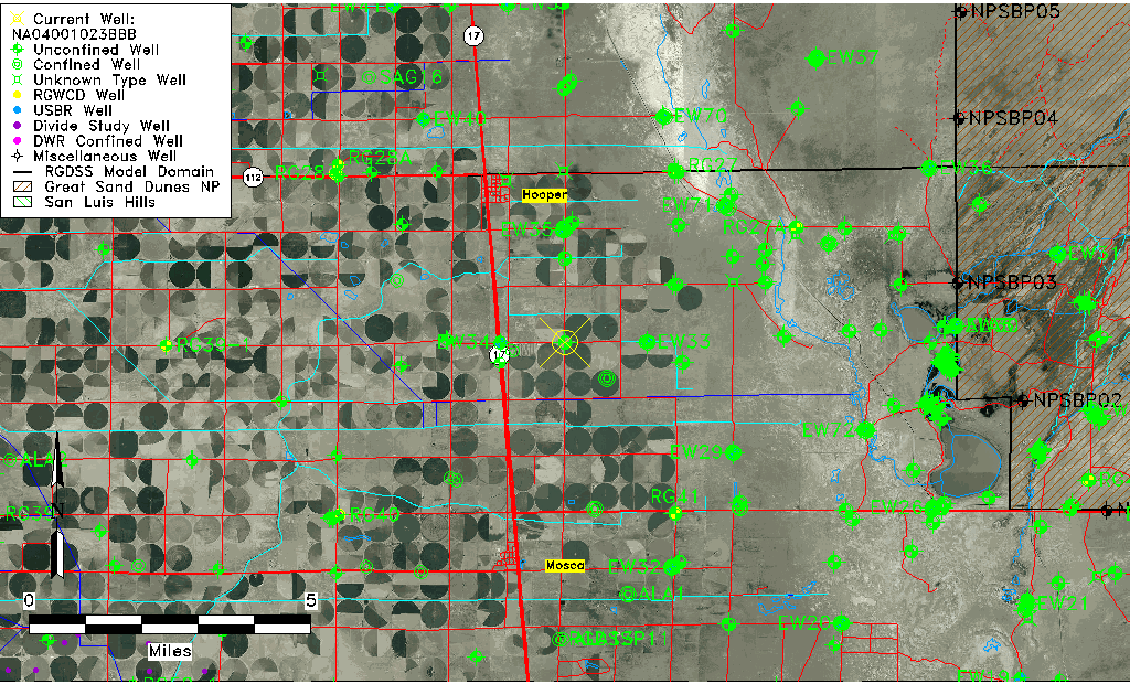
| Well Information Table |
|---|
| Common Well ID | NA04001023BBB |
| USGS Well ID | 374223105511401 |
| GSDNP Well Name | 374223105511401 |
| USGS Station Name | NA04001023BBB |
| USGS Site Type | Well |
| USGS Site Use Information | Observation |
| USGS Groundwater Use Information | Unused |
| Data Source(s) | USGS, USGS |
| Location Data |
|---|
| TRS | NA04001023BBB |
| USGS TRS 1 | NA04001023BBB |
| Longitude/Latitude (NAD83) | -105.85446500 , 37.70638930 |
| Longitude/Latitude Data Source | GWSI decimal LAT/LONG field |
| USGS Longitude/Latitude (NAD83) | -105.854465000 , 37.706389300 |
| Easting, Northing RGDSS-NAD83 (US ft) | 147835.63 , 258692.22 |
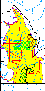
| USGS County | Alamosa County |
| Elevation and Depth Data |
|---|
| Ground Elevation (ft NAVD88) | 7551.86 |
| Elevation Data Source | USGS GWSI database |
| USGS Ground Elevation (ft NGVD29) | 7548.00 |
| 1/3-Arc Second NED Ground Elevation (ft NAVD88) | 7551.19 |
| 1-Arc Second NED Ground Elevation (ft NAVD88) | 7549.78 |
| SRTM Ground Elevation (ft NAVD88) | 7552.49 |
| Total Depth (ft) | 19.80 |
| USGS Hole Depth (ft) | 20.00 |
| USGS Well Depth (ft) | 19.80 |
| Model Layer | 1 |
| Model Layer Source | Dunes Layer |
| Depth of Bottom of Layer 1 | 79 |
| Depth of Bottom of Layer 2 | 272 |
| Depth of Bottom of Layer 3 | 1290 |
| Depth of Bottom of Layer 4 | 2171 |
| Additional Well Information | Logs, Geohydrology, Construction, Aquifer |
| Aquifer Information |
|---|
| Aquifer Type | Unconfined |
| Aquifer Type Source | TD Elevation/Model Layer |
| USGS Primary Aquifer | Cenozoic Erathem |
| USGS Aquifer Type | Unconfined Single Aquifer |
| USGS Hydrologic Unit | San Luis |
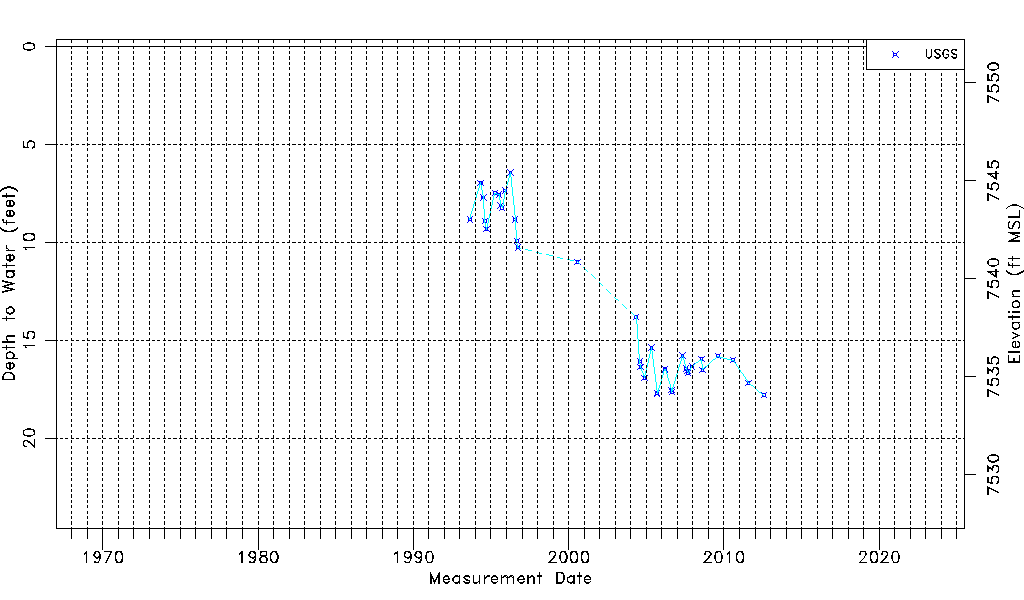
| USGS Data Available | Water-level (GW.LEV) |
| Water-level Database Information |
|---|
| Water-level Count | 42 |
| Water-level Date Range | 08/24/1993 thru 07/25/2012 |
| Monitored within the last 18 months | No, most recently on 07/25/2012 |
| Depth-to-Water Range (ft) | 6.43 to 17.80 |
| Water Table Elevation Range (ft NAVD88) | 7534.06 to 7545.43 |
| Water-Level-Source:Number-of-Measurements | USGS:42 |