| Well Information Table |
|---|
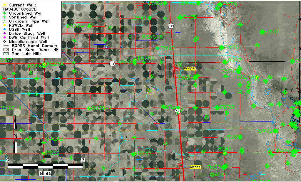
| Common Well ID | NA04001008BCB |
| USGS Well ID | 374320105543001 |
| USGS Station Name | NA04001008BCB |
| USGS Site Type | Well |
| USGS Site Use Information | Withdrawal of Water |
| USGS Groundwater Use Information | Irrigation |
| Data Source(s) | USGS |
| Location Data |
|---|
| TRS | NA04001008BCB |
| USGS TRS 1 | NA04001008BCB |
| USGS TRS | NWSWNWS008T0040NR0010EN |
| Longitude/Latitude (NAD83) | -105.90891060 , 37.72222230 |
| Longitude/Latitude Data Source | GWSI decimal LAT/LONG field |
| USGS Longitude/Latitude (NAD83) | -105.908910600 , 37.722222300 |
| Easting, Northing RGDSS-NAD83 (US ft) | 132104.09 , 264491.89 |
| USGS Topography | Valley flat |
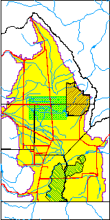
| USGS County | Alamosa County |
| Elevation and Depth Data |
|---|
| Ground Elevation (ft NAVD88) | 7565.88 |
| Elevation Data Source | USGS GWSI database |
| USGS Ground Elevation (ft NGVD29) | 7562.00 |
| 1/3-Arc Second NED Ground Elevation (ft NAVD88) | 7563.79 |
| 1-Arc Second NED Ground Elevation (ft NAVD88) | 7562.75 |
| SRTM Ground Elevation (ft NAVD88) | 7575.72 |
| Total Depth (ft) | 125.00 |
| USGS Well Depth (ft) | 125.00 |
| Model Layer | 2 |
| Model Layer Source | Well Depth |
| Depth of Bottom of Layer 1 | 97 |
| Depth of Bottom of Layer 2 | 215 |
| Depth of Bottom of Layer 3 | 1158 |
| Depth of Bottom of Layer 4 | 2525 |
| Additional Well Information | Geohydrology, Construction |
| Aquifer Information |
|---|
| Aquifer Type | Confined |
| Aquifer Type Source | TD Elevation/Model Layer |
| USGS Primary Aquifer | Cenozoic Erathem |
| USGS Hydrologic Unit | San Luis |
| USGS Data Available | Water-level (GW.LEV) |
| Water-level Database Information |
|---|
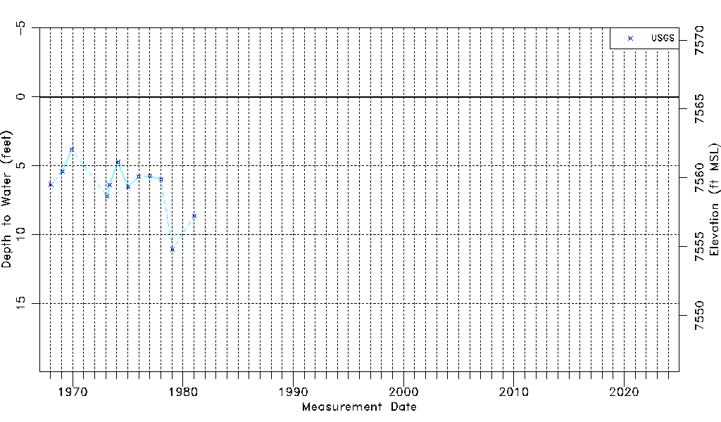
| Water-level Count | 12 |
| Water-level Date Range | 01/15/1968 thru 01/14/1981 |
| Monitored within the last 18 months | No, most recently on 01/14/1981 |
| Depth-to-Water Range (ft) | 3.85 to 11.07 |
| Water Table Elevation Range (ft NAVD88) | 7554.81 to 7562.03 |
| Water-Level-Source:Number-of-Measurements | USGS:12 |