| Well Information Table |
|---|
| Common Well ID | NA04100831CCC RG31 |
| RGWCD Well ID | RG31 |
| USGS Well ID | 374455106085501 |
| USGS Station Name | NA04100831CCC RG31 |
| USGS Site Type | Well |
| USGS Site Use Information | Withdrawal of Water |
| USGS Groundwater Use Information | Irrigation |
| Data Source(s) | USGS, RGWCD |
| Location Data |
|---|
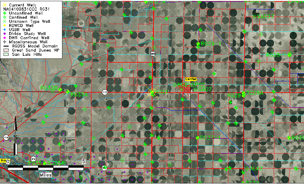
| TRS | NA04100831CCC RG31 |
| RGWCD TRS | NA04100831CCC |
| USGS TRS 1 | NA04100831CCC RG31 |
| USGS TRS | SWSWSWS031T0041NR0008EN |
| Longitude/Latitude (NAD83) | -106.14876389 , 37.74863333 |
| Longitude/Latitude Data Source | RGWCD/Davis Engineering |
| RGWCD Longitude/Latitude (NAD83) | -106:08:55.55 , 37:44:55.08 |
| USGS Longitude/Latitude (NAD83) | -106.149194700 , 37.748612200 |
| Easting, Northing RGDSS-NAD83 (US ft) | 62797.94 , 274374.63 |
| USGS Topography | Valley flat |
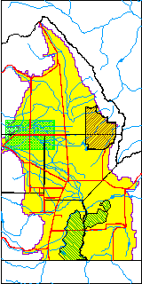
| USGS County | Saguache County |
| Elevation and Depth Data |
|---|
| Ground Elevation (ft NAVD88) | 7669.00 |
| Elevation Data Source | RGWCD well database |
| RGWCD Measuring Point Elevation (ft NAVD88) | 7669.700 |
| RGWCD Well Riser Height (ft) | 0.700 |
| RGWCD Ground Surface (ft NAVD88) | 7669.00 |
| USGS Ground Elevation (ft NGVD29) | 7668.00 |
| 1/3-Arc Second NED Ground Elevation (ft NAVD88) | 7669.09 |
| 1-Arc Second NED Ground Elevation (ft NAVD88) | 7669.26 |
| SRTM Ground Elevation (ft NAVD88) | 7674.03 |
| Total Depth (ft) | 73.00 |
| USGS Well Depth (ft) | 73.00 |
| Model Layer | 1 |
| Model Layer Source | RGWCD |
| Depth of Bottom of Layer 1 | 116 |
| Depth of Bottom of Layer 2 | 242 |
| Depth of Bottom of Layer 3 | 544 |
| Depth of Bottom of Layer 4 | 2255 |
| Additional Well Information | Geohydrology, Construction |
| Aquifer Information |
|---|
| Aquifer Type | Unconfined |
| Aquifer Type Source | RGWCD_AQ |
| USGS Primary Aquifer | Cenozoic Erathem |
| USGS Aquifer Type | Unconfined Single Aquifer |
| USGS Hydrologic Unit | San Luis |
| USGS Data Available | Water-level (GW.LEV) |
| Water-level Database Information |
|---|
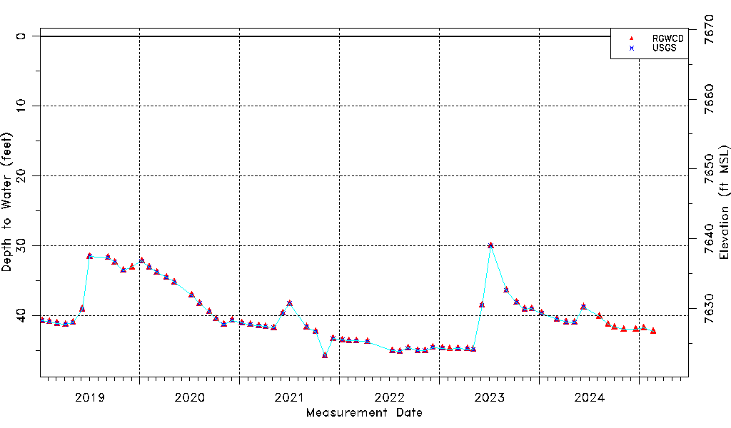
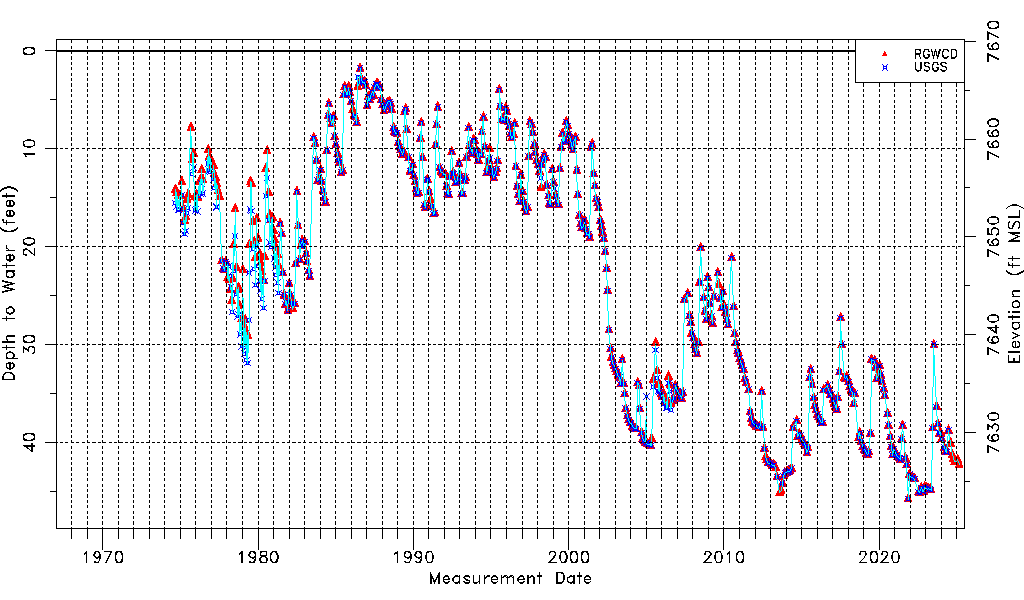
| Water-level Count | 712 |
| Water-level Date Range | 09/05/1974 thru 06/15/2026 |
| Monitored within the last 18 months | Yes, most recently on 06/15/2026 |
| Depth-to-Water Range (ft) | 1.79 to 45.78 |
| Water Table Elevation Range (ft NAVD88) | 7623.22 to 7667.21 |
| Water-Level-Source:Number-of-Measurements | RGWCD:612 USGS:549 |