| Well Information Table |
|---|
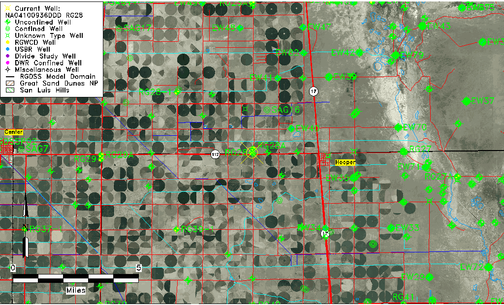
| Common Well ID | NA04100936DDD RG28 |
| RGWCD Well ID | RG28 |
| USGS Well ID | 374459105554201 |
| USGS Station Name | NA04100936DDD RG28 |
| USGS Construction Date | 01/01/1974 |
| USGS Site Type | Well |
| USGS Site Use Information | Observation |
| USGS Groundwater Use Information | Unused |
| Data Source(s) | USGS, RGWCD |
| Location Data |
|---|
| TRS | NA04100936DDD RG28 |
| RGWCD TRS | NA04100936DDD |
| USGS TRS 1 | NA04100936DDD RG28 |
| USGS TRS | NESESES036T0041NR0009EN |
| Longitude/Latitude (NAD83) | -105.92891097 , 37.74972185 |
| Longitude/Latitude Data Source | RGWCD/Davis Engineering |
| RGWCD Longitude/Latitude (NAD27) | -105:55:42 , 37:44:59 |
| USGS Longitude/Latitude (NAD83) | -105.928911000 , 37.749721850 |
| Easting, Northing RGDSS-NAD83 (US ft) | 126348.95 , 274518.05 |
| USGS Topography | Valley flat |
| USGS County | Saguache County |
| Elevation and Depth Data |
|---|
| Ground Elevation (ft NAVD88) | 7573.92 |
| Elevation Data Source | RGWCD well database |
| RGWCD Measuring Point Elevation (ft NGVD29) | 7571.200 |
| RGWCD Well Riser Height (ft) | 1.200 |
| RGWCD Ground Surface (ft NGVD29) | 7570.00 |
| USGS Ground Elevation (ft NGVD29) | 7570.00 |
| 1/3-Arc Second NED Ground Elevation (ft NAVD88) | 7573.82 |
| 1-Arc Second NED Ground Elevation (ft NAVD88) | 7575.89 |
| SRTM Ground Elevation (ft NAVD88) | 7585.30 |
| Total Depth (ft) | 27.00 |
| USGS Well Depth (ft) | 27.00 |
| Model Layer | 1 |
| Model Layer Source | RGWCD |
| Depth of Bottom of Layer 1 | 106 |
| Depth of Bottom of Layer 2 | 213 |
| Depth of Bottom of Layer 3 | 1155 |
| Depth of Bottom of Layer 4 | 2782 |
| Additional Well Information | Logs, Geohydrology, Construction |
| Aquifer Information |
|---|
| Aquifer Type | Unconfined |
| Aquifer Type Source | RGWCD_AQ |
| USGS Primary Aquifer | Cenozoic Erathem |
| USGS Hydrologic Unit | San Luis |
| USGS Data Available | Water-level (GW.LEV) |
| Water-level Database Information |
|---|
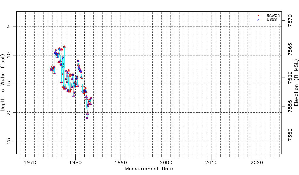
| Water-level Count | 108 |
| Water-level Date Range | 09/05/1974 thru 06/03/1983 |
| Monitored within the last 18 months | No, most recently on 06/03/1983 |
| Depth-to-Water Range (ft) | 8.60 to 21.01 |
| Water Table Elevation Range (ft NAVD88) | 7552.91 to 7565.32 |
| Water-Level-Source:Number-of-Measurements | RGWCD:102 USGS:89 |