| Well Information Table |
|---|
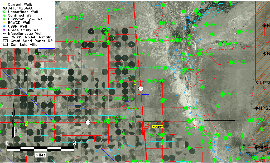
| Common Well ID | NA04101020AAA |
| USGS Well ID | 374734105533001 |
| USGS Station Name | NA04101020AAA |
| USGS Construction Date | 08/10/1993 |
| USGS Site Type | Well |
| USGS Site Use Information | Observation |
| USGS Groundwater Use Information | Unused |
| Data Source(s) | USGS |
| Location Data |
|---|
| TRS | NA04101020AAA |
| USGS TRS 1 | NA04101020AAA |
| USGS TRS | NENENES 20T 41NR 10E |
| Longitude/Latitude (NAD83) | -105.89203610 , 37.79281944 |
| Longitude/Latitude Data Source | GWSI decimal LAT/LONG field |
| USGS Longitude/Latitude (NAD83) | -105.892036100 , 37.792819440 |
| Easting, Northing RGDSS-NAD83 (US ft) | 137045.38 , 290178.98 |
| USGS Topography | Valley flat |
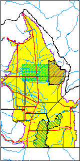
| USGS County | Saguache County |
| USGS Map Name | DEADMAN CAMP SW |
| USGS Map Scale | 2400 |
| Elevation and Depth Data |
|---|
| Ground Elevation (ft NAVD88) | 7552.00 |
| Elevation Data Source | USGS GWSI database |
| USGS Ground Elevation (ft NAVD88) | 7552.00 |
| 1/3-Arc Second NED Ground Elevation (ft NAVD88) | 7550.34 |
| 1-Arc Second NED Ground Elevation (ft NAVD88) | 7549.51 |
| SRTM Ground Elevation (ft NAVD88) | 7552.17 |
| Total Depth (ft) | 22.80 |
| USGS Hole Depth (ft) | 23.00 |
| USGS Well Depth (ft) | 22.80 |
| Model Layer | 1 |
| Model Layer Source | Dunes Layer |
| Depth of Bottom of Layer 1 | 103 |
| Depth of Bottom of Layer 2 | 231 |
| Depth of Bottom of Layer 3 | 1312 |
| Depth of Bottom of Layer 4 | 3248 |
| Additional Well Information | Logs, Geohydrology, Construction, Aquifer |
| Aquifer Information |
|---|
| Aquifer Type | Unconfined |
| Aquifer Type Source | TD Elevation/Model Layer |
| USGS Primary Aquifer | 112ALMS |
| USGS Aquifer Type | Unconfined Single Aquifer |
| USGS Hydrologic Unit | San Luis |
| USGS Data Available | Water-level (GW.LEV) |
| Water-level Database Information |
|---|
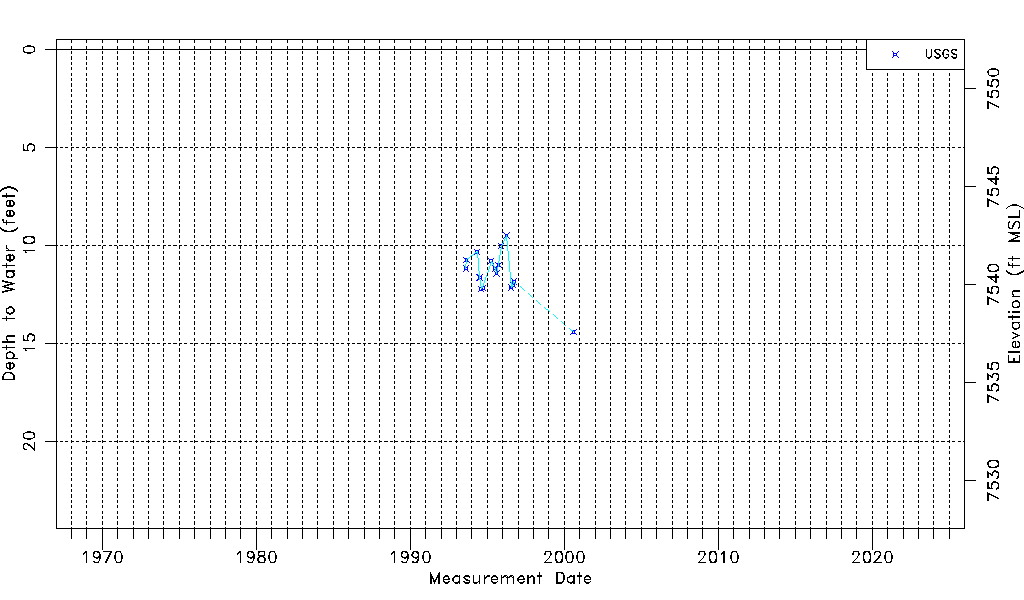
| Water-level Count | 17 |
| Water-level Date Range | 08/10/1993 thru 08/08/2000 |
| Monitored within the last 18 months | No, most recently on 08/08/2000 |
| Depth-to-Water Range (ft) | 9.50 to 14.43 |
| Water Table Elevation Range (ft NAVD88) | 7537.57 to 7542.50 |
| Water-Level-Source:Number-of-Measurements | USGS:17 |