| Well Information Table |
|---|
| Common Well ID | NA04101013AAA |
| USGS Well ID | 374900105490001 |
| GSDNP Well Name | 374900105490001 |
| USGS Station Name | NA04101013AAA |
| USGS Construction Date | 01/01/1946 |
| USGS Site Type | Well |
| USGS Site Use Information | Observation |
| USGS Groundwater Use Information | Unused |
| Data Source(s) | USGS |
| Location Data |
|---|
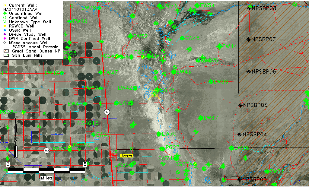
| TRS | NA04101013AAA |
| USGS TRS 1 | NA04101013AAA |
| USGS TRS | NENENES013T0041NR0010EN |
| Longitude/Latitude (NAD83) | -105.82807420 , 37.80249956 |
| Longitude/Latitude Data Source | GWSI decimal LAT/LONG field |
| USGS Longitude/Latitude (NAD83) | -105.828074200 , 37.802499560 |
| Easting, Northing RGDSS-NAD83 (US ft) | 155528.60 , 293664.42 |
| USGS Topography | Flat Surface |
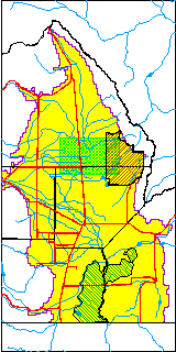
| USGS County | Saguache County |
| Elevation and Depth Data |
|---|
| Ground Elevation (ft NAVD88) | 7534.92 |
| Elevation Data Source | USGS GWSI database |
| USGS Ground Elevation (ft NGVD29) | 7531.00 |
| 1/3-Arc Second NED Ground Elevation (ft NAVD88) | 7537.70 |
| 1-Arc Second NED Ground Elevation (ft NAVD88) | 7533.38 |
| SRTM Ground Elevation (ft NAVD88) | 7535.66 |
| Total Depth (ft) | 7.00 |
| USGS Well Depth (ft) | 7.00 |
| Model Layer | 1 |
| Model Layer Source | Well Depth |
| Depth of Bottom of Layer 1 | 100 |
| Depth of Bottom of Layer 2 | 282 |
| Depth of Bottom of Layer 3 | 1548 |
| Depth of Bottom of Layer 4 | 3556 |
| Additional Well Information | Geohydrology, Construction |
| Aquifer Information |
|---|
| Aquifer Type | Unconfined |
| Aquifer Type Source | TD Elevation/Model Layer |
| USGS Primary Aquifer | Cenozoic Erathem |
| USGS Hydrologic Unit | San Luis |
| USGS Data Available | Water-level (GW.LEV) |
| Water-level Database Information |
|---|
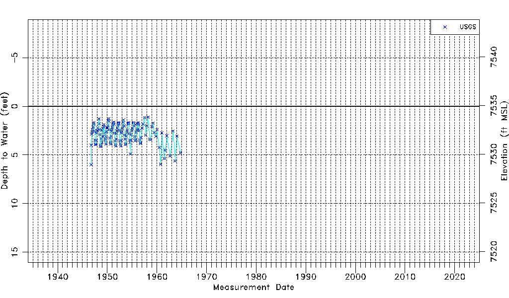
| Water-level Count | 138 |
| Water-level Date Range | 10/01/1946 thru 10/01/1964 |
| Monitored within the last 18 months | No, most recently on 10/01/1964 |
| Depth-to-Water Range (ft) | 1.12 to 6.00 |
| Water Table Elevation Range (ft NAVD88) | 7528.92 to 7533.80 |
| Water-Level-Source:Number-of-Measurements | USGS:138 |