| Well Information Table |
|---|
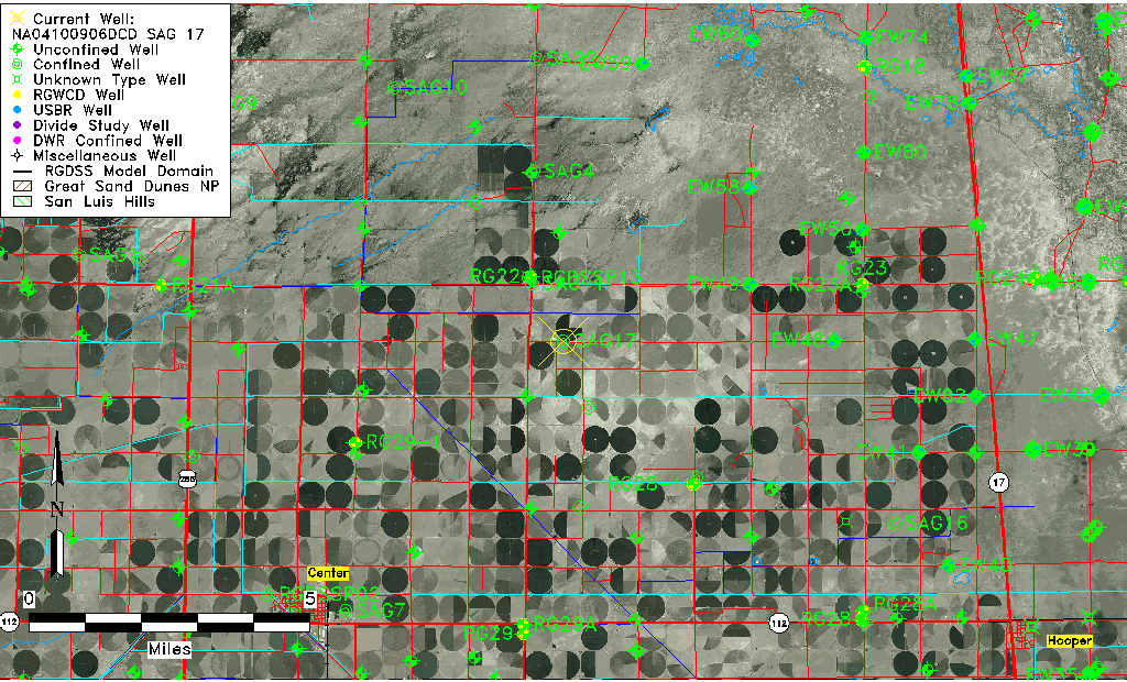
| Common Well ID | NA04100906DCD SAG 17 |
| RGWCD Confined Aquifer Well ID | SAG17 |
| USGS Well ID | 374915106013001 |
| USGS Station Name | NA04100906DCD SAG 17 |
| USGS Construction Date | 01/01/1961 |
| USGS Site Type | Well |
| USGS Site Use Information | Withdrawal of Water |
| USGS Groundwater Use Information | Stock |
| Data Source(s) | USGS |
| Location Data |
|---|
| TRS | NA04100906DCD SAG 17 |
| USGS TRS 1 | NA04100906DCD SAG 17 |
| USGS TRS | SESWSES006T0041NR0009EN |
| Longitude/Latitude (NAD83) | -106.02592365 , 37.82118444 |
| Longitude/Latitude Data Source | Davis Engineering Survey |
| USGS Longitude/Latitude (NAD83) | -106.025916700 , 37.821194440 |
| Easting, Northing RGDSS-NAD83 (US ft) | 98407.64 , 300626.16 |
| USGS Topography | Valley flat |
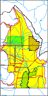
| USGS County | Saguache County |
| Elevation and Depth Data |
|---|
| Ground Elevation (ft NAVD88) | 7583.13 |
| Elevation Data Source | Davis Engineering Survey |
| USGS Ground Elevation (ft NAVD88) | 7583.13 |
| 1/3-Arc Second NED Ground Elevation (ft NAVD88) | 7582.50 |
| 1-Arc Second NED Ground Elevation (ft NAVD88) | 7581.26 |
| SRTM Ground Elevation (ft NAVD88) | 7590.23 |
| Total Depth (ft) | 700.00 |
| USGS Well Depth (ft) | 700.00 |
| Model Layer | 3 |
| Model Layer Source | Well Depth |
| Depth of Bottom of Layer 1 | 102 |
| Depth of Bottom of Layer 2 | 185 |
| Depth of Bottom of Layer 3 | 868 |
| Depth of Bottom of Layer 4 | 2476 |
| Additional Well Information | Geohydrology, Construction |
| Aquifer Information |
|---|
| Aquifer Type | Confined |
| Aquifer Type Source | RGWCD_AQ |
| USGS Primary Aquifer | Cenozoic Erathem |
| USGS Aquifer Type | Confined Single Aquifer |
| USGS Hydrologic Unit | San Luis |
| USGS Data Available | Water-level (GW.LEV) |
| Water-level Database Information |
|---|
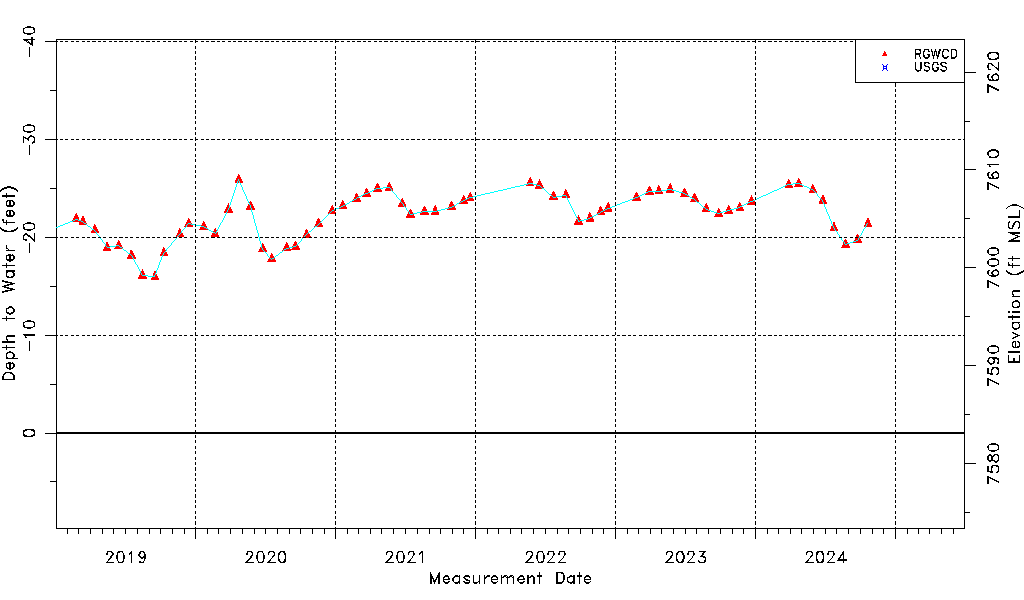
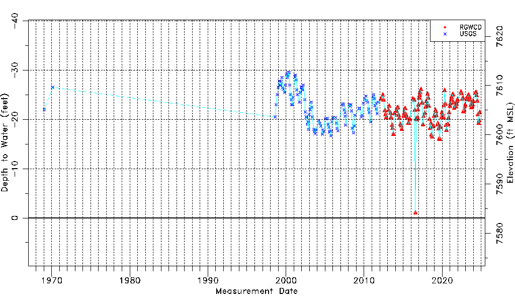
| Water-level Count | 244 |
| Water-level Date Range | 01/21/1969 thru 03/17/2026 |
| Monitored within the last 18 months | Yes, most recently on 03/17/2026 |
| Depth-to-Water Range (ft) | -29.50 to -1.00 |
| Water Table Elevation Range (ft NAVD88) | 7584.13 to 7612.63 |
| Water-Level-Source:Number-of-Measurements | RGWCD:135 USGS:109 |