| Well Information Table |
|---|
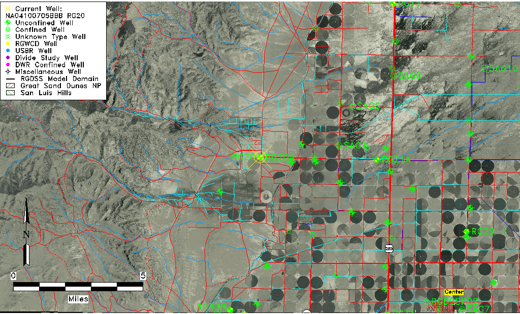
| Common Well ID | NA04100705BBB RG20 |
| RGWCD Well ID | RG20 |
| USGS Well ID | 375010106141901 |
| USGS Station Name | NA04100705BBB RG20 |
| USGS Construction Date | 01/01/1965 |
| USGS Site Type | Well |
| USGS Site Use Information | Unused |
| USGS Groundwater Use Information | Unused |
| Data Source(s) | USGS, RGWCD |
| Location Data |
|---|
| TRS | NA04100705BBB RG20 |
| RGWCD TRS | NA04100705BBB |
| USGS TRS 1 | NA04100705BBB RG20 |
| USGS TRS | NWNWNWS005T0041NR0007EN |
| Longitude/Latitude (NAD83) | -106.23919643 , 37.83611261 |
| Longitude/Latitude Data Source | RGWCD/Davis Engineering |
| RGWCD Longitude/Latitude (NAD27) | -106:14:19 , 37:50:10 |
| USGS Longitude/Latitude (NAD83) | -106.239196400 , 37.836112600 |
| Easting, Northing RGDSS-NAD83 (US ft) | 36852.50 , 306368.72 |
| USGS Topography | Valley flat |
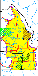
| USGS County | Saguache County |
| Elevation and Depth Data |
|---|
| Ground Elevation (ft NAVD88) | 7787.68 |
| Elevation Data Source | RGWCD well database |
| RGWCD Measuring Point Elevation (ft NGVD29) | 7784.100 |
| RGWCD Well Riser Height (ft) | 1.100 |
| RGWCD Ground Surface (ft NGVD29) | 7783.00 |
| USGS Ground Elevation (ft NGVD29) | 7783.00 |
| 1/3-Arc Second NED Ground Elevation (ft NAVD88) | 7789.88 |
| 1-Arc Second NED Ground Elevation (ft NAVD88) | 7789.58 |
| SRTM Ground Elevation (ft NAVD88) | 7805.45 |
| Total Depth (ft) | 325.00 |
| USGS Well Depth (ft) | 325.00 |
| Model Layer | 1 |
| Model Layer Source | RGWCD |
| Depth of Bottom of Layer 1 | 249 |
| Depth of Bottom of Layer 2 | 408 |
| Additional Well Information | Geohydrology, Construction |
| Aquifer Information |
|---|
| Aquifer Type | Unconfined |
| Aquifer Type Source | RGWCD_AQ |
| USGS Primary Aquifer | Cenozoic Erathem |
| USGS Aquifer Type | Unconfined Single Aquifer |
| USGS Hydrologic Unit | Saguache |
| USGS Data Available | Water-level (GW.LEV) |
| Water-level Database Information |
|---|
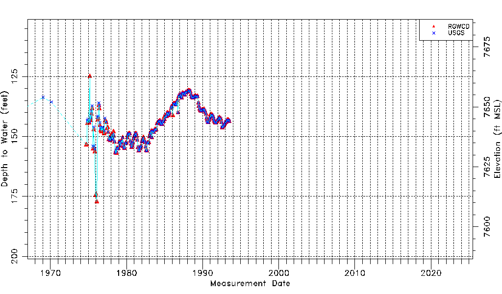
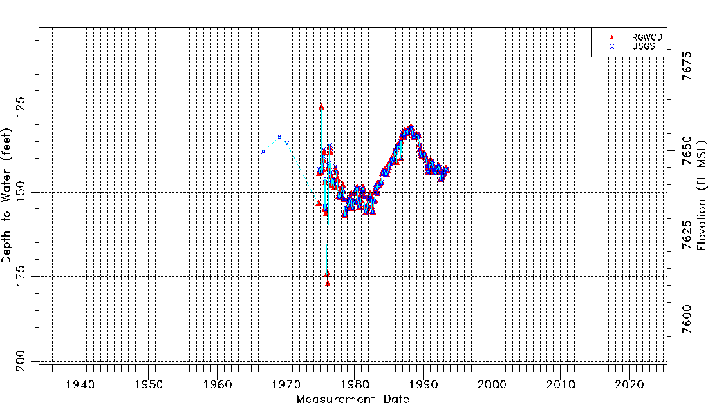
| Water-level Count | 265 |
| Water-level Date Range | 09/13/1966 thru 07/12/1993 |
| Monitored within the last 18 months | No, most recently on 07/12/1993 |
| Depth-to-Water Range (ft) | 125.00 to 177.16 |
| Water Table Elevation Range (ft NAVD88) | 7610.52 to 7662.68 |
| Water-Level-Source:Number-of-Measurements | RGWCD:224 USGS:213 |