| Well Information Table |
|---|
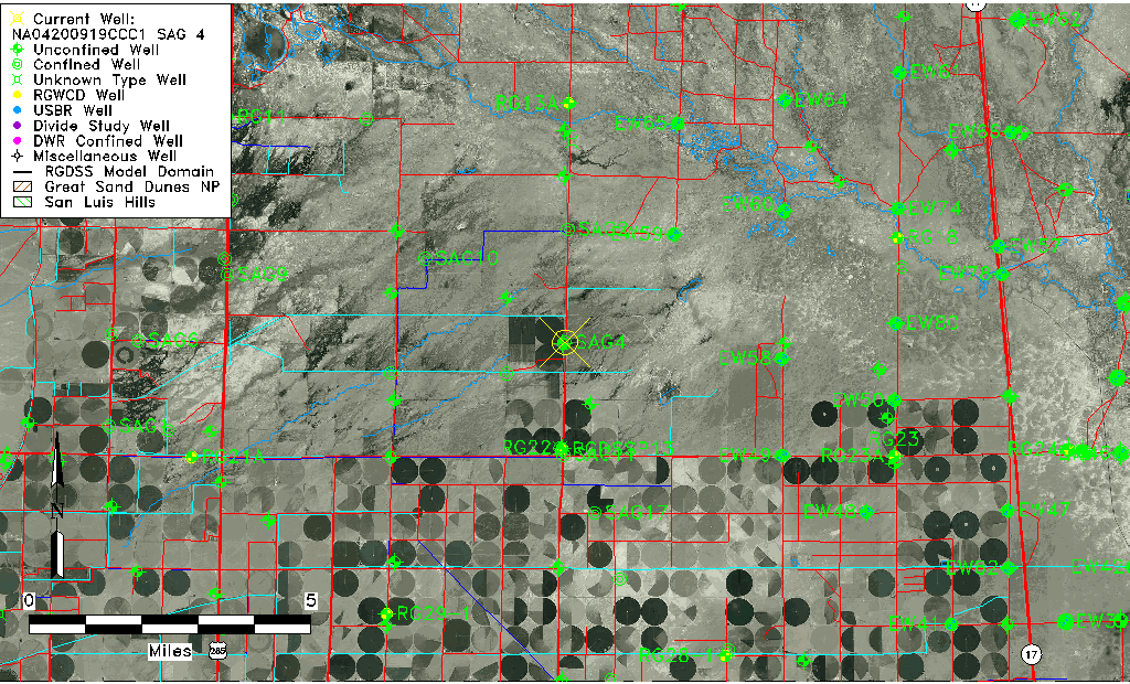
| Common Well ID | NA04200919CCC1 SAG 4 |
| RGWCD Confined Aquifer Well ID | SAG4 |
| USGS Well ID | 375155106021501 |
| USGS Station Name | NA04200919CCC1 SAG 4 |
| USGS Construction Date | 01/01/1964 |
| USGS Site Type | Well |
| USGS Site Use Information | Withdrawal of Water |
| USGS Groundwater Use Information | Irrigation |
| Data Source(s) | USGS |
| Location Data |
|---|
| TRS | NA04200919CCC1 SAG 4 |
| USGS TRS 1 | NA04200919CCC1 SAG 4 |
| USGS TRS | SWSWSWS019T0042NR0009EN |
| Longitude/Latitude (NAD83) | -106.03585438 , 37.86500591 |
| Longitude/Latitude Data Source | Davis Engineering Survey |
| USGS Longitude/Latitude (NAD83) | -106.035861100 , 37.865000000 |
| Easting, Northing RGDSS-NAD83 (US ft) | 95603.24 , 316590.14 |
| USGS Topography | Valley flat |
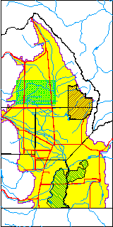
| USGS County | Saguache County |
| Elevation and Depth Data |
|---|
| Ground Elevation (ft NAVD88) | 7574.32 |
| Elevation Data Source | Davis Engineering Survey |
| USGS Ground Elevation (ft NAVD88) | 7574.32 |
| 1/3-Arc Second NED Ground Elevation (ft NAVD88) | 7573.41 |
| 1-Arc Second NED Ground Elevation (ft NAVD88) | 7572.96 |
| SRTM Ground Elevation (ft NAVD88) | 7578.50 |
| Total Depth (ft) | 2301.00 |
| USGS Well Depth (ft) | 2301.00 |
| Model Layer | 4 |
| Model Layer Source | Well Depth |
| Depth of Bottom of Layer 1 | 70 |
| Depth of Bottom of Layer 2 | 191 |
| Depth of Bottom of Layer 3 | 570 |
| Depth of Bottom of Layer 4 | 2423 |
| Additional Well Information | Geohydrology, Construction |
| Aquifer Information |
|---|
| Aquifer Type | Confined |
| Aquifer Type Source | RGWCD_AQ |
| USGS Primary Aquifer | Cenozoic Erathem |
| USGS Aquifer Type | Confined Single Aquifer |
| USGS Hydrologic Unit | Saguache |
| USGS Data Available | Water-level (GW.LEV) |
| Water-level Database Information |
|---|
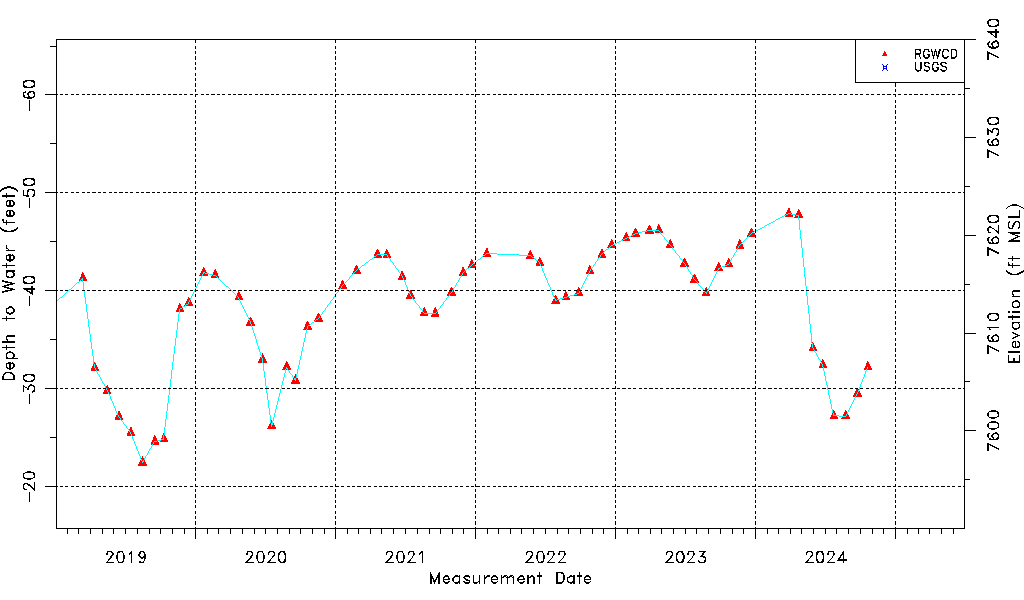
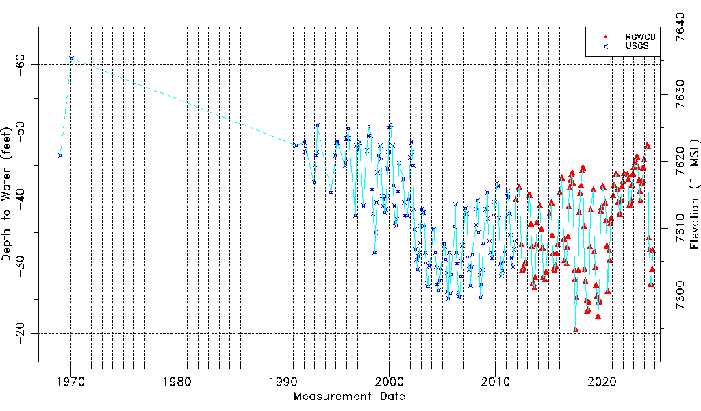
| Water-level Count | 298 |
| Water-level Date Range | 01/20/1969 thru 03/16/2026 |
| Monitored within the last 18 months | Yes, most recently on 03/16/2026 |
| Depth-to-Water Range (ft) | -61.00 to -20.43 |
| Water Table Elevation Range (ft NAVD88) | 7594.75 to 7635.32 |
| Water-Level-Source:Number-of-Measurements | RGWCD:137 USGS:161 |