| Well Information Table |
|---|
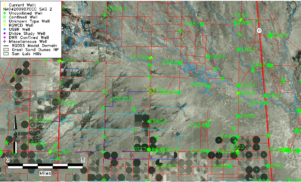
| Common Well ID | NA04200907CCC SAG 2 |
| RGWCD Confined Aquifer Well ID | SAG2 |
| USGS Well ID | 375310106021501 |
| USGS Station Name | NA04200907CCC SAG 2 |
| USGS Construction Date | 01/01/1967 |
| USGS Site Type | Well |
| USGS Site Use Information | Withdrawal of Water |
| USGS Groundwater Use Information | Irrigation |
| Data Source(s) | USGS |
| Location Data |
|---|
| TRS | NA04200907CCC SAG 2 |
| USGS TRS 1 | NA04200907CCC SAG 2 |
| USGS TRS | SWSWSWS007T0042NR0009EN |
| Longitude/Latitude (NAD83) | -106.03509103 , 37.89407887 |
| Longitude/Latitude Data Source | Davis Engineering Survey |
| USGS Longitude/Latitude (NAD83) | -106.038077300 , 37.886110900 |
| Easting, Northing RGDSS-NAD83 (US ft) | 95865.57 , 327173.05 |
| USGS Topography | Valley flat |
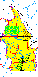
| USGS County | Saguache County |
| Elevation and Depth Data |
|---|
| Ground Elevation (ft NAVD88) | 7566.35 |
| Elevation Data Source | Davis Engineering Survey |
| USGS Ground Elevation (ft NGVD29) | 7563.00 |
| 1/3-Arc Second NED Ground Elevation (ft NAVD88) | 7565.63 |
| 1-Arc Second NED Ground Elevation (ft NAVD88) | 7565.84 |
| SRTM Ground Elevation (ft NAVD88) | 7570.67 |
| Total Depth (ft) | 1987.00 |
| USGS Well Depth (ft) | 1987.00 |
| Model Layer | 4 |
| Model Layer Source | Well Depth |
| Depth of Bottom of Layer 1 | 94 |
| Depth of Bottom of Layer 2 | 166 |
| Depth of Bottom of Layer 3 | 479 |
| Depth of Bottom of Layer 4 | 2260 |
| Additional Well Information | Geohydrology, Construction |
| Aquifer Information |
|---|
| Aquifer Type | Confined |
| Aquifer Type Source | RGWCD_AQ |
| USGS Primary Aquifer | Cenozoic Erathem |
| USGS Aquifer Type | Confined Single Aquifer |
| USGS Hydrologic Unit | Saguache |
| USGS Data Available | Water-level (GW.LEV) |
| Water-level Database Information |
|---|
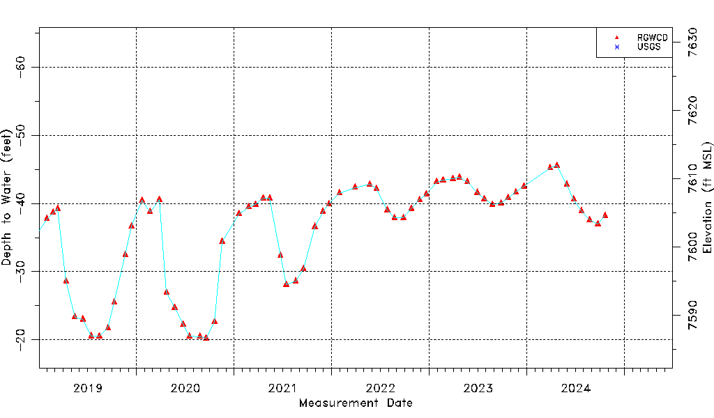
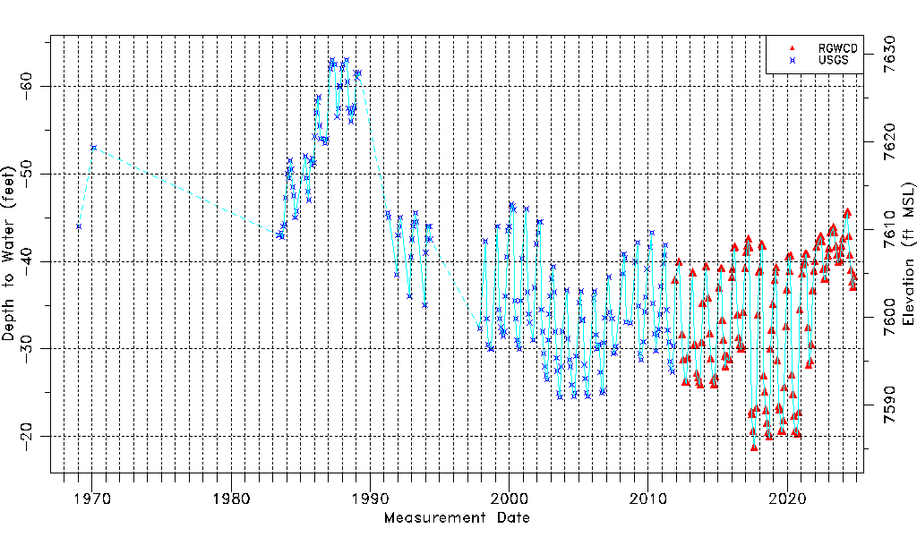
| Water-level Count | 338 |
| Water-level Date Range | 01/20/1969 thru 03/16/2026 |
| Monitored within the last 18 months | Yes, most recently on 03/16/2026 |
| Depth-to-Water Range (ft) | -63.00 to -18.71 |
| Water Table Elevation Range (ft NAVD88) | 7585.06 to 7629.35 |
| Water-Level-Source:Number-of-Measurements | RGWCD:141 USGS:197 |