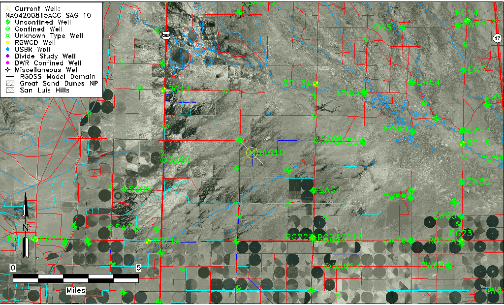
| Well Information Table |
|---|
| Common Well ID | NA04200815ACC SAG 10 |
| RGWCD Confined Aquifer Well ID | SAG10 |
| USGS Well ID | 375310106050001 |
| USGS Station Name | NA04200815ACC SAG 10 |
| USGS Construction Date | 01/01/1963 |
| USGS Site Type | Well |
| USGS Site Use Information | Withdrawal of Water |
| USGS Groundwater Use Information | Irrigation |
| Data Source(s) | USGS |
| Location Data |
|---|
| TRS | NA04200815ACC SAG 10 |
| USGS TRS 1 | NA04200815ACC SAG 10 |
| USGS TRS | SWSWNES015T0042NR0008EN |
| Longitude/Latitude (NAD83) | -106.08129902 , 37.88642881 |
| Longitude/Latitude Data Source | Davis Engineering Survey |
| USGS Longitude/Latitude (NAD83) | -106.081305600 , 37.886416670 |
| Easting, Northing RGDSS-NAD83 (US ft) | 82522.57 , 324444.37 |
| USGS Topography | Valley flat |
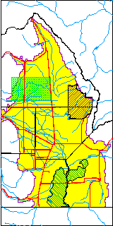
| USGS County | Saguache County |
| USGS Map Name | HARRENCE LAKE |
| USGS Map Scale | 24000 |
| Elevation and Depth Data |
|---|
| Ground Elevation (ft NAVD88) | 7584.49 |
| Elevation Data Source | Davis Engineering Survey |
| USGS Ground Elevation (ft NAVD88) | 7584.49 |
| 1/3-Arc Second NED Ground Elevation (ft NAVD88) | 7584.43 |
| 1-Arc Second NED Ground Elevation (ft NAVD88) | 7583.71 |
| SRTM Ground Elevation (ft NAVD88) | 7591.86 |
| Total Depth (ft) | 2087.00 |
| USGS Well Depth (ft) | 2087.00 |
| Model Layer | 4 |
| Model Layer Source | Well Depth |
| Depth of Bottom of Layer 1 | 97 |
| Depth of Bottom of Layer 2 | 151 |
| Depth of Bottom of Layer 3 | 467 |
| Depth of Bottom of Layer 4 | 2249 |
| Additional Well Information | Geohydrology, Construction |
| Aquifer Information |
|---|
| Aquifer Type | Confined |
| Aquifer Type Source | RGWCD_AQ |
| USGS Primary Aquifer | Cenozoic Erathem |
| USGS Aquifer Type | Confined Single Aquifer |
| USGS Hydrologic Unit | Saguache |
| USGS Data Available | Water-level (GW.LEV) |
| Water-level Database Information |
|---|
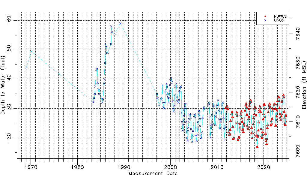
| Water-level Count | 322 |
| Water-level Date Range | 01/21/1969 thru 03/16/2026 |
| Monitored within the last 18 months | Yes, most recently on 03/16/2026 |
| Depth-to-Water Range (ft) | -59.00 to -16.95 |
| Water Table Elevation Range (ft NAVD88) | 7601.44 to 7643.49 |
| Water-Level-Source:Number-of-Measurements | RGWCD:146 USGS:176 |