| Well Information Table |
|---|
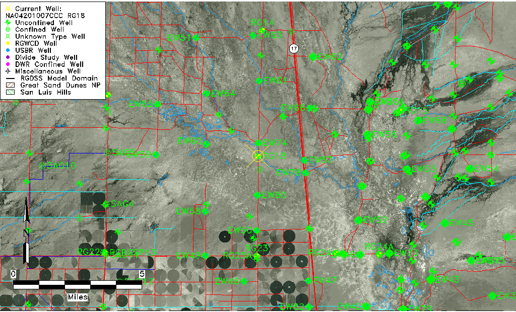
| Common Well ID | NA04201007CCC RG18 |
| RGWCD Well ID | RG18 |
| USGS Well ID | 375324105553301 |
| USGS Station Name | NA04201007CCC RG18 |
| USGS Site Type | Well |
| USGS Site Use Information | Anode |
| USGS Groundwater Use Information | Unused |
| Data Source(s) | USGS, RGWCD |
| Location Data |
|---|
| TRS | NA04201007CCC RG18 |
| RGWCD TRS | NA04201007CCC |
| USGS TRS 1 | NA04201007CCC RG18 |
| USGS TRS | SWSWSWS007T0042NR0010EN |
| Longitude/Latitude (NAD83) | -105.92814722 , 37.89225556 |
| Longitude/Latitude Data Source | RGWCD/Davis Engineering |
| RGWCD Longitude/Latitude (NAD83) | -105:55:41.33 , 37:53:32.12 |
| USGS Longitude/Latitude (NAD83) | -105.926407500 , 37.889999460 |
| Easting, Northing RGDSS-NAD83 (US ft) | 126715.60 , 326404.36 |
| USGS Topography | Valley flat |
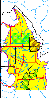
| USGS County | Saguache County |
| Elevation and Depth Data |
|---|
| Ground Elevation (ft NAVD88) | 7546.40 |
| Elevation Data Source | RGWCD well database |
| RGWCD Measuring Point Elevation (ft NAVD88) | 7547.400 |
| RGWCD Well Riser Height (ft) | 1.000 |
| RGWCD Ground Surface (ft NAVD88) | 7546.40 |
| USGS Ground Elevation (ft NGVD29) | 7539.00 |
| 1/3-Arc Second NED Ground Elevation (ft NAVD88) | 7544.07 |
| 1-Arc Second NED Ground Elevation (ft NAVD88) | 7545.41 |
| SRTM Ground Elevation (ft NAVD88) | 7551.54 |
| Total Depth (ft) | 57.00 |
| USGS Well Depth (ft) | 57.00 |
| Model Layer | 1 |
| Model Layer Source | RGWCD |
| Depth of Bottom of Layer 1 | 81 |
| Depth of Bottom of Layer 2 | 151 |
| Depth of Bottom of Layer 3 | 784 |
| Depth of Bottom of Layer 4 | 3168 |
| Additional Well Information | Geohydrology, Construction |
| Aquifer Information |
|---|
| Aquifer Type | Unconfined |
| Aquifer Type Source | RGWCD_AQ |
| USGS Primary Aquifer | Cenozoic Erathem |
| USGS Aquifer Type | Unconfined Single Aquifer |
| USGS Hydrologic Unit | Saguache |
| USGS Data Available | Water-level (GW.LEV) |
| Water-level Database Information |
|---|
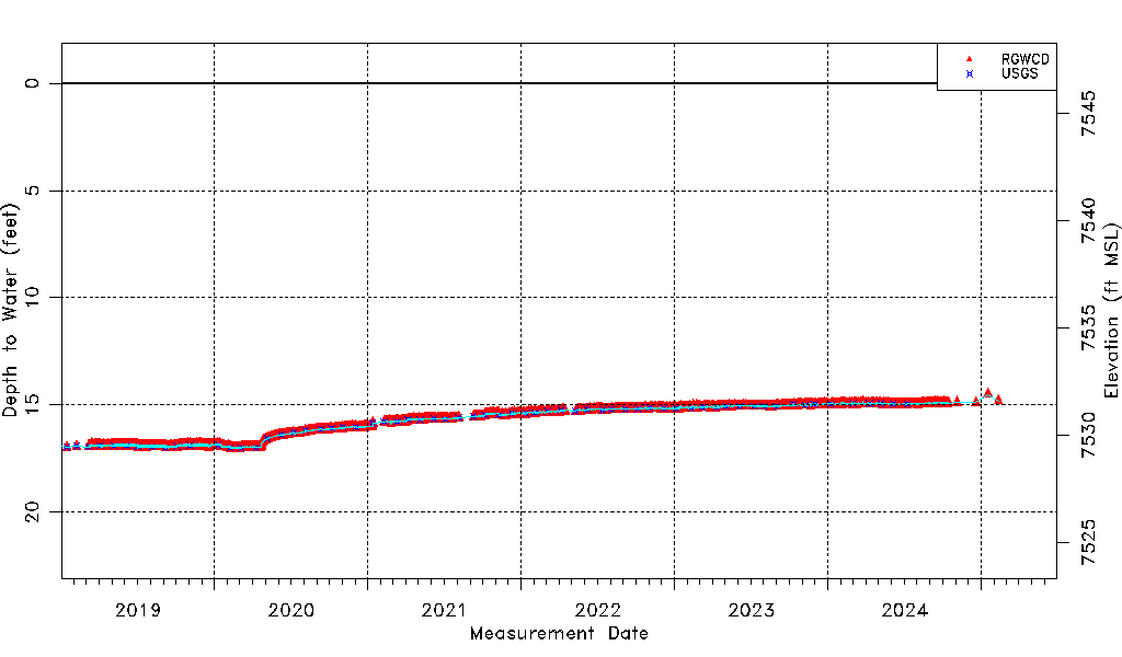
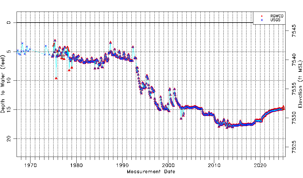
| Water-level Count | 4660 |
| Water-level Date Range | 01/05/1967 thru 07/01/2026 |
| Monitored within the last 18 months | Yes, most recently on 07/01/2026 |
| Depth-to-Water Range (ft) | 3.10 to 18.10 |
| Water Table Elevation Range (ft NAVD88) | 7528.30 to 7543.30 |
| Water-Level-Source:Number-of-Measurements | RGWCD:4626 USGS:574 |