| Well Information Table |
|---|
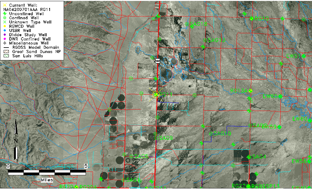
| Common Well ID | NA04200701AAA RG11 |
| RGWCD Well ID | RG11 |
| USGS Well ID | 375520106081201 |
| USGS Station Name | NA04200701AAA RG11 |
| USGS Construction Date | 07/18/1978 |
| USGS Site Type | Well |
| USGS Site Use Information | Anode |
| USGS Groundwater Use Information | Unused |
| Data Source(s) | USGS, RGWCD |
| Location Data |
|---|
| TRS | NA04200701AAA RG11 |
| RGWCD TRS | NA04200701AAA |
| USGS TRS 1 | NA04200701AAA RG11 |
| Longitude/Latitude (NAD83) | -106.14592308 , 37.92255512 |
| Longitude/Latitude Data Source | RGWCD/Davis Engineering |
| RGWCD Longitude/Latitude (NAD83) | -106:08:45.3231 , 37:55:21.19844 |
| USGS Longitude/Latitude (NAD83) | -106.137247000 , 37.922222580 |
| Easting, Northing RGDSS-NAD83 (US ft) | 63944.99 , 337685.92 |
| USGS Topography | Undulating |
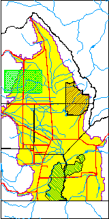
| USGS County | Saguache County |
| USGS Map Name | SWEDE CORNER |
| USGS Map Scale | 24000 |
| Elevation and Depth Data |
|---|
| Ground Elevation (ft NAVD88) | 7595.43 |
| Elevation Data Source | RGWCD well database |
| RGWCD Measuring Point Elevation (ft NAVD88) | 7597.430 |
| RGWCD Well Riser Height (ft) | 2.000 |
| RGWCD Ground Surface (ft NAVD88) | 7595.43 |
| USGS Ground Elevation (ft NGVD29) | 7590.00 |
| 1/3-Arc Second NED Ground Elevation (ft NAVD88) | 7594.52 |
| 1-Arc Second NED Ground Elevation (ft NAVD88) | 7595.42 |
| SRTM Ground Elevation (ft NAVD88) | 7604.99 |
| Total Depth (ft) | 40.00 |
| USGS Hole Depth (ft) | 40.00 |
| USGS Well Depth (ft) | 40.00 |
| Model Layer | 1 |
| Model Layer Source | RGWCD |
| Depth of Bottom of Layer 1 | 48 |
| Depth of Bottom of Layer 2 | 165 |
| Depth of Bottom of Layer 3 | 378 |
| Depth of Bottom of Layer 4 | 1665 |
| Additional Well Information | Geohydrology |
| Aquifer Information |
|---|
| Aquifer Type | Unconfined |
| Aquifer Type Source | RGWCD_AQ |
| USGS Hydrologic Unit | Saguache |
| USGS Data Available | Water-level (GW.LEV) |
| Water-level Database Information |
|---|
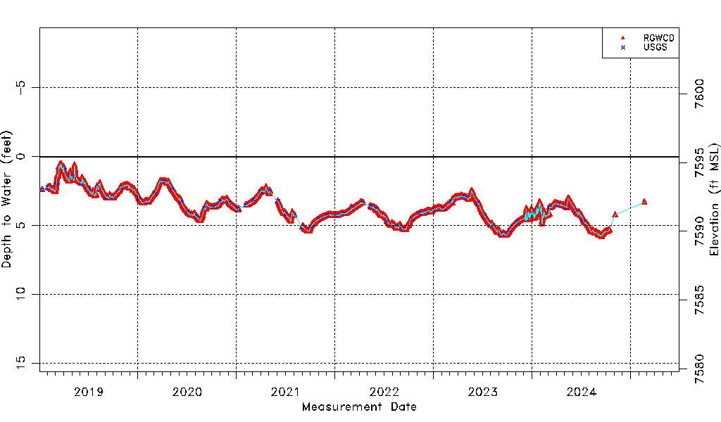
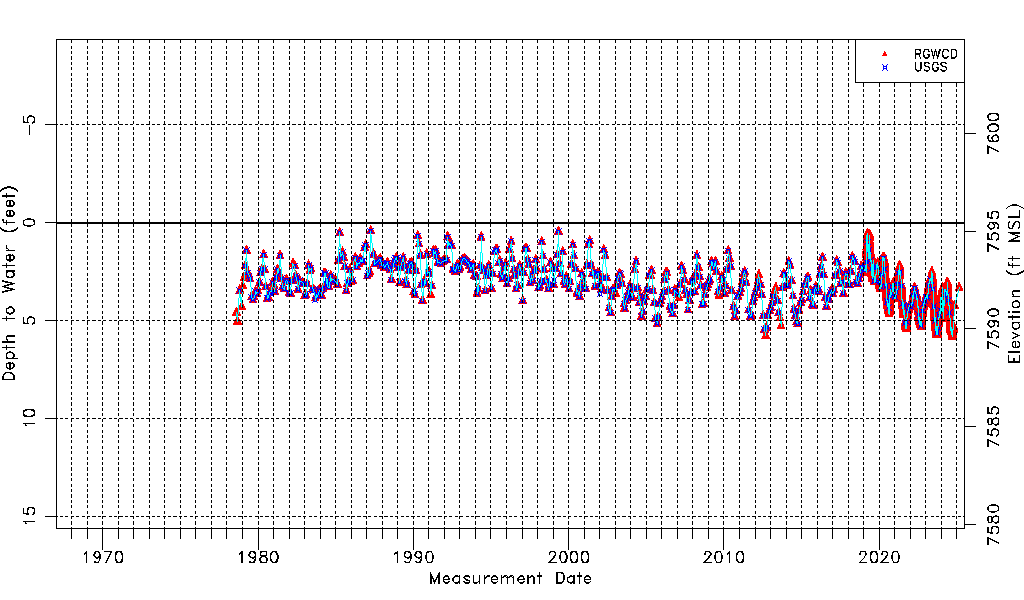
| Water-level Count | 4526 |
| Water-level Date Range | 08/10/1978 thru 06/12/2026 |
| Monitored within the last 18 months | Yes, most recently on 06/12/2026 |
| Depth-to-Water Range (ft) | 0.43 to 5.81 |
| Water Table Elevation Range (ft NAVD88) | 7589.62 to 7595.00 |
| Water-Level-Source:Number-of-Measurements | RGWCD:4514 USGS:527 |