| Well Information Table |
|---|
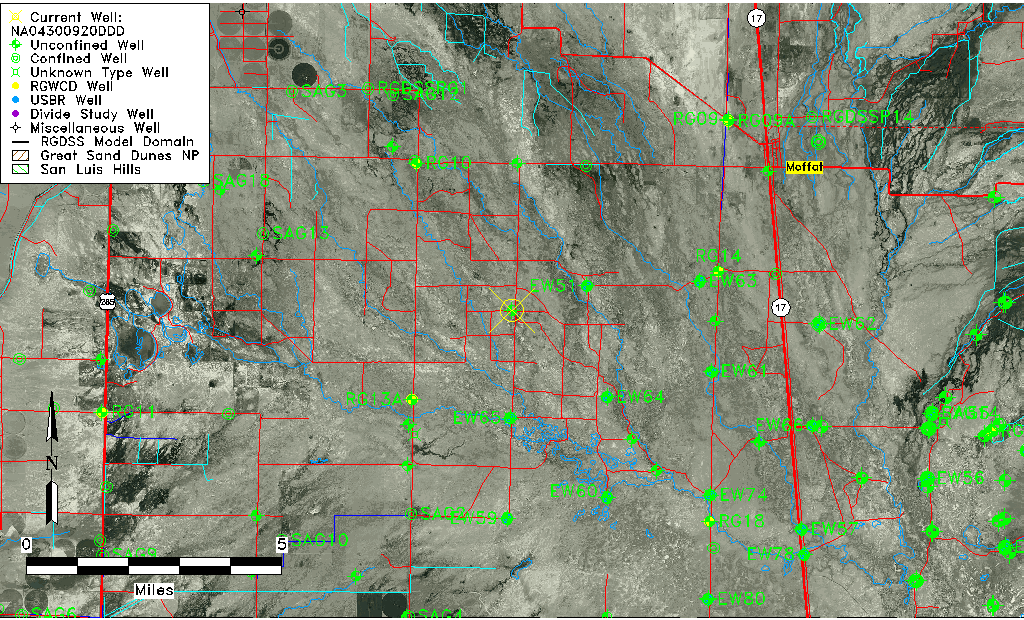
| Common Well ID | NA04300920DDD |
| USGS Well ID | 375707105595501 |
| USGS Station Name | NA04300920DDD |
| USGS Construction Date | 01/01/1967 |
| USGS Site Type | Well |
| USGS Site Use Information | Observation |
| USGS Groundwater Use Information | Unused |
| Data Source(s) | USGS |
| Location Data |
|---|
| TRS | NA04300920DDD |
| USGS TRS 1 | NA04300920DDD |
| USGS TRS | SESESES020T0043NR0009EN |
| Longitude/Latitude (NAD83) | -105.99918540 , 37.95194396 |
| Longitude/Latitude Data Source | GWSI decimal LAT/LONG field |
| USGS Longitude/Latitude (NAD83) | -105.999185400 , 37.951943960 |
| Easting, Northing RGDSS-NAD83 (US ft) | 106299.70 , 348199.24 |
| USGS Topography | Valley flat |
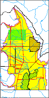
| USGS County | Saguache County |
| USGS Map Name | MOFFAT SOUTH |
| USGS Map Scale | 24000 |
| Elevation and Depth Data |
|---|
| Ground Elevation (ft NAVD88) | 7556.03 |
| Elevation Data Source | USGS GWSI database |
| USGS Ground Elevation (ft NGVD29) | 7552.00 |
| 1/3-Arc Second NED Ground Elevation (ft NAVD88) | 7557.82 |
| 1-Arc Second NED Ground Elevation (ft NAVD88) | 7556.14 |
| SRTM Ground Elevation (ft NAVD88) | 7562.34 |
| Total Depth (ft) | 15.00 |
| USGS Well Depth (ft) | 15.00 |
| Model Layer | 1 |
| Model Layer Source | Well Depth |
| Depth of Bottom of Layer 1 | 96 |
| Depth of Bottom of Layer 2 | 150 |
| Depth of Bottom of Layer 3 | 334 |
| Depth of Bottom of Layer 4 | 2194 |
| Additional Well Information | Geohydrology, Construction |
| Aquifer Information |
|---|
| Aquifer Type | Unconfined |
| Aquifer Type Source | TD Elevation/Model Layer |
| USGS Primary Aquifer | Cenozoic Erathem |
| USGS Hydrologic Unit | Saguache |
| USGS Data Available | Water-level (GW.LEV) |
| Water-level Database Information |
|---|
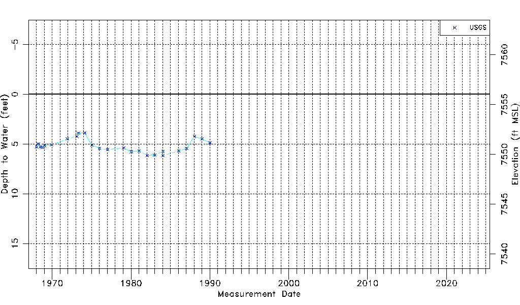
| Water-level Count | 25 |
| Water-level Date Range | 01/16/1968 thru 01/08/1990 |
| Monitored within the last 18 months | No, most recently on 01/08/1990 |
| Depth-to-Water Range (ft) | 3.89 to 6.16 |
| Water Table Elevation Range (ft NAVD88) | 7549.87 to 7552.14 |
| Water-Level-Source:Number-of-Measurements | USGS:25 |