| Well Information Table |
|---|
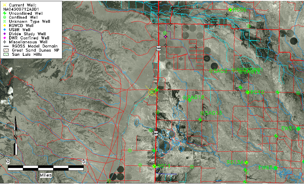
| Common Well ID | NA04300712ABD1 |
| USGS Well ID | 375930106091001 |
| USGS Station Name | NA04300712ABD1 |
| USGS Construction Date | 01/01/1966 |
| USGS Site Type | Well |
| USGS Site Use Information | Withdrawal of Water |
| USGS Groundwater Use Information | Irrigation |
| Data Source(s) | USGS |
| Location Data |
|---|
| TRS | NA04300712ABD1 |
| USGS TRS 1 | NA04300712ABD1 |
| USGS TRS | SENWNES012T0043NR0007EN |
| Longitude/Latitude (NAD83) | -106.14920618 , 37.99334852 |
| Longitude/Latitude Data Source | MJS review of DWR |
| USGS Longitude/Latitude (NAD83) | -106.153357600 , 37.991666840 |
| Easting, Northing RGDSS-NAD83 (US ft) | 63132.63 , 363463.41 |
| USGS Topography | Valley flat |
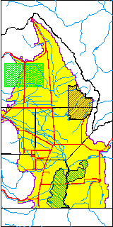
| USGS County | Saguache County |
| Elevation and Depth Data |
|---|
| Ground Elevation (ft NAVD88) | 7652.21 |
| Elevation Data Source | MJS review of DWR |
| USGS Ground Elevation (ft NGVD29) | 7648.00 |
| 1/3-Arc Second NED Ground Elevation (ft NAVD88) | 7652.36 |
| 1-Arc Second NED Ground Elevation (ft NAVD88) | 7651.37 |
| SRTM Ground Elevation (ft NAVD88) | 7666.70 |
| Total Depth (ft) | 200.00 |
| USGS Well Depth (ft) | 200.00 |
| Model Layer | 2 |
| Model Layer Source | Well Depth |
| Depth of Bottom of Layer 1 | 99 |
| Depth of Bottom of Layer 2 | 224 |
| Additional Well Information | Geohydrology, Construction |
| Aquifer Information |
|---|
| Aquifer Type | Confined |
| Aquifer Type Source | TD Elevation/Model Layer |
| USGS Primary Aquifer | Cenozoic Erathem |
| USGS Hydrologic Unit | Saguache |
| USGS Data Available | Water-level (GW.LEV) |
| Water-level Database Information |
|---|
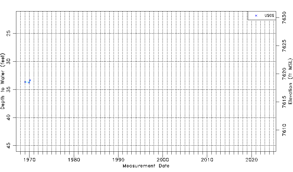
| Water-level Count | 3 |
| Water-level Date Range | 01/21/1969 thru 02/26/1970 |
| Monitored within the last 18 months | No, most recently on 02/26/1970 |
| Depth-to-Water Range (ft) | 33.34 to 33.75 |
| Water Table Elevation Range (ft NAVD88) | 7618.46 to 7618.87 |
| Water-Level-Source:Number-of-Measurements | USGS:3 |