| Well Information Table |
|---|
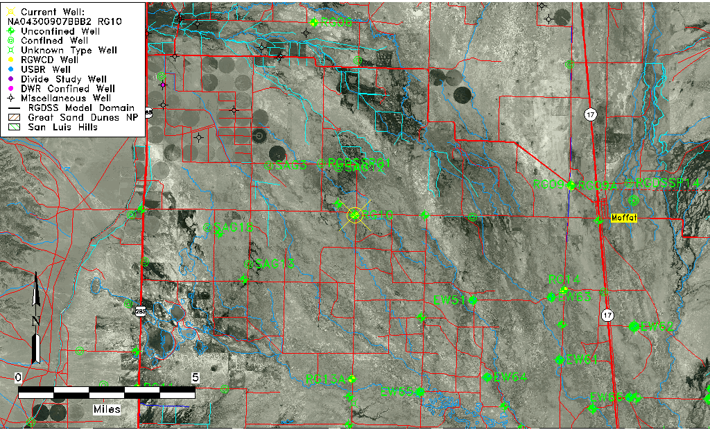
| Common Well ID | NA04300907BBB2 RG10 |
| RGWCD Well ID | RG10 |
| USGS Well ID | 375938106015901 |
| USGS Station Name | NA04300907BBB2 RG10 |
| USGS Construction Date | 03/14/1974 |
| USGS Site Type | Well |
| USGS Site Use Information | Observation |
| USGS Groundwater Use Information | Unused |
| Data Source(s) | USGS, RGWCD |
| Location Data |
|---|
| TRS | NA04300907BBB2 RG10 |
| RGWCD TRS | NA04300907BBB2 |
| USGS TRS 1 | NA04300907BBB2 RG10 |
| USGS TRS | NWNWNWS007T0043NR009E |
| Longitude/Latitude (NAD83) | -106.03359125 , 37.99358824 |
| Longitude/Latitude Data Source | RGWCD/Davis Engineering |
| RGWCD Longitude/Latitude (NAD83) | -106:02:00.9285 , 37:59:36.91767 |
| USGS Longitude/Latitude (NAD83) | -106.033630300 , 37.993888500 |
| Easting, Northing RGDSS-NAD83 (US ft) | 96442.10 , 363397.31 |
| USGS Topography | Valley flat |
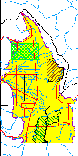
| USGS County | Saguache County |
| USGS Map Name | HARRENCE LAKE |
| USGS Map Scale | 24000 |
| Elevation and Depth Data |
|---|
| Ground Elevation (ft NAVD88) | 7583.21 |
| Elevation Data Source | RGWCD well database |
| RGWCD Measuring Point Elevation (ft NAVD88) | 7584.211 |
| RGWCD Well Riser Height (ft) | 1.000 |
| RGWCD Ground Surface (ft NAVD88) | 7583.21 |
| USGS Ground Elevation (ft NGVD29) | 7581.00 |
| 1/3-Arc Second NED Ground Elevation (ft NAVD88) | 7584.44 |
| 1-Arc Second NED Ground Elevation (ft NAVD88) | 7584.67 |
| SRTM Ground Elevation (ft NAVD88) | 7588.31 |
| Total Depth (ft) | 27.00 |
| USGS Well Depth (ft) | 27.00 |
| Model Layer | 1 |
| Model Layer Source | RGWCD |
| Depth of Bottom of Layer 1 | 96 |
| Depth of Bottom of Layer 2 | 206 |
| Depth of Bottom of Layer 3 | 673 |
| Depth of Bottom of Layer 4 | 2149 |
| Additional Well Information | Geohydrology, Construction, Aquifer |
| Aquifer Information |
|---|
| Aquifer Type | Unconfined |
| Aquifer Type Source | RGWCD_AQ |
| USGS Primary Aquifer | Tertiary System |
| USGS Hydrologic Unit | Saguache |
| USGS Data Available | Water-level (GW.LEV) |
| Water-level Database Information |
|---|
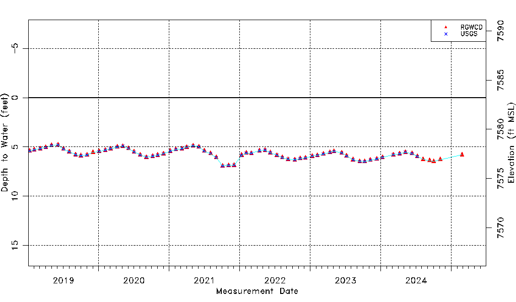
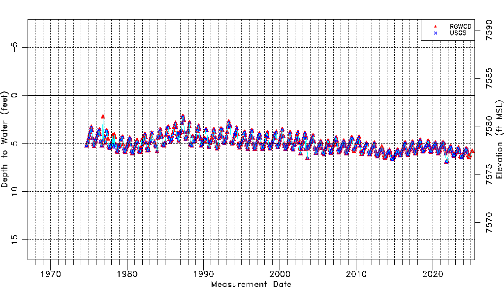
| Water-level Count | 625 |
| Water-level Date Range | 09/05/1974 thru 07/09/2026 |
| Monitored within the last 18 months | Yes, most recently on 07/09/2026 |
| Depth-to-Water Range (ft) | 2.22 to 7.38 |
| Water Table Elevation Range (ft NAVD88) | 7575.83 to 7580.99 |
| Water-Level-Source:Number-of-Measurements | RGWCD:616 USGS:574 |