| Well Information Table |
|---|
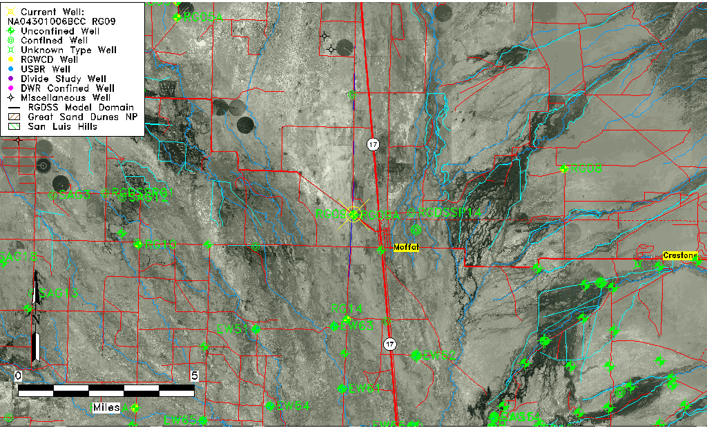
| Common Well ID | NA04301006BCC RG09 |
| RGWCD Well ID | RG09 |
| USGS Well ID | 380023105551701 |
| USGS Station Name | NA04301006BCC RG09 |
| USGS Construction Date | 04/21/1974 |
| USGS Site Type | Well |
| USGS Site Use Information | Observation |
| USGS Groundwater Use Information | Unused |
| Data Source(s) | USGS, RGWCD |
| Location Data |
|---|
| TRS | NA04301006BCC RG09 |
| RGWCD TRS | NA04301006BCC |
| USGS TRS 1 | NA04301006BCC RG09 |
| USGS TRS | SWSWNWS06 T043N R010E N |
| Longitude/Latitude (NAD83) | -105.92196030 , 38.00638820 |
| Longitude/Latitude Data Source | GWSI decimal LAT/LONG field |
| USGS Longitude/Latitude (NAD83) | -105.921960300 , 38.006388200 |
| Easting, Northing RGDSS-NAD83 (US ft) | 128615.73 , 367948.24 |
| USGS Topography | Valley flat |
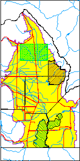
| USGS County | Saguache County |
| USGS Map Name | MOFFAT NORTH |
| USGS Map Scale | 24000 |
| Elevation and Depth Data |
|---|
| Ground Elevation (ft NAVD88) | 7568.08 |
| Elevation Data Source | USGS GWSI database |
| RGWCD Measuring Point Elevation (ft NGVD29) | 0.000 |
| RGWCD Well Riser Height (ft) | 1.000 |
| USGS Ground Elevation (ft NGVD29) | 7564.00 |
| 1/3-Arc Second NED Ground Elevation (ft NAVD88) | 7569.20 |
| 1-Arc Second NED Ground Elevation (ft NAVD88) | 7567.87 |
| SRTM Ground Elevation (ft NAVD88) | 7575.46 |
| Total Depth (ft) | 25.00 |
| USGS Well Depth (ft) | 25.00 |
| Model Layer | 1 |
| Model Layer Source | RGWCD |
| Depth of Bottom of Layer 1 | 102 |
| Depth of Bottom of Layer 2 | 269 |
| Depth of Bottom of Layer 3 | 742 |
| Depth of Bottom of Layer 4 | 3527 |
| Additional Well Information | Production, Geohydrology, Construction, Aquifer |
| Aquifer Information |
|---|
| Aquifer Type | Unconfined |
| Aquifer Type Source | RGWCD_AQ |
| USGS Primary Aquifer | Quaternary System |
| USGS Hydrologic Unit | Saguache |
| USGS Data Available | Water-level (GW.LEV) |
| Water-level Database Information |
|---|
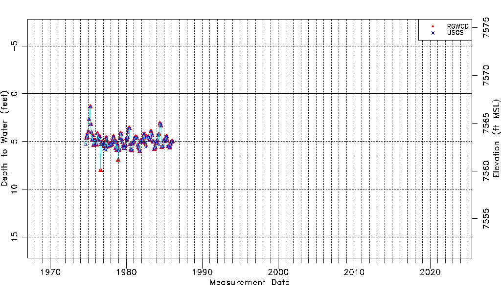
| Water-level Count | 142 |
| Water-level Date Range | 09/05/1974 thru 02/09/1986 |
| Monitored within the last 18 months | No, most recently on 02/09/1986 |
| Depth-to-Water Range (ft) | 1.38 to 8.00 |
| Water Table Elevation Range (ft NAVD88) | 7560.08 to 7566.70 |
| Water-Level-Source:Number-of-Measurements | RGWCD:136 USGS:134 |