| Well Information Table |
|---|
| Common Well ID | NA04401131BBC RG08 |
| RGWCD Well ID | RG08 |
| USGS Well ID | 380128105484401 |
| USGS Station Name | NA04401131BBC RG08 |
| USGS Construction Date | 04/25/1974 |
| USGS Site Type | Well |
| USGS Site Use Information | Observation |
| USGS Groundwater Use Information | Unused |
| Data Source(s) | USGS, RGWCD |
| Location Data |
|---|
| TRS | NA04401131BBC RG08 |
| RGWCD TRS | NA04401131BBC |
| USGS TRS 1 | NA04401131BBC RG08 |
| USGS TRS | SWNWNWS31 T044N R011E N |
| Longitude/Latitude (NAD83) | -105.81260958 , 38.02534056 |
| Longitude/Latitude Data Source | RGWCD/Davis Engineering |
| RGWCD Longitude/Latitude (NAD83) | -105:48:45.3945 , 38:01:31.22603 |
| USGS Longitude/Latitude (NAD83) | -105.812790900 , 38.024443490 |
| Easting, Northing RGDSS-NAD83 (US ft) | 160124.60 , 374778.37 |
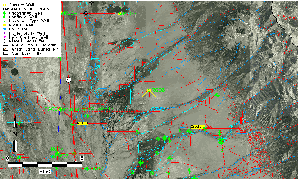
| USGS County | Saguache County |
| USGS Map Name | MIRAGE |
| USGS Map Scale | 24000 |
| Elevation and Depth Data |
|---|
| Ground Elevation (ft NAVD88) | 7615.46 |
| Elevation Data Source | RGWCD well database |
| RGWCD Measuring Point Elevation (ft NAVD88) | 7617.460 |
| RGWCD Well Riser Height (ft) | 2.000 |
| RGWCD Ground Surface (ft NAVD88) | 7615.46 |
| USGS Ground Elevation (ft NGVD29) | 7612.00 |
| 1/3-Arc Second NED Ground Elevation (ft NAVD88) | 7618.32 |
| 1-Arc Second NED Ground Elevation (ft NAVD88) | 7616.71 |
| SRTM Ground Elevation (ft NAVD88) | 7624.41 |
| Total Depth (ft) | 27.00 |
| USGS Well Depth (ft) | 27.00 |
| Model Layer | 1 |
| Model Layer Source | RGWCD |
| Depth of Bottom of Layer 1 | 143 |
| Depth of Bottom of Layer 2 | 354 |
| Depth of Bottom of Layer 3 | 1010 |
| Depth of Bottom of Layer 4 | 3637 |
| Additional Well Information | Production, Geohydrology, Construction, Aquifer |
| Aquifer Information |
|---|
| Aquifer Type | Unconfined |
| Aquifer Type Source | RGWCD_AQ |
| USGS Primary Aquifer | Quaternary System |
| USGS Hydrologic Unit | San Luis |
| USGS Data Available | Water-level (GW.LEV) |
| Water-level Database Information |
|---|
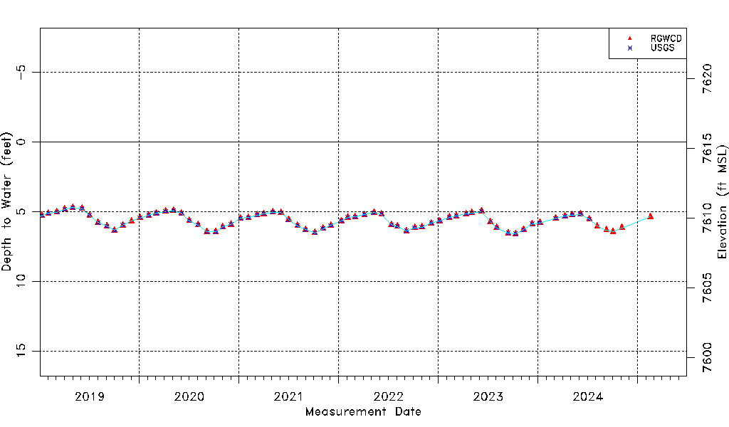
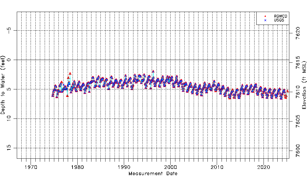
| Water-level Count | 631 |
| Water-level Date Range | 09/05/1974 thru 07/01/2026 |
| Monitored within the last 18 months | Yes, most recently on 07/01/2026 |
| Depth-to-Water Range (ft) | 2.01 to 6.60 |
| Water Table Elevation Range (ft NAVD88) | 7608.86 to 7613.45 |
| Water-Level-Source:Number-of-Measurements | RGWCD:619 USGS:580 |