| Well Information Table |
|---|
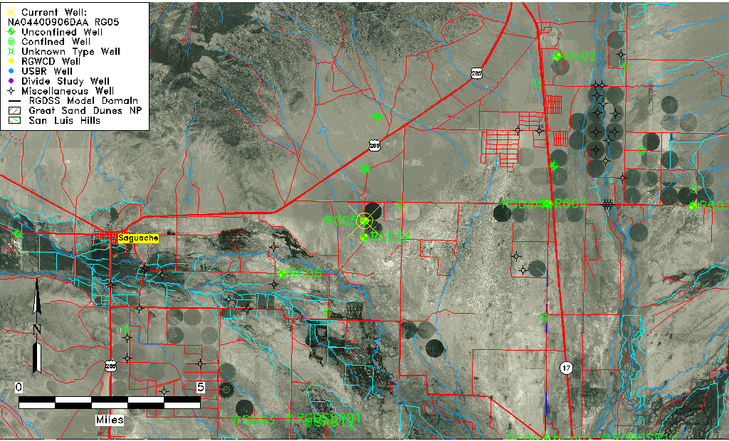
| Common Well ID | NA04400906DAA RG05 |
| RGWCD Well ID | RG05 |
| USGS Well ID | 380537106004801 |
| USGS Station Name | NA04400906DAA RG05 |
| USGS Site Type | Well |
| USGS Site Use Information | Withdrawal of Water |
| USGS Groundwater Use Information | Irrigation |
| Data Source(s) | USGS, RGWCD, DWR |
| Location Data |
|---|
| TRS | NA04400906DAA RG05 |
| RGWCD TRS | NA04400906DAA |
| USGS TRS 1 | NA04400906DAA RG05 |
| USGS TRS | NENESES006T0044NR0009EN |
| Longitude/Latitude (NAD83) | -106.01390600 , 38.09361060 |
| Longitude/Latitude Data Source | GWSI decimal LAT/LONG field |
| USGS Longitude/Latitude (NAD83) | -106.013906000 , 38.093610600 |
| Easting, Northing RGDSS-NAD83 (US ft) | 102251.20 , 399788.55 |
| USGS Topography | Valley flat |
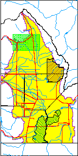
| USGS County | Saguache County |
| Elevation and Depth Data |
|---|
| Ground Elevation (ft NAVD88) | 7658.27 |
| Elevation Data Source | USGS GWSI database |
| RGWCD Measuring Point Elevation (ft NGVD29) | 0.000 |
| RGWCD Well Riser Height (ft) | 0.000 |
| USGS Ground Elevation (ft NGVD29) | 7654.00 |
| 1/3-Arc Second NED Ground Elevation (ft NAVD88) | 7657.07 |
| 1-Arc Second NED Ground Elevation (ft NAVD88) | 7656.94 |
| SRTM Ground Elevation (ft NAVD88) | 7657.49 |
| Total Depth (ft) | 172.00 |
| USGS Well Depth (ft) | 172.00 |
| Model Layer | 1 |
| Model Layer Source | RGWCD |
| Depth of Bottom of Layer 1 | 194 |
| Depth of Bottom of Layer 2 | 285 |
| Depth of Bottom of Layer 3 | 568 |
| Depth of Bottom of Layer 4 | 1459 |
| Additional Well Information | Geohydrology, Construction |
| Aquifer Information |
|---|
| Aquifer Type | Unconfined |
| Aquifer Type Source | RGWCD_AQ |
| USGS Primary Aquifer | Cenozoic Erathem |
| USGS Hydrologic Unit | Saguache |
| USGS Data Available | Water-level (GW.LEV) |
| Water-level Database Information |
|---|
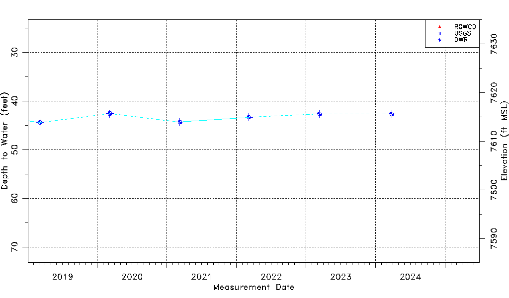
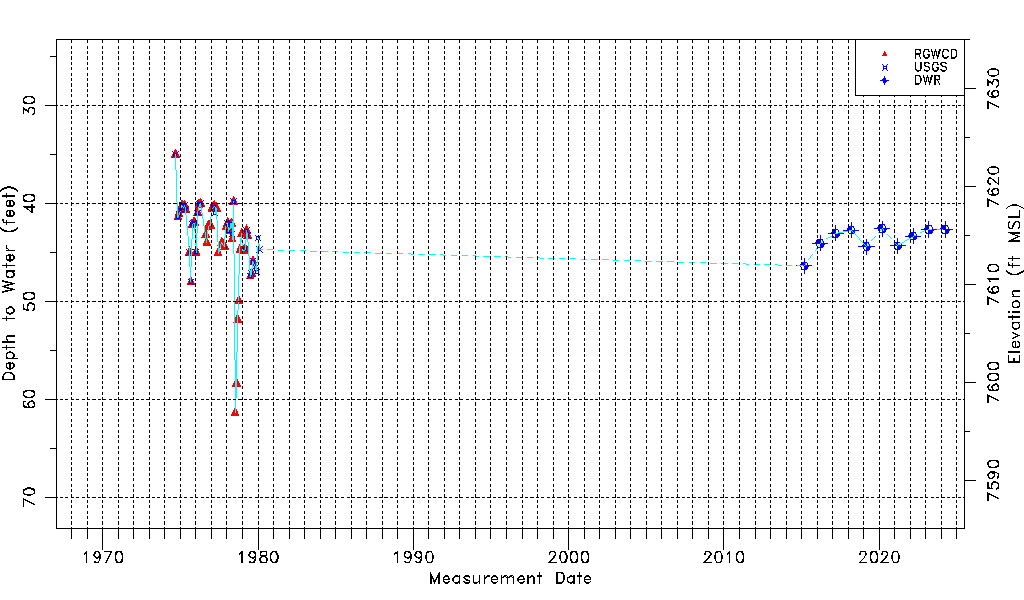
| Water-level Count | 74 |
| Water-level Date Range | 09/05/1974 thru 03/11/2026 |
| Monitored within the last 18 months | Yes, most recently on 03/11/2026 |
| Depth-to-Water Range (ft) | 35.00 to 61.40 |
| Water Table Elevation Range (ft NAVD88) | 7596.87 to 7623.27 |
| Water-Level-Source:Number-of-Measurements | RGWCD:52 USGS:36 DWR:12 |