| Well Information Table |
|---|
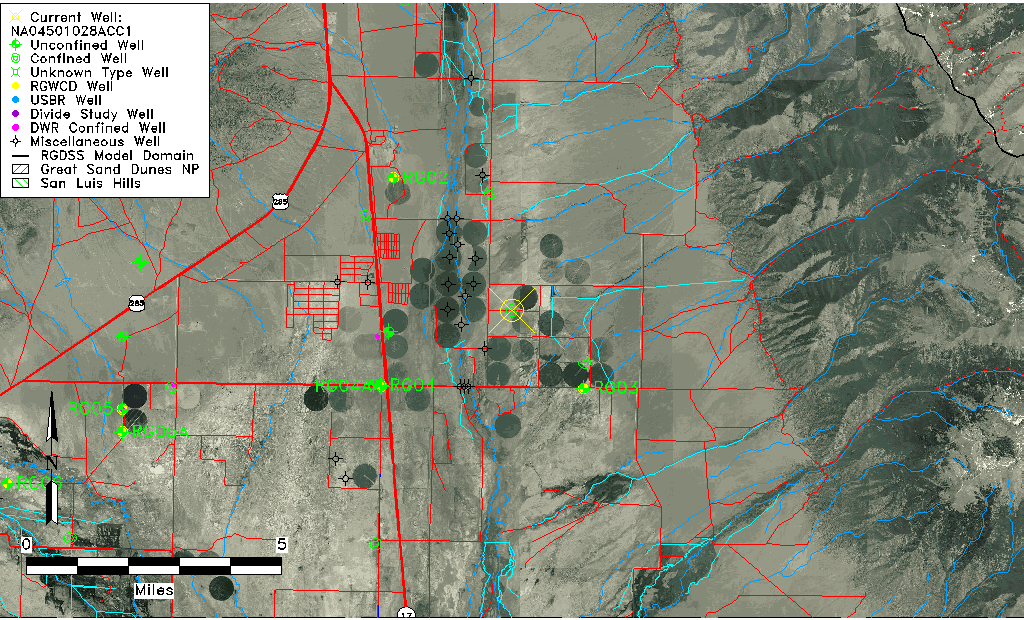
| Common Well ID | NA04501028ACC1 |
| USGS Well ID | 380719105522501 |
| USGS Station Name | NA04501028ACC1 |
| USGS Construction Date | 12/15/1975 |
| USGS Site Type | Well |
| USGS Site Use Information | Observation |
| USGS Groundwater Use Information | Unused |
| Data Source(s) | USGS |
| Location Data |
|---|
| TRS | NA04501028ACC1 |
| USGS TRS 1 | NA04501028ACC1 |
| USGS TRS | SWSWNES028T0045NR0010EN |
| Longitude/Latitude (NAD83) | -105.87417960 , 38.12194350 |
| Longitude/Latitude Data Source | GWSI decimal LAT/LONG field |
| USGS Longitude/Latitude (NAD83) | -105.874179600 , 38.121943500 |
| Easting, Northing RGDSS-NAD83 (US ft) | 142474.83 , 409980.71 |
| USGS Topography | Valley flat |
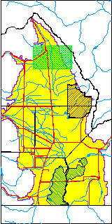
| USGS County | Saguache County |
| USGS Map Name | MIRAGE QUAD |
| USGS Map Scale | 24000 |
| Elevation and Depth Data |
|---|
| Ground Elevation (ft NAVD88) | 7679.37 |
| Elevation Data Source | USGS GWSI database |
| USGS Ground Elevation (ft NGVD29) | 7675.00 |
| 1/3-Arc Second NED Ground Elevation (ft NAVD88) | 7689.33 |
| 1-Arc Second NED Ground Elevation (ft NAVD88) | 7686.57 |
| SRTM Ground Elevation (ft NAVD88) | 7693.59 |
| Total Depth (ft) | 935.00 |
| USGS Hole Depth (ft) | 935.00 |
| USGS Well Depth (ft) | 935.00 |
| Model Layer | 4 |
| Model Layer Source | Well Depth |
| Depth of Bottom of Layer 1 | 117 |
| Depth of Bottom of Layer 2 | 159 |
| Depth of Bottom of Layer 3 | 453 |
| Depth of Bottom of Layer 4 | 3637 |
| Additional Well Information | Production, Logs, Geohydrology, Construction, Aquifer |
| Aquifer Information |
|---|
| Aquifer Type | Confined |
| Aquifer Type Source | TD Elevation/Model Layer |
| USGS Hydrologic Unit | San Luis |
| USGS Data Available | Water-level (GW.LEV) |
| Water-level Database Information |
|---|
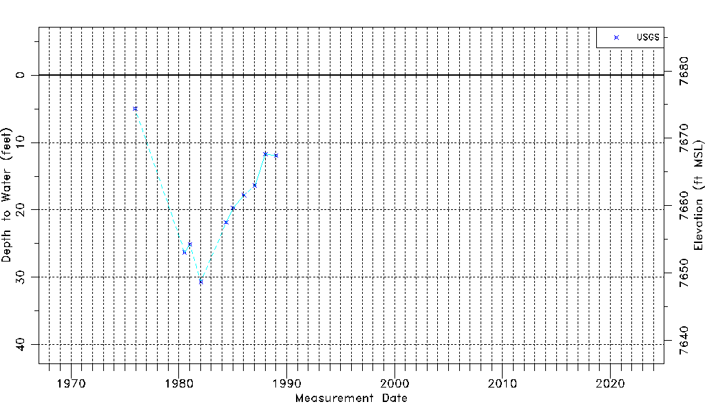
| Water-level Count | 10 |
| Water-level Date Range | 12/15/1975 thru 01/10/1989 |
| Monitored within the last 18 months | No, most recently on 01/10/1989 |
| Depth-to-Water Range (ft) | 5.00 to 30.66 |
| Water Table Elevation Range (ft NAVD88) | 7648.71 to 7674.37 |
| Water-Level-Source:Number-of-Measurements | USGS:10 |